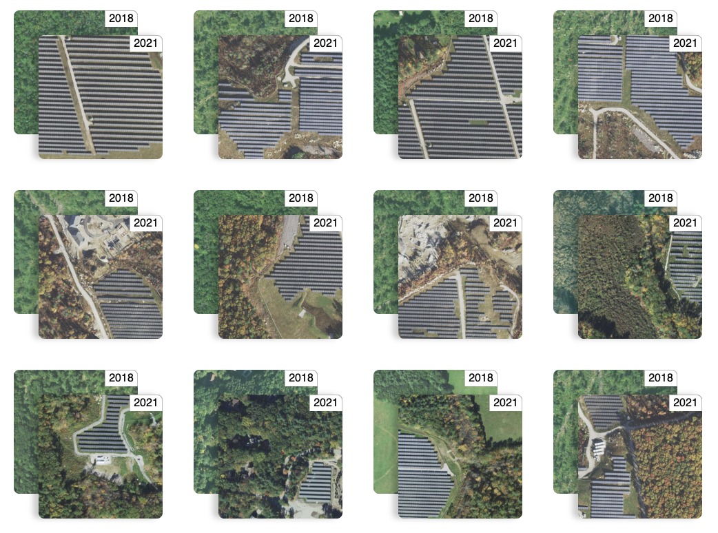
Explore our World
A comprehensive blog archive of Geospatial and Earth observation technology.
Recommended topics:
Open SourceClimateMachine LearningOpen DataSpatial AnalysisCommunityData AnalyticsRaster VisionCivil EngineeringSTAC
-
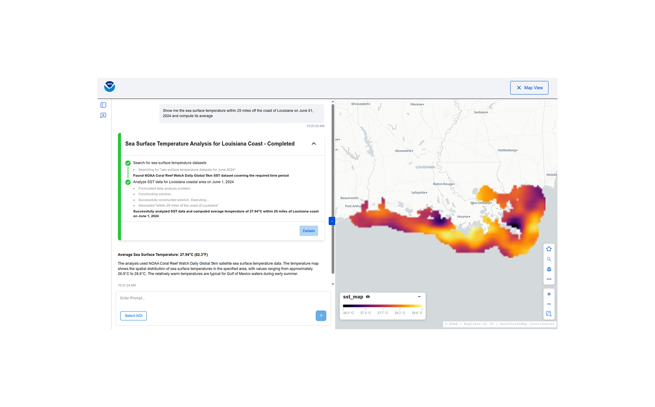
Building Conversational Interfaces for Querying and Analyzing Geospatial Data
NOAA maintains thousands of datasets of various kinds (remote sensing, in-situ, derived etc.) across multiple domains (climate, weather, ecology, etc.) consumed by a wide variety of users (scientists, engineers, urban planners, etc.), but discovering, accessing, and using these datasets remains a significant challenge. Recent developments in cloud-native geospatial technologies and standards have made geospatial data…