All blog posts
<- View categories
-
Getting Acquainted with Element 84: A Guide to our Intro Client Calls
As AI-powered search and generative engine optimization (GEO) change the way people find information online, we are having more conversations with organizations we haven’t met before. In this blog we give a sneak preview into the typical conversation structure we have with new-to-us organizations through frequently asked questions that we regularly answer during introductory calls.…
-
Federal Director Profile: A Conversation with Mark Reese
In late 2023, our team at Element 84 implemented an internal “business unit” structure within our project teams to loosely group client work based on industry and focus area. From the inception of this organizational change, Mark Reese took on the “Federal” business unit and continues to manage our portfolio with US federal agency clients.…

-
De-Risking AI: A Roadmap for AI Integration in Finance and Other Highly Regulated Industries
For businesses operating in highly regulated industries, zero risk tolerance policies often lead to delays in AI adoption. Although there are certainly risks that accompany irresponsible AI use, with intentional implementation AI has the potential to boost productivity, reduce risk, and increase profits. Furthermore, failing to implement AI is a risk of its own in…

-
ChatGSFC: Building Composable AI Tools for NASA on Open Source Tooling
What is ChatGSFC? We’ve spent the past year helping NASA build and scale a chat-based AI tool called ChatGSFC. Along the way we’ve learned some things about composable tooling, open-source strategy, user empowerment, and community building. Over 7,000 people across NASA use ChatGSFC to support their work. This includes everything from risk analysis and mission…
-
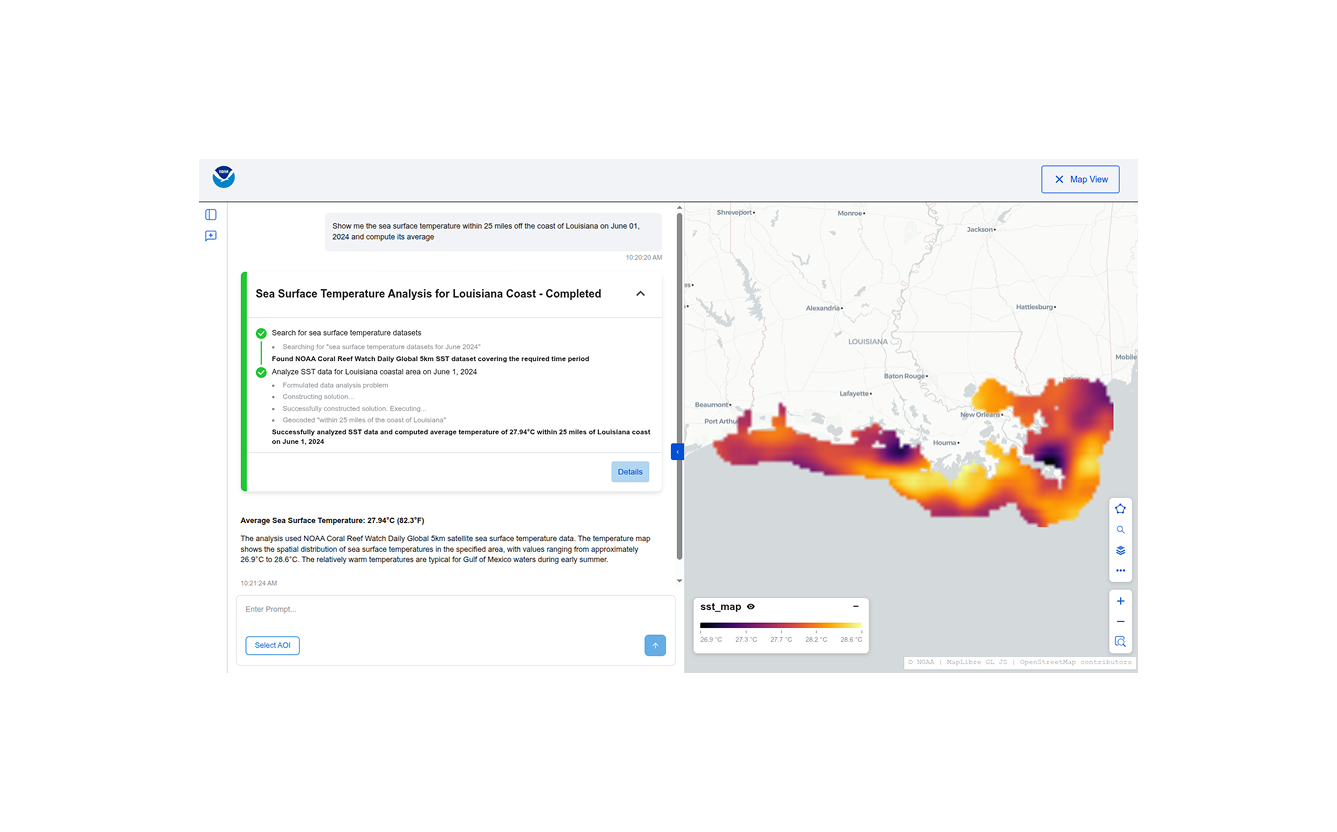
Building Conversational Interfaces for Querying and Analyzing Geospatial Data
NOAA maintains thousands of datasets of various kinds (remote sensing, in-situ, derived etc.) across multiple domains (climate, weather, ecology, etc.) consumed by a wide variety of users (scientists, engineers, urban planners, etc.), but discovering, accessing, and using these datasets remains a significant challenge. Recent developments in cloud-native geospatial technologies and standards have made geospatial data…
-
Building and Validating LLM-Generated Captions and Embeddings for Geospatial Imagery in Queryable Earth
At Element 84, we’ve been exploring how LLMs can improve geospatial imagery search. We recently published a blog post detailing our latest updates to our Queryable Earth demo which lets users search for visible features on the Earth using natural language. Until recently, it relied entirely on SkyCLIP, an open-source vision-language model, to generate the…
-
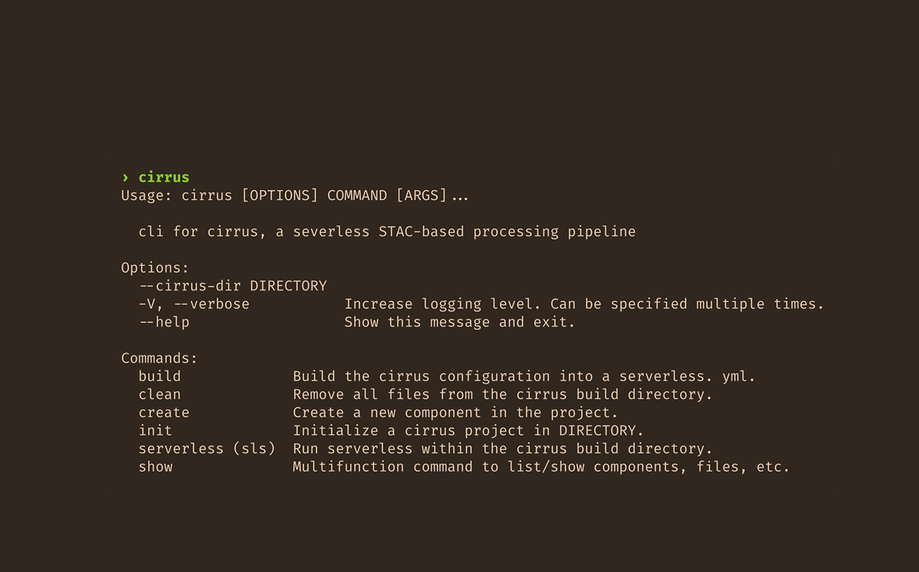
(Re)Making Cirrus: Three lessons learned
In part two of this blog series reflecting on our work with Cirrus, we discuss three core lessons that we uncovered.

-
If AI Is Going to Task Satellites, We Need Standards
It’s been about a month since North51 in Banff. For those who haven’t been, it’s a unique event on the geospatial calendar. It’s a small, single-track conference that fosters great group discussions rather than broadcasting lectures. There are no sales pitches here, just geospatial people staring at the same mountain range, trying to figure out…

-
(Re)Making Cirrus: Reflections on five years spent building an open-source data orchestrator
This post is based on the author’s talk (Re)Making Cirrus: Five Years Building a Data Orchestration Framework, presented at FOSS4 NA 2025 and FOSS4G 2025. We’ve remade Cirrus at least three times. Maybe four, depending on how you count. Cirrus, a data orchestration framework we develop and use here at Element 84, recently celebrated its…
-
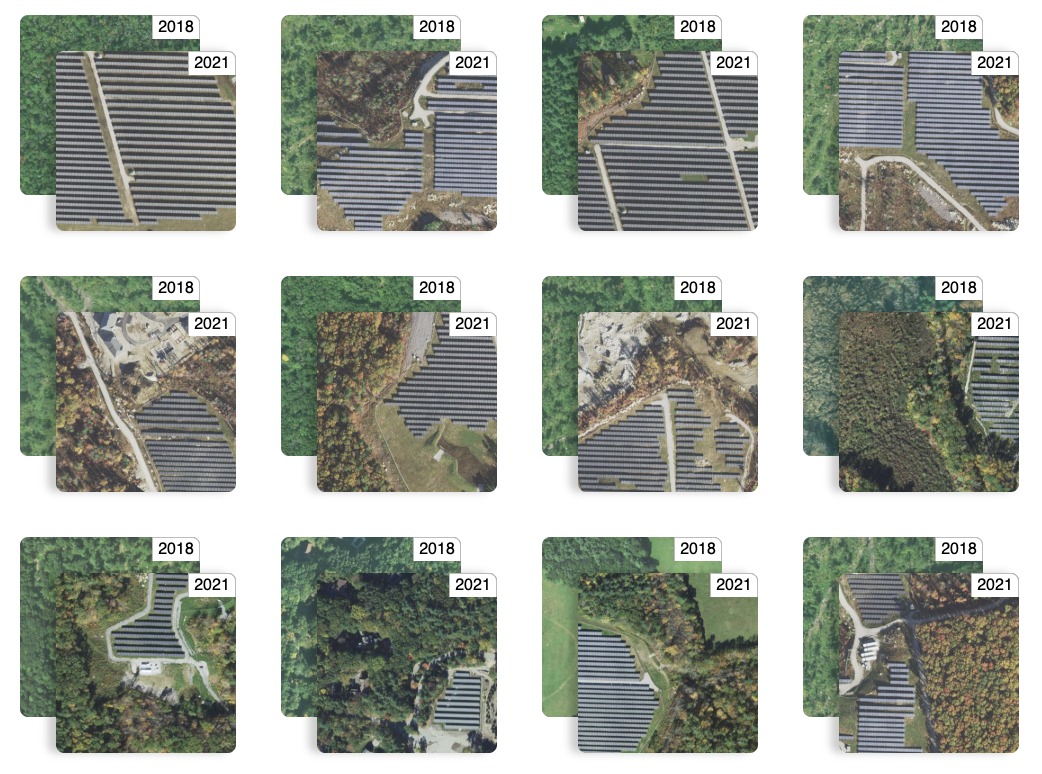
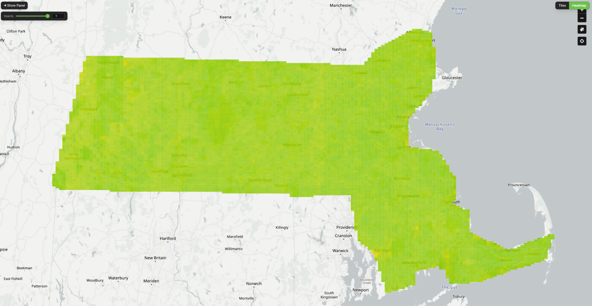
Queryable Earth Demo Update: Now with Change Detection!
We detail how we used our research surrounding queryable Earth and natural language geocoding to demonstrate data accessibility in an intuitive and interactive way – and how you might be able to harness some of the same ideas in your own work.