All blog posts
<- View categories
-

Using Kerchunk to make NOAA’s National Water Model Dataset more accessible
In this blog, we discuss our experience using Kerchunk to improve access times to short-range streamflow predictions generated by NOAA’s National Water Model Predictions Dataset, achieving a speedup of 4 times, using 16 times less memory.
-
Announcing our 2023 Geospatial Tech Radar
Ahead of this year’s FOSS4G North America gathering, we’re rolling out a 2023 edition of our Geospatial Tech Radar idea, which we plan to update annually to track what’s up-and-coming in geospatial techniques, standards, data, and tools/platforms.В

-
Running ROCm 5.4.2, ONNX, and PyTorch on a SteamDeck
In this blog post, we’ll guide you through setting up ROCm 5.4.2, ONNX, and PyTorch on a SteamDeck.
-
Streamlining search-and-rescue operations using machine learning on the edge
In this blog, we discuss various improvements that we have made to the proposed workflow first discussed in our previous blog post focused on edge processing of drone imagery for search-and-rescue.
-
Introducing Earth Search Console: An AWS Open Data Exploration UI
In this blog, we’ll detail how Earth Search Console leverages FilmDrop, and what Console components we are most excited about.

-
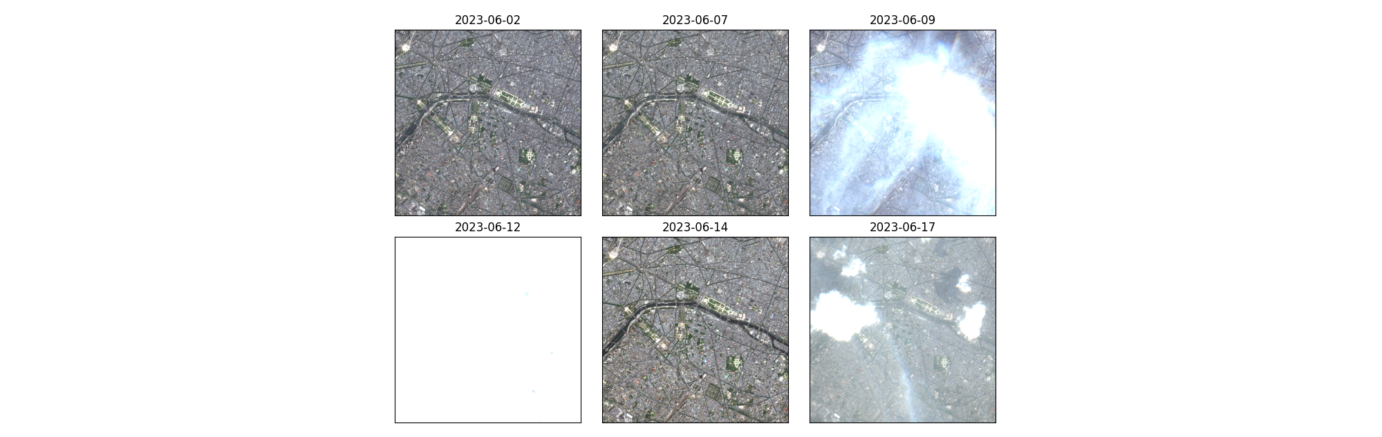
Exploring unsupervised change detection with Sentinel-2 vector embeddings
In this blog post, we explore the application of a foundation model pre-trained on Sentinel-2 imagery, to the downstream task of change detection.В
-
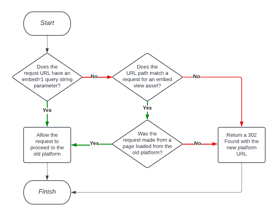
Using Amazon CloudFront Functions to Facilitate Smooth Project Transitions with Conditional Redirects
In this blog, we detail our experience making this project transition possible for our client by implementing conditional redirects via Amazon CloudFront functions.
-
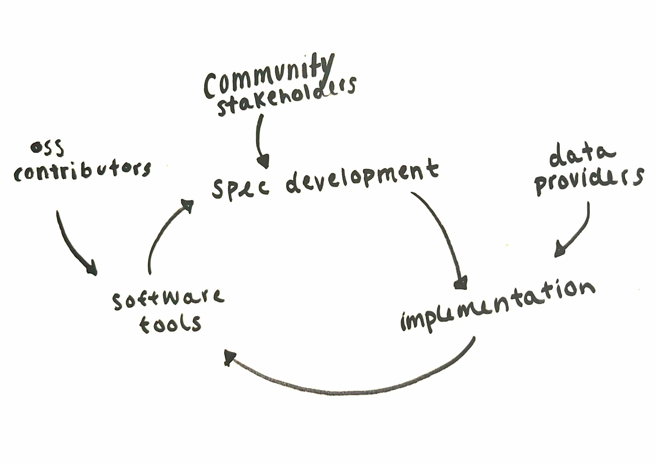
Modularization and Extensibility in Scientific Python
We discuss how modularization and extensibility serve to make the scientific Python ecosystem more accessible to users, and how this concept is reflected in STAC.
-
Introducing Raster Vision v0.21
In this post we highlight the major changes rolled out in the latest update of Raster Vision, our open-source ML library.
-
Edge Processing of Drone Data for Search and Rescue using Open Source Tooling on an AWS Snowcone
Element 84 has developed near real-time edge processing of drone and aerial imagery for human identification that leverages machine learning and AWS Snowcone edge capabilities during austere operations for search and rescue applications.