Open Data
<- Return to all blogs
-
STAC: A Retrospective, Part 2 (Why STAC was Successful)
In Part 1 of this series we covered the origin story of STAC, exploring the history and the initial sprints that created the spec. Now, it’s time to cover the how and the why of its success.
-
STAC: A Retrospective, Part 2 (Why STAC was Successful)
In Part 1 of this series we covered the origin story of STAC, exploring the history and the initial sprints that created the spec. Now, it’s time to cover the how and the why of its success.
-
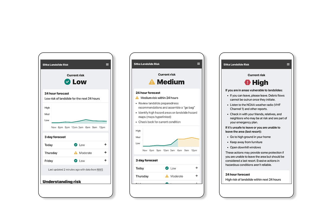
Designing risk visualizations: why appropriate complexity mattersВ
In this blog I detail some case studies that have been top-of-mind recently to demonstrate the importance of appropriate complexity, and how it can contribute to meaningful action when applied with intention, particularly in the context of risk analysis.В
-
Emerging trends in geospatial: May 2024
In this post, we highlight a few of the trends in geospatial our team noticed at SatSummit, and we’re outlining how we plan to integrate these trends into our work.

-
Announcing our 2023 Geospatial Tech Radar
Ahead of this year’s FOSS4G North America gathering, we’re rolling out a 2023 edition of our Geospatial Tech Radar idea, which we plan to update annually to track what’s up-and-coming in geospatial techniques, standards, data, and tools/platforms.В

-
Introducing Earth Search Console: An AWS Open Data Exploration UI
In this blog, we’ll detail how Earth Search Console leverages FilmDrop, and what Console components we are most excited about.

-
Automated Building Footprint Extraction (Part 2): Evaluation Metrics
In the second part of our Automated Building Footprint Extraction series, we review some evaluation metrics for building footprint extraction.
-
Our 10% Time Program: How We Encourage Innovation Internally
We outline our 10% time program in detail, highlight some notable examples and themes, and describe the impact of the program.

-
1% For Open Source: Financial Support for Tools We Use
We donate a portion of our profits each year to support open source projects nominated by our team.
-
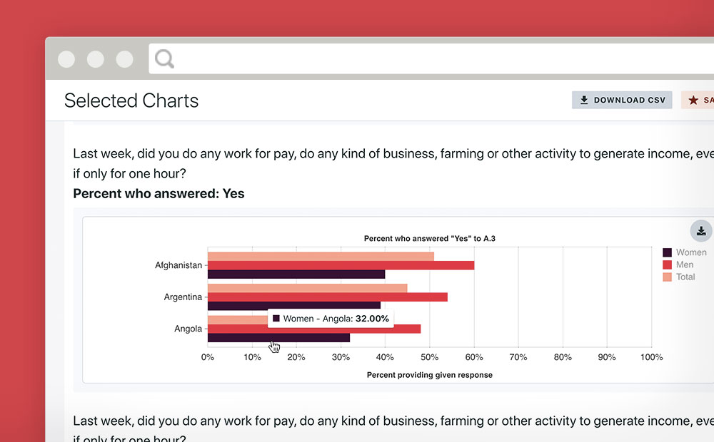
Making Gender Data Actionable
Azavea partnered with Facebook and Ladysmith to make an engaging platform that makes data from a massive gender survey actionable.
-
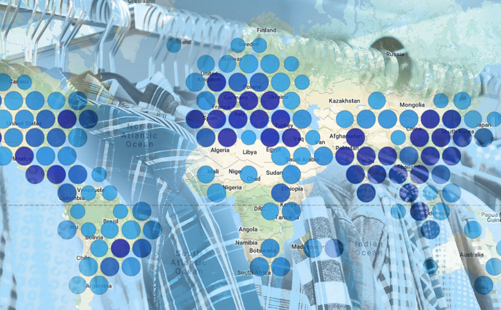
Bringing Open Data to the Apparel Industry
We chatted with the Open Apparel Registry team about how open data and open source are becoming a larger part of the apparel industry.