Software Engineering
<- Return to all blogs
-
Building Conversational Interfaces for Querying and Analyzing Geospatial Data
NOAA maintains thousands of datasets of various kinds (remote sensing, in-situ, derived etc.) across multiple domains (climate, weather, ecology, etc.) consumed by a wide variety of users (scientists, engineers, urban planners, etc.), but discovering, accessing, and using these datasets remains a significant challenge. Recent developments in cloud-native geospatial technologies and standards have made geospatial data…
-
Building and Validating LLM-Generated Captions and Embeddings for Geospatial Imagery in Queryable Earth
At Element 84, we’ve been exploring how LLMs can improve geospatial imagery search. We recently published a blog post detailing our latest updates to our Queryable Earth demo which lets users search for visible features on the Earth using natural language. Until recently, it relied entirely on SkyCLIP, an open-source vision-language model, to generate the…
-
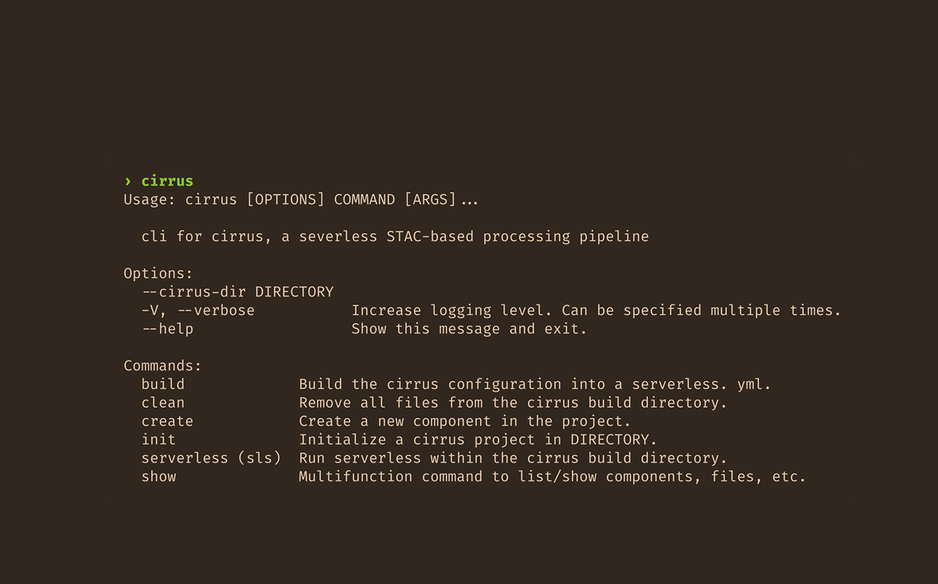
(Re)Making Cirrus: Three lessons learned
In part two of this blog series reflecting on our work with Cirrus, we discuss three core lessons that we uncovered.

-
If AI Is Going to Task Satellites, We Need Standards
It’s been about a month since North51 in Banff. For those who haven’t been, it’s a unique event on the geospatial calendar. It’s a small, single-track conference that fosters great group discussions rather than broadcasting lectures. There are no sales pitches here, just geospatial people staring at the same mountain range, trying to figure out…

-
(Re)Making Cirrus: Reflections on five years spent building an open-source data orchestrator
This post is based on the author’s talk (Re)Making Cirrus: Five Years Building a Data Orchestration Framework, presented at FOSS4 NA 2025 and FOSS4G 2025. We’ve remade Cirrus at least three times. Maybe four, depending on how you count. Cirrus, a data orchestration framework we develop and use here at Element 84, recently celebrated its…
-
AI Coding and the Future of Open-Source Geospatial Software
In an episode of Star Trek: The Next Generation, Commander Data (an android), creates a new android, Lal. His creation, paralleling the new generation of AI-assisted tools, extends her creator’s capabilities but also begins to operate autonomously. Lal begins to learn, evolve, and act independently, faster than Data can fully guide her. Eventually, she is…

-
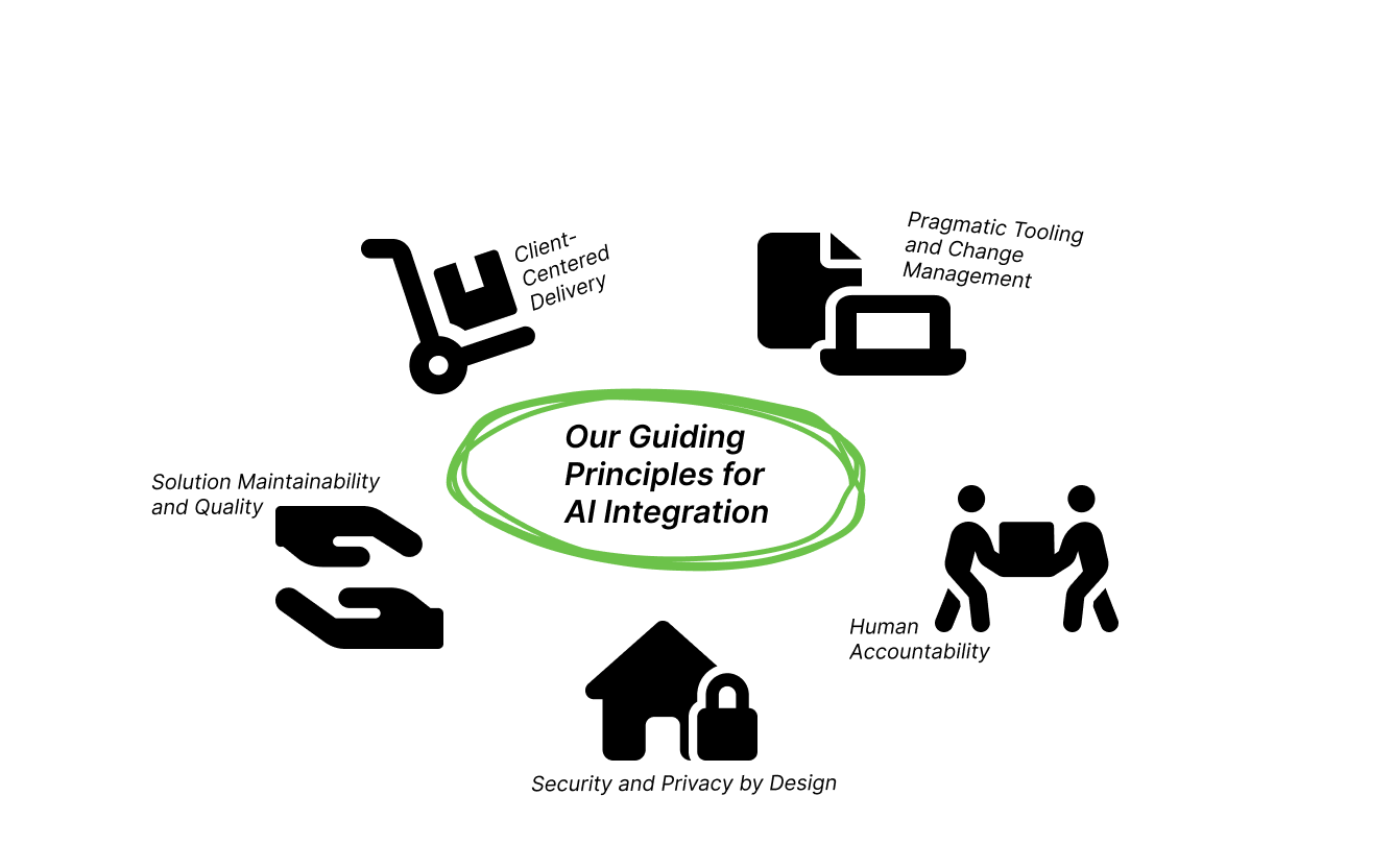
Beyond the Hype: Element 84’s Pragmatic Vision for AI in Engineering
At Element 84, we’ve always been focused on solving our clients’ most complex geospatial problems with high-quality, reliable, and scalable software. We’re excited about AI’s potential to accelerate development and allow our engineers to focus their creative energy on core problem-solving. To achieve that without sacrificing our quality and reliability, our approach is centered around…
-
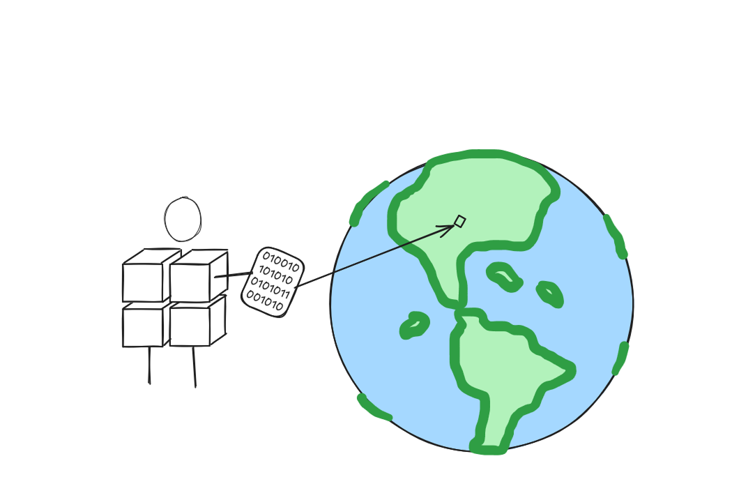
Exploring AlphaEarth Embeddings
Earlier this year, in July 2025, Google DeepMind contributed to the conversation on Earth Observation (EO) foundation models and vector embeddings by releasing a dataset of EO vector embeddings generated by their new AlphaEarth Foundations (AEF) model. Originally released only inside Google Earth Engine, these embeddings were finally made publicly and freely available on Source…
-
Metadata makes the data format: metadata storage and representation across array formats
In this continuation of our recent raster data format blog series we discuss metadata: how do COG and Zarr represent metadata and how can geospatial coordinate metadata be represented across different formats? Where should metadata be stored? and more!
-
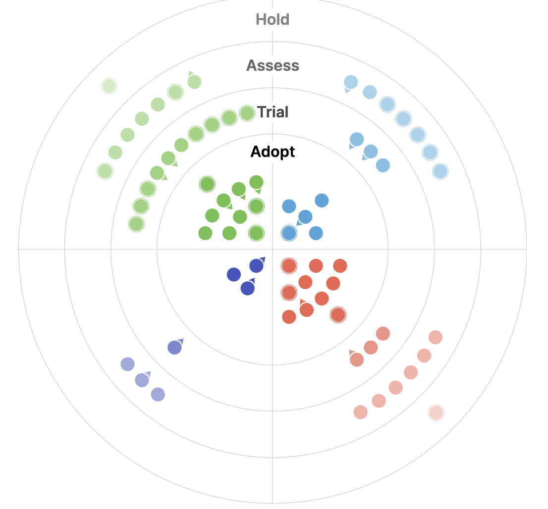
The 2025 Geospatial Tech Radar: Agentic AI, EO Embeddings, and Cloud-Native Maturity
We analyze trends and highlights from the third iteration of our Geospatial Tech Radar including Agentic AI and MCP, EO Foundation Models and Embeddings, and the solidification of Cloud-Native Geospatial.