Geospatial
<- Return to all blogs
-

Tasking Sprint
Two weeks ago, right before SatSummit, we hosted a “Satellite Tasking API Sprint” at our office in Alexandria. The goal was to initiate a conversation around standardizing how users submit tasking requests to data providers. The companies attending, made up of data providers, analytics users, and developers, represented a wide and deep knowledge base around…
-
A Software Engineer’s First Experience with Geospatial: Data, Tooling, and STAC
About a year ago, I started on a new project at Element 84 working with geospatial imagery. In this blog post, I will document some things I learned on my journey. My hope is these lessons learned will help encourage more generalist software engineers to start experimenting with geospatial data and tooling. I had never…
-
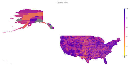
A Tool to Highlight Underfunded and Under-resourced Communities: A Peek Behind the Technical Curtain of Headwaters Economics’ Rural Capacity Index
To address the disparity in access to funding resources, we partnered with Headwaters Economics to develop the Rural Capacity Index.
-
Cloud Optimized Formats: NetCDF-as-Zarr Optimizations and Next Steps
At Element 84 we help groups rethink how they approach technology and are particularly focused on supporting migration to the cloud. As we moved from local hard drives to the cloud, there are things we took for granted when it came to file formats. On your own hard drive reads are cheap and latency is…
-
Dan Pilone on the Minds Behind Maps Podcast
Earlier this month, Dan Pilone, our Co-founder and CEO spent a few hours with Maxime Lenormand at the Minds Behind Maps Podcast. The conversation spans a variety of topics from Dask and Xarray, game theory and open source software, through people-focused growth and Element 84’s hiring process. Dan Pilone is the CEO and co-founder of…
-
Jeff Siarto on the MapScaping Podcast
Since 2010, we’ve been working with scientists and data providers at NASA, NOAA, and USGS to help improve their remote sensing data systems through better processing pipelines, metadata, and improved user experiences. A large part of that effort was aimed at improving time-to-science—reducing the amount of time spent downloading, processing, and preparing data versus actually…
-
Machine Learning to Drive Urban Resilience: Mapping Tree Canopy with the World Bank
As one of seven pilot programs to address environmental issues in Africa, Azavea trained student workers to label satellite imagery using GroundWork and created a machine learning model to identify tree canopy.

-
Deconstructing Analysis-Ready Data
The 4th Analysis Ready Data (ARD) Workshop was held virtually in October 2021. Consisting of ten minute lightning talks packed into 1 hour sessions, participants from government and industry presented developments in “Analysis Ready Data”. Each day followed a specific theme such as calibration and validation, standards, time series, optical, SAR, and vegetation. The problem?…
-
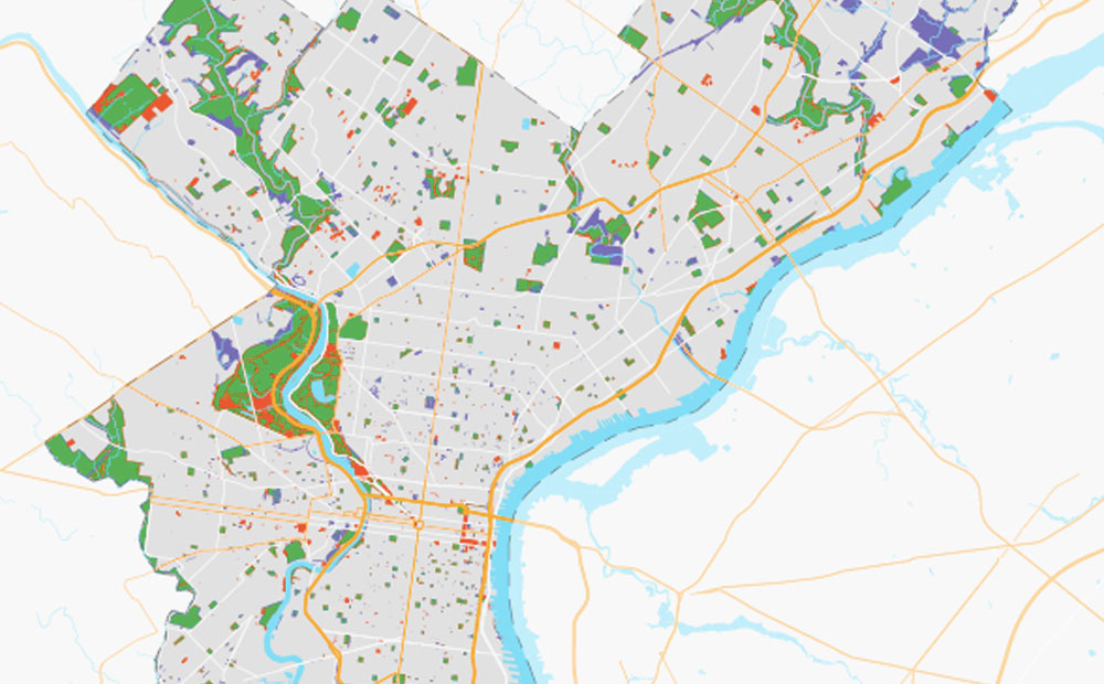
How Can OpenStreetMap be Used to Track UN Sustainable Development Goals?
We learned that OpenStreetMap is a great source of data for tracking SDG indicator 11.7.1. OSM provides data on public open or green spaces in cities that is similar in quality to more “official” sources like municipal Open Data portals, and collecting the data from OSM requires relatively little effort.
-
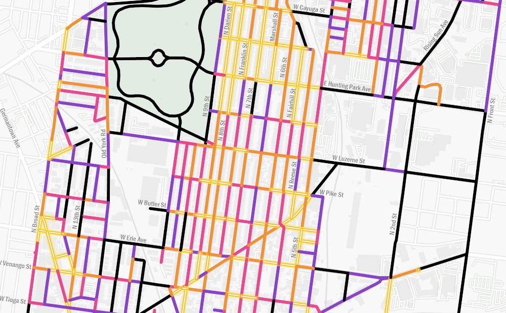
Using GIS to Guide Philadelphia’s First Neighborhood-Level Forestry Plan
The adoption of Philadelphia’s Urban Forest Strategic Plan and Hunting Park’s Forestry Plan presents a unique opportunity to address the need for equitable tree planting and the reduction of heat vulnerability, as these two plans are the city’s first cohesive attempts to prioritize and manage its urban forest.