All blog posts
<- View categories
-
A Software Engineer’s First Experience with Geospatial: Data, Tooling, and STAC
About a year ago, I started on a new project at Element 84 working with geospatial imagery. In this blog post, I will document some things I learned on my journey. My hope is these lessons learned will help encourage more generalist software engineers to start experimenting with geospatial data and tooling. I had never…
-
Why We Haven’t Taken on Investment
20 years on, Azavea has never taken on investor capital. Our CEO, Robert Cheetham, explains why this is the case.

-
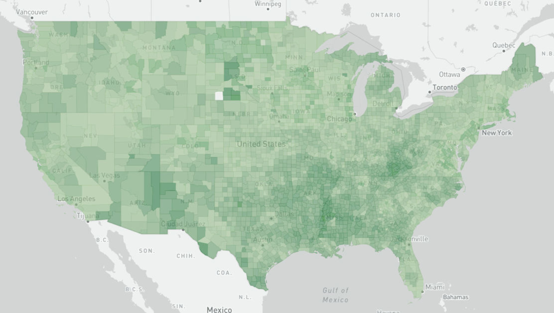
How to code-split GeoJSON layers for your MapBoxGL.js React apps
A recent project required us to implement an interactive map of the United States with a custom counties layer. This is what we learned.
-
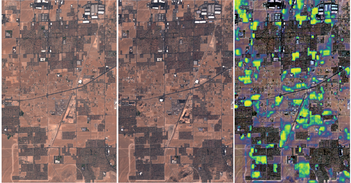
Change detection with Raster Vision
This blog explores the direct classification approach to change detection using our open-source geospatial deep learning framework, Raster Vision, and the publicly available Onera Satellite Change Detection (OSCD) dataset.
-
Highlighting NumFocus Projects: How Open Source Projects Empower Our Work
NumFocus is a nonprofit that supports many open source tools used in Azavea’s projects. Here, we highlight how they have supported our work.
-
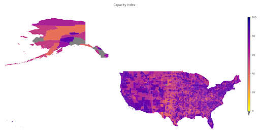
A Tool to Highlight Underfunded and Under-resourced Communities: A Peek Behind the Technical Curtain of Headwaters Economics’ Rural Capacity Index
To address the disparity in access to funding resources, we partnered with Headwaters Economics to develop the Rural Capacity Index.
-
Cloud Optimized Formats: NetCDF-as-Zarr Optimizations and Next Steps
At Element 84 we help groups rethink how they approach technology and are particularly focused on supporting migration to the cloud. As we moved from local hard drives to the cloud, there are things we took for granted when it came to file formats. On your own hard drive reads are cheap and latency is…
-
Dan Pilone on the Minds Behind Maps Podcast
Earlier this month, Dan Pilone, our Co-founder and CEO spent a few hours with Maxime Lenormand at the Minds Behind Maps Podcast. The conversation spans a variety of topics from Dask and Xarray, game theory and open source software, through people-focused growth and Element 84’s hiring process. Dan Pilone is the CEO and co-founder of…
-
Jeff Siarto on the MapScaping Podcast
Since 2010, we’ve been working with scientists and data providers at NASA, NOAA, and USGS to help improve their remote sensing data systems through better processing pipelines, metadata, and improved user experiences. A large part of that effort was aimed at improving time-to-science—reducing the amount of time spent downloading, processing, and preparing data versus actually…
-
Our Top 3 Netlify Use Cases: Deciding When to Use Netlify
Netlify is a platform for web developers and designers that offers hosting and serverless backend services. Here, we provide Azavea’s top three use cases for it and its benefits for our software engineers and designers.