Software Engineering
<- Return to all blogs
-
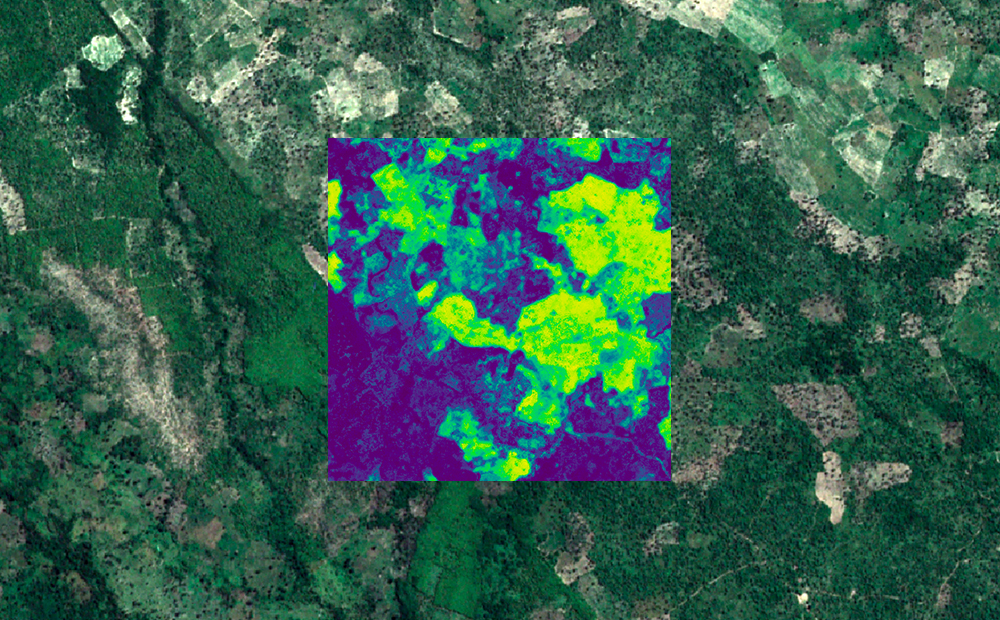
Mapping Africa: Crowdsourced Machine Learning
We leveraged our ability to process raster imagery, our open sources libraries, and our knack for machine learning to map agricultural fields in Africa.
-
Mapping Africa: Crowdsourced Machine Learning
We leveraged our ability to process raster imagery, our open sources libraries, and our knack for machine learning to map agricultural fields in Africa.
-
Accuracy is in the Eye of the Beholder
Accuracy in deep learning models is not as cut and dry as many present it to be. We examine several examples where accuracy is more of a judgment call.
-
Responsive Typography: rem, em, and px
Intro Dealing with type on the web can be a challenge, especially when you have to account for the ever-changing range of screen sizes. Ultimately the font size(s) you use for headings, body copy, and whatever else directly effects the layout of you page, and when you’re dealing with dozens, or even hundreds of pages…
-
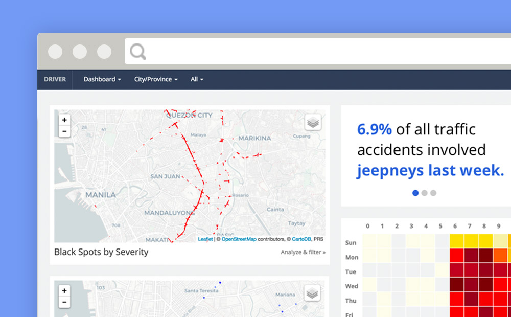
Reducing Road Crashes with DRIVER
Over 1.3 million people are killed on the world’s roads every year. More than 30 million suffer life-changing injuries. Based on current trauma levels an estimated 400 million people will be killed or injured between now and 2030. Source: IDB Road crashes are a leading cause of death globally, but these deaths occur mostly in…
-
A Year of QA at E84
A little over a year ago, I was looking to leave my previous position at a large consulting agency. At the time, I was working as a business analyst and was wearing a few too many hats. I was looking to transition away from the waterfall-heavy role and more into a design-based role, such as…
-
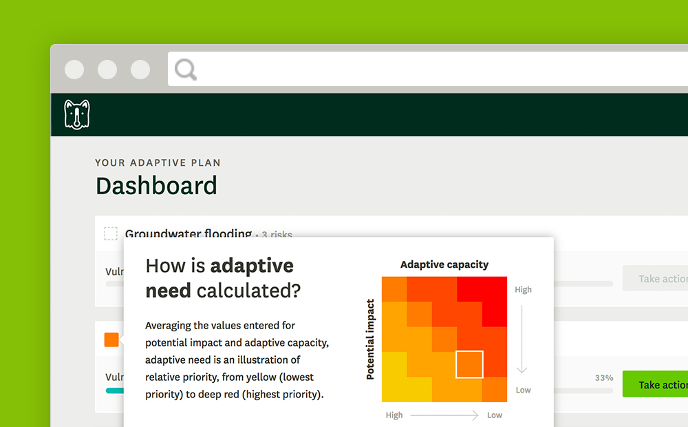
AWS Enables Temperate
We recently released Temperate: A new climate adaptation planning companion for cities. This blog explores how AWS, and the data they host, fueled this app.
-
Enhancing the Pangeo Community with NASA Earth Observing System (EOS) Data
One of our main missions at Element 84 is to help reduce the amount of time that researchers (scientific and corporate, alike) spend wrangling, downloading, cleaning, and prepping data in pursuit of their primary research question. A recent NASA study put that number at around 60%–leaving less than half of a scientist’s time available for…
-
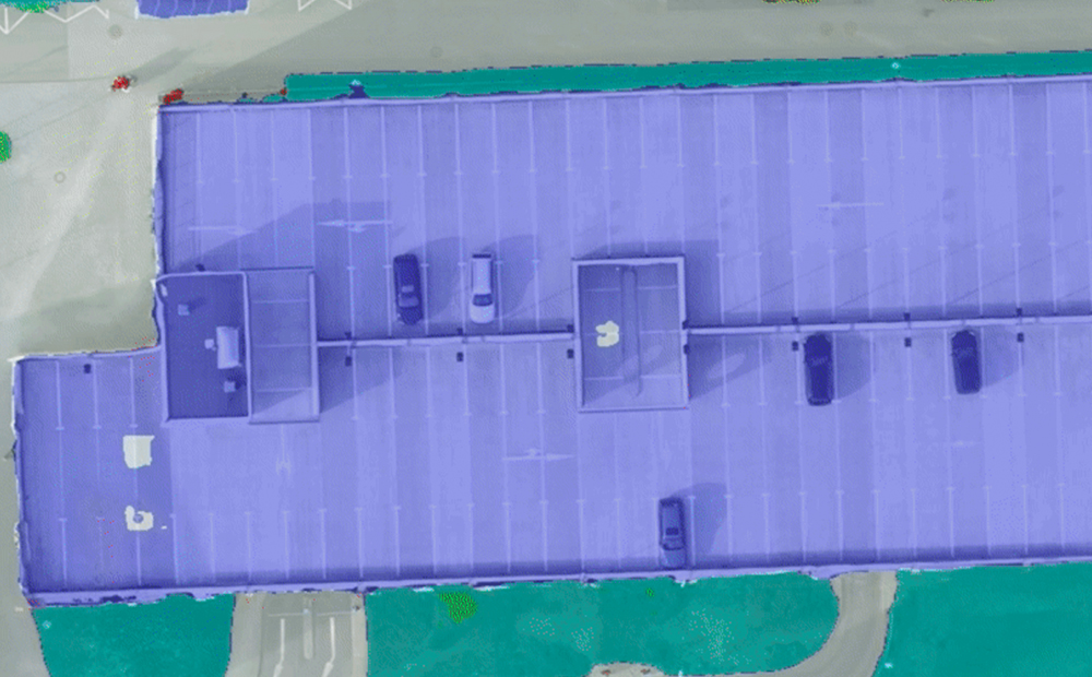
Raster Vision: A New Open Source Framework for Deep Learning on Satellite and Aerial Imagery
Azavea is pleased to announce the release of Raster Vision, a new open source framework for deep learning on satellite and aerial imagery.

-
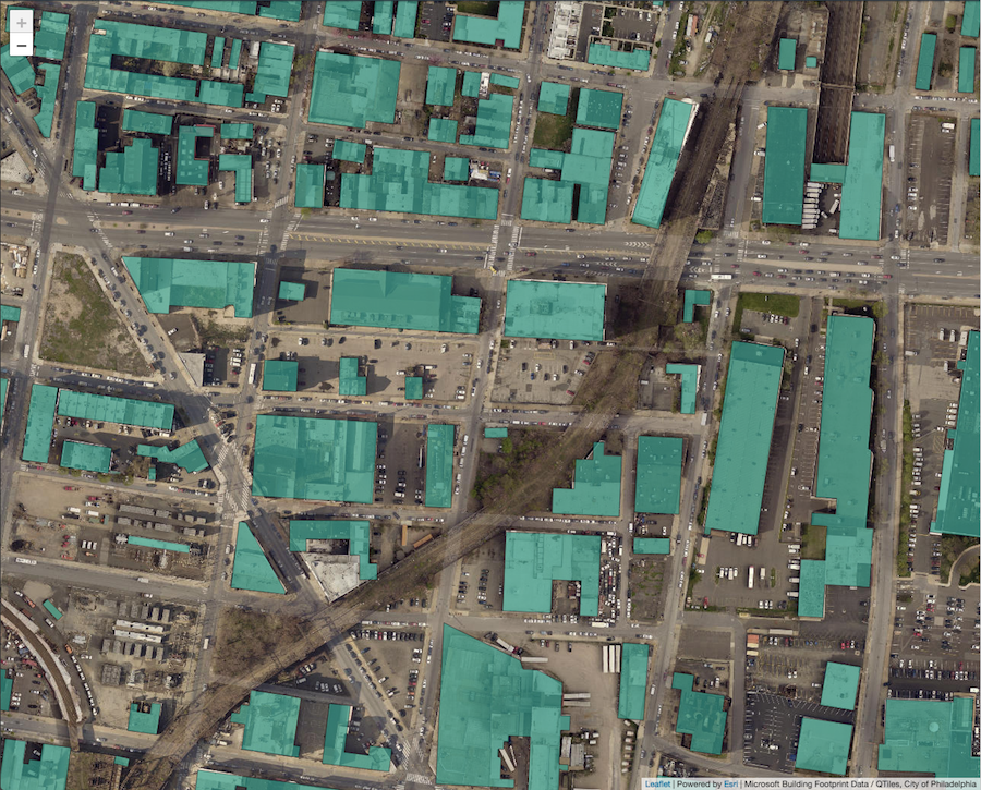
Creating Leaflet Tiles from Open Data using PostGIS and QGIS
A guide to transforming open geospatial data into slippy map tiles to display in Leaflet or OpenLayers using PostGIS, QGIS, and QTiles.
-
Engineer Onboarding with Breakable Toy
My experience joining the Operations Team at Azavea. This was the first time my colleagues used the Breakable Toy apprenticeship pattern.