Machine Learning
<- Return to all blogs
-
Building and Validating LLM-Generated Captions and Embeddings for Geospatial Imagery in Queryable Earth
At Element 84, we’ve been exploring how LLMs can improve geospatial imagery search. We recently published a blog post detailing our latest updates to our Queryable Earth demo which lets users search for visible features on the Earth using natural language. Until recently, it relied entirely on SkyCLIP, an open-source vision-language model, to generate the…
-
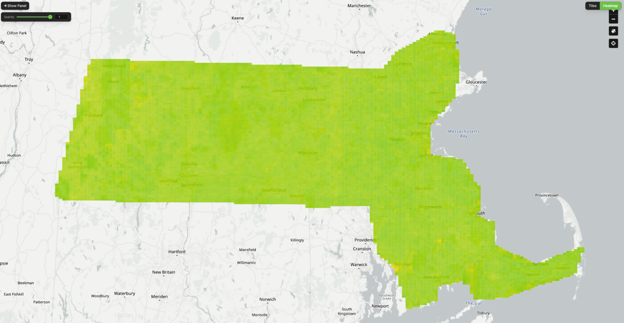
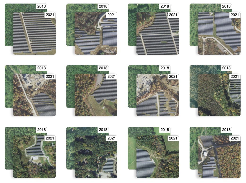
Queryable Earth Demo Update: Now with Change Detection!В
We detail how we used our research surrounding queryable Earth and natural language geocoding to demonstrate data accessibility in an intuitive and interactive way – and how you might be able to harness some of the same ideas in your own work.В
-
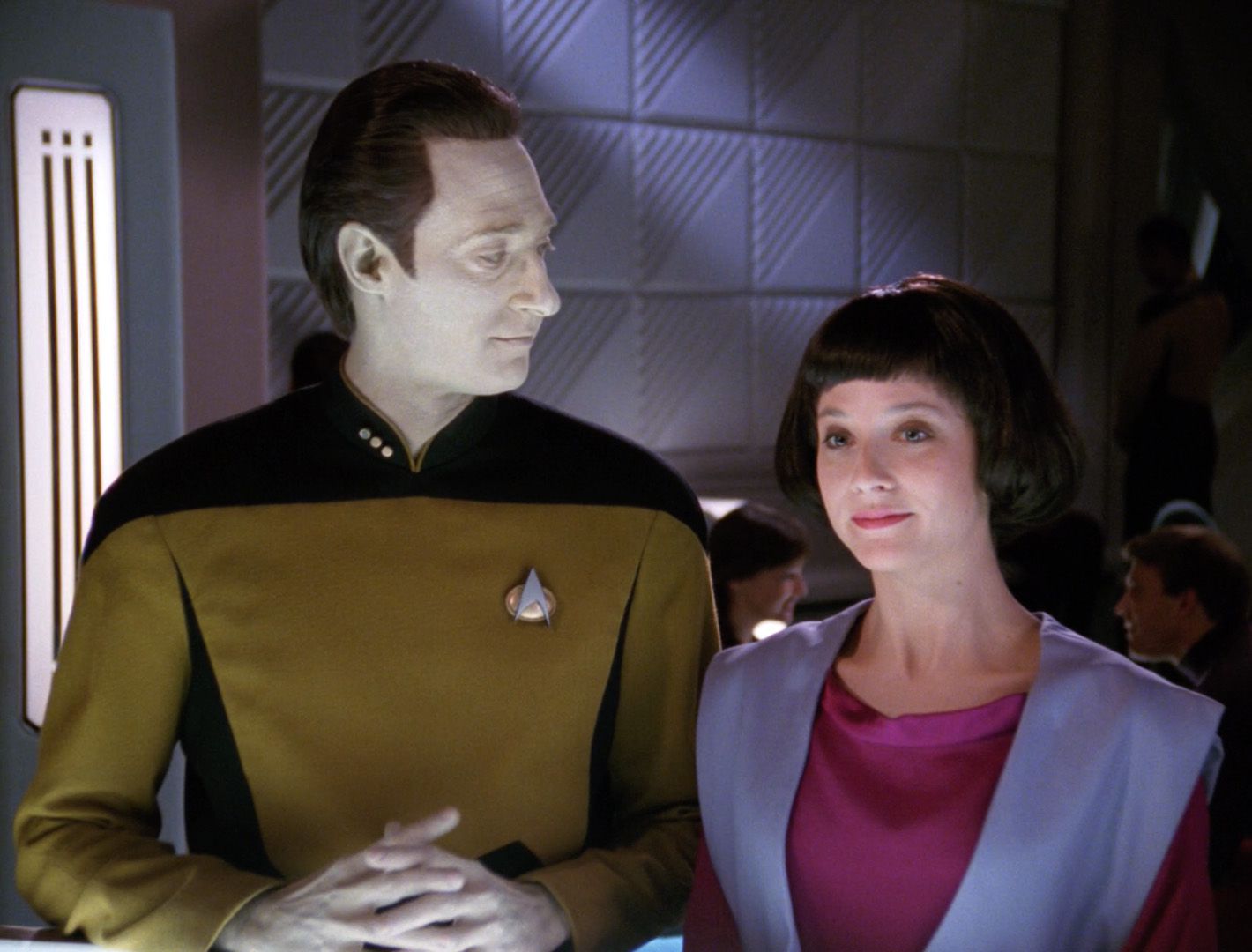
AI Coding and the Future of Open-Source Geospatial Software
In an episode of Star Trek: The Next Generation, Commander Data (an android), creates a new android, Lal. His creation, paralleling the new generation of AI-assisted tools, extends her creator’s capabilities but also begins to operate autonomously. Lal begins to learn, evolve, and act independently, faster than Data can fully guide her. Eventually, she is…
-
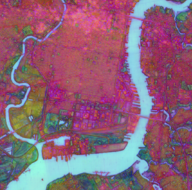
Exploring AlphaEarth Embeddings
Earlier this year, in July 2025, Google DeepMind contributed to the conversation on Earth Observation (EO) foundation models and vector embeddings by releasing a dataset of EO vector embeddings generated by their new AlphaEarth Foundations (AEF) model. Originally released only inside Google Earth Engine, these embeddings were finally made publicly and freely available on Source…
-
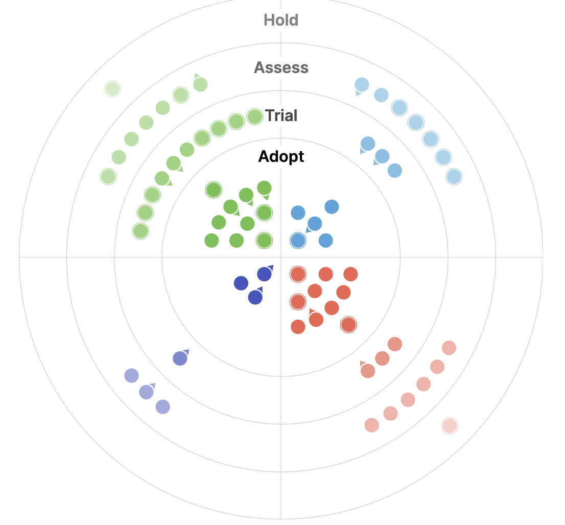
The 2025 Geospatial Tech Radar: Agentic AI, EO Embeddings, and Cloud-Native Maturity
We analyze trends and highlights from the third iteration of our Geospatial Tech Radar including Agentic AI and MCP, EO Foundation Models and Embeddings, and the solidification of Cloud-Native Geospatial.
-
Introducing Natural Language Geocoding v0.1.0: An LLM-Enabled Geocoding Database
The landscape of geospatial AI is rapidly evolving. Many organizations are building LLM-powered solutions that tackle complex geospatial problems and answer sophisticated questions about our planet. These agentic approaches allow LLMs to autonomously select from toolsets that include geospatial tools, Earth Observation (EO) catalogs, and EO data processing capabilities. The result? Systems that can process…
-
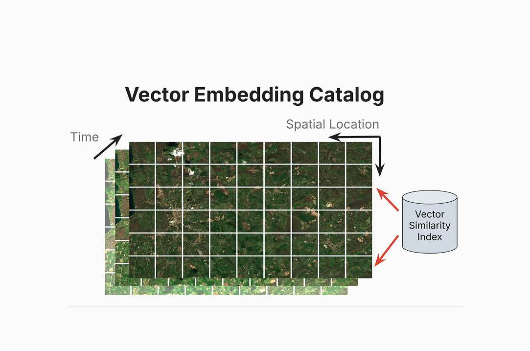
Why We’re Talking About a Centralized Vector Embeddings Catalog Now
We discuss our detailed white paper in which we make the case for how Earth Observation (EO) data providers such as NASA can dramatically improve access to their data by creating a centralized vector embeddings catalog, in addition to the more standard data catalogs that they already maintain.
-
Prioritizing Responsible AI
AI is moving fast. It’s moving faster than we can govern and regulate it, and even sometimes faster than our understanding of its full impact. As we push the boundaries of what AI can do, everyone is scrambling to keep up. Thus, the guidance and governance around AI usage are still evolving.В In this time…

-
Generating truly useful solutions to real problems with the help of user experience and AI
We discuss how AI and user experience methodologies might serve to connect scientists and researchers back to important data and technology to solve the world’s biggest problems.

-
The State of Geospatial AI Heading into 2025
For the second year in a row, I spent the week after Thanksgiving in Las Vegas, immersed in AWS re:Invent. Last year’s conference left me energized and inspired— geospatial AI was just beginning to emerge as a transformative force. This year, as anticipated, AI took center stage, with a wealth of sessions dedicated to its…
