Company
<- Return to all blogs
-
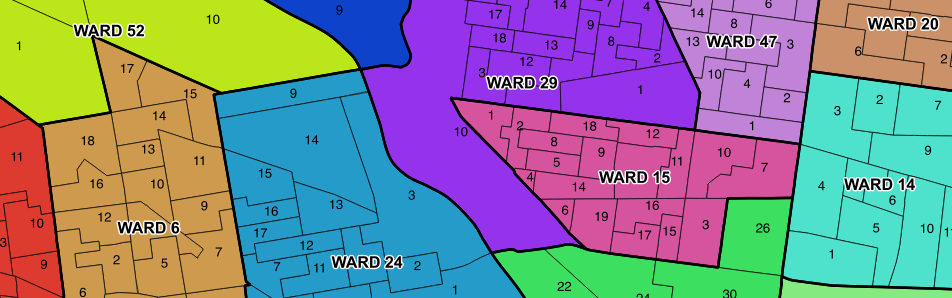
Updated Philadelphia Political Ward Data on OpenDataPhilly
In this post, we discuss our findings after compiling historic Philadelphia political ward data and ward division data from different sources.
-
Updated Philadelphia Political Ward Data on OpenDataPhilly
In this post, we discuss our findings after compiling historic Philadelphia political ward data and ward division data from different sources.
-
Focus
I’ve struggled with what I should write about for my first e84 blog post. You see, I’m not your typical high-tech employee. I don’t have a computer science degree. I’m not a math nut. I’ve never solved a Rubik’s Cube. That being said, I’ve got experience ranging a wide gamut of disciplines that I’ve managed…
-
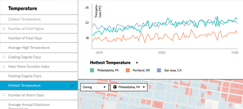
Research Grant for $1.5 Million Awarded to Develop Web-based Climate Change Impact Assessment Service
Accessible climate change analysis tools, like this climate change impact assessment service, will help local decision-makers proactively manage disaster risk, ensure access to safe water and food, and strengthen preparedness and response strategies.
-
Major Research Grant Awarded for Climate Change Data Service
We detail a recent Small Business Innovation Research (SBIR) grant we were awarded from the U.S. Department of Energy for our climate change data service.
-
OpenDataPhilly Wins 2015 Web Project of the Year at Philadelphia Geek Awards
OpenDataPhilly won 2015 Web Project of the Year.
-
Research Grants Awarded to Build Web Tools for Managing and Modeling with Earth Observation Data
In this blog, we discuss our receipt of grants that we will use to build out earth observation web tools like ModelLab and Raster Foundry.
-
Research Grants to Manage and Model Earth Observation Data
We dive into how we plan to use two Small Business Innovation Research grants to manage and model earth observation data.

-
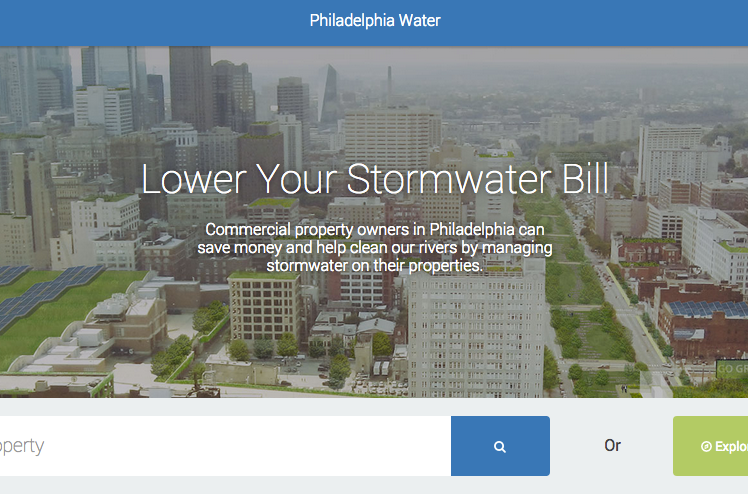
Saving Water by Saving Money: Incentivizing Greener Cities
We outline some highlights from our work so far with the Philadelphia Water Department as we collaborate to aid in “Saving Water by Saving Money”.
-
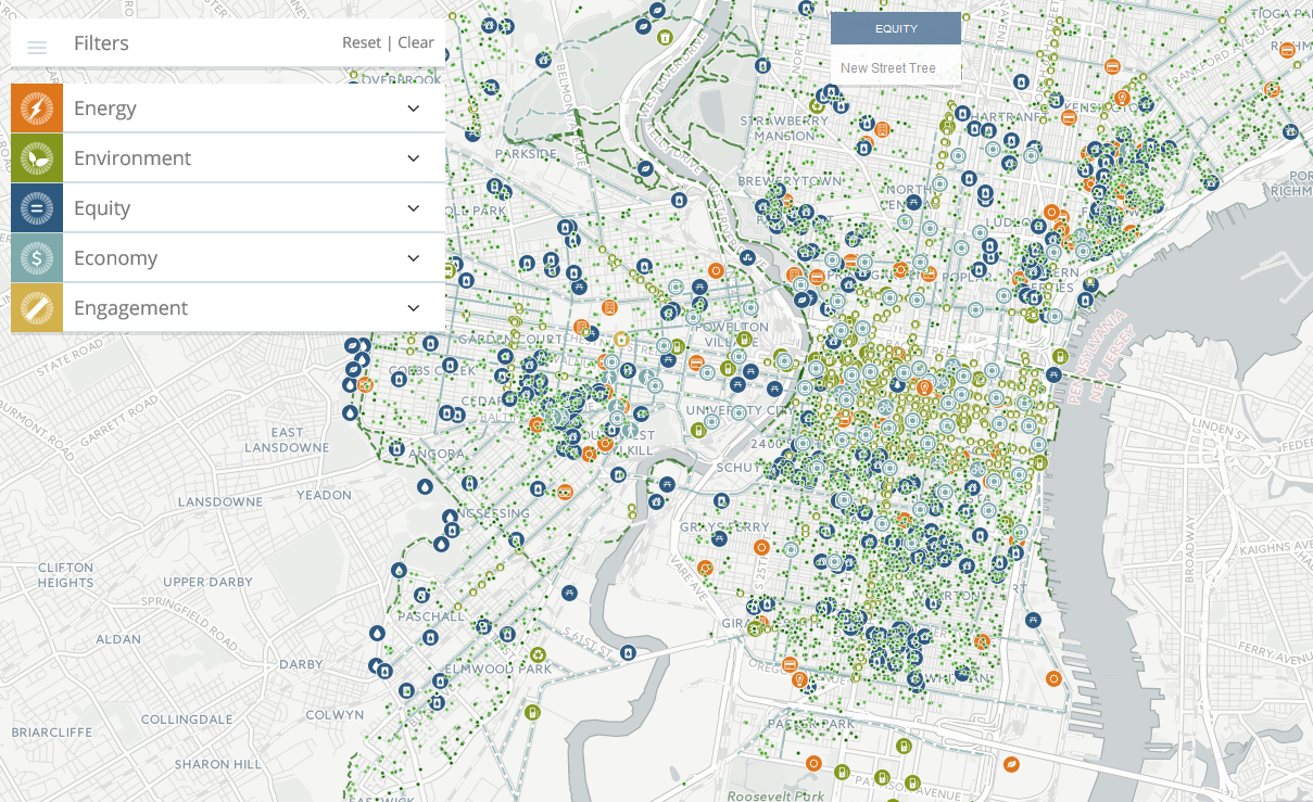
How to Fit 37 Data Sets Into One Map: Creative Cartography
In this post, we tackle a common challenge involving displaying a variety of data sets in one map.
-
TNC Recognized with Special Achievement in GIS (SAG) Award
We discuss our receipt of a Special Achievement in GIS Award for our work alongside The Nature Conservancy.