All blog posts
<- View categories
-
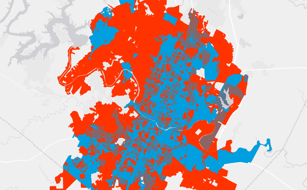
Improving City Transit Networks through Data and Public Policy
Using open source data and easily customizable software, Azavea worked with PeopleForBikes to improve city transit networks.
-
Improving City Transit Networks through Data and Public Policy
Using open source data and easily customizable software, Azavea worked with PeopleForBikes to improve city transit networks.
-
E84 at the July 2021 ESIP Meeting
We are looking forward to the ESIP Meeting this week, July 19-23, 2021. Our engagement with ESIP is deep. Element 84 (E84) has been a member of ESIP since 2014 and we have sponsored every ESIP meeting since they started their meeting sponsor program in July 2017, making this our 8th sponsorship! By supporting ESIP,…
-
Introducing Loam: A Client-Side GDAL Wrapper for Javascript
We’re launching a library called Loam. Loam allows GDAL to be used in client-side code in a web application. Loam wraps a version of GDAL compiled to WebAssembly and makes the GDAL API and utilities available to Javascript running from within a web browser.
-
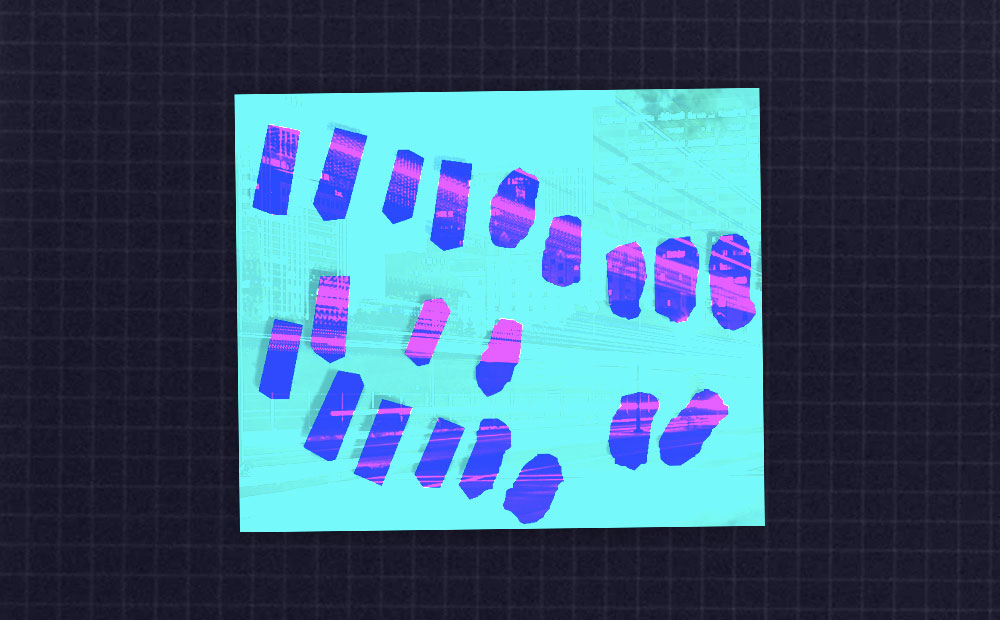
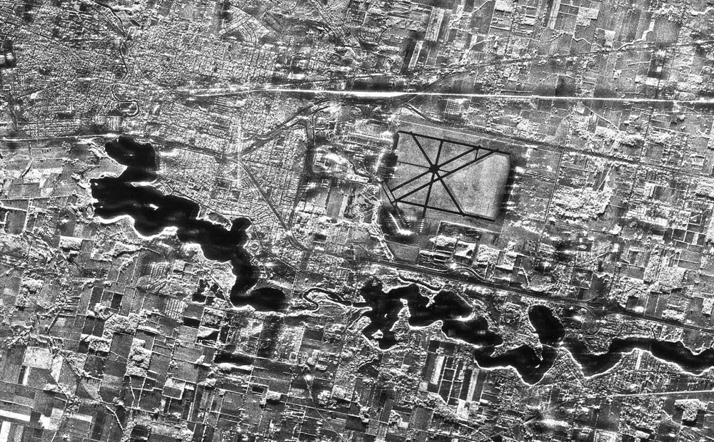
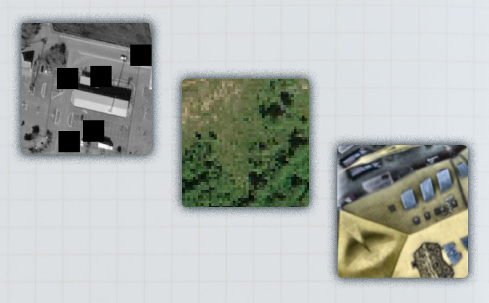
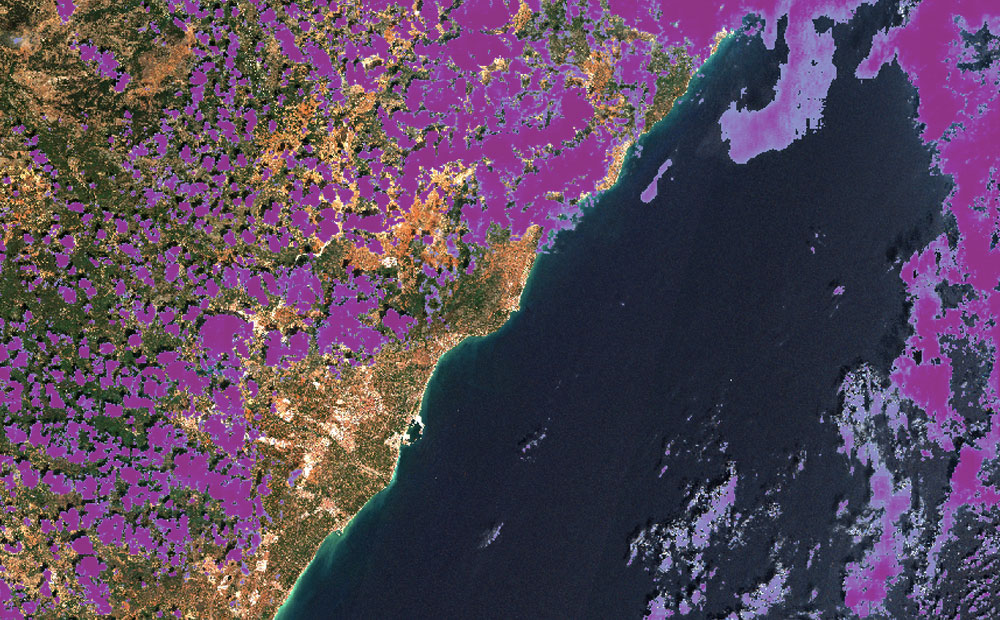
Labeling SAR Imagery for Machine Learning: A Beginners Guide
SAR imagery is having a moment. In this blog we explore what exactly it is, why it is so special, and tips for labeling it.
-
Introducing Raster Vision 0.13
This release presents a major jump in Raster Vision’s power and flexibility. The newly added features allow for finer control of the model training as well as greater flexibility in ingesting data.
-
Getting Started with STAC APIs
STAC is a specification for enabling online search and discovery of geospatial assets. This post walks through getting started with a number of STAC APIs.
-
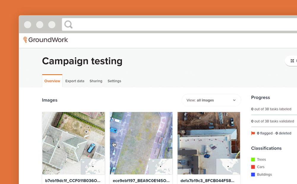
GroundWork Launches Campaigns
Need to create a training dataset that contains multiple images? GroundWork launches “Campaigns” to help you handle large datasets for machine learning.
-
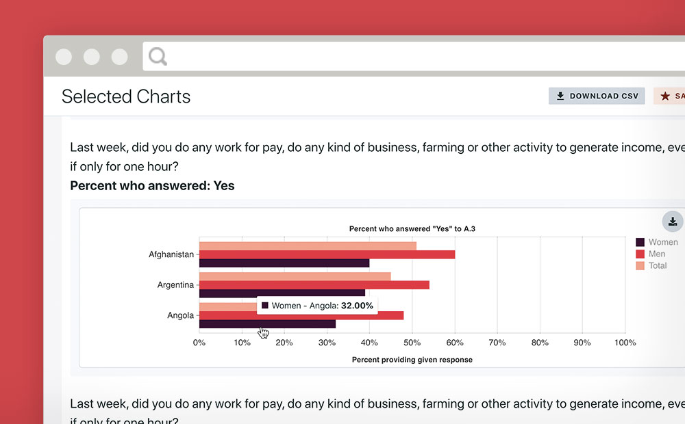
Making Gender Data Actionable
Azavea partnered with Facebook and Ladysmith to make an engaging platform that makes data from a massive gender survey actionable.
-
Cloud Detection in Satellite Imagery
We compare the results of two machine learning models that detect clouds in Sentinel-2 satellite imagery and share pointers about models you can try for yourself.
-
Load Testing a TMS Tile Server with k6.io
k6.io provides a flexible base for load testing with a convenient scripting language, and the quickstart docs will get you pretty far, but testing with a session of TMS requests had some unique challenges.