Spatial Analysis
<- Return to all blogs
-
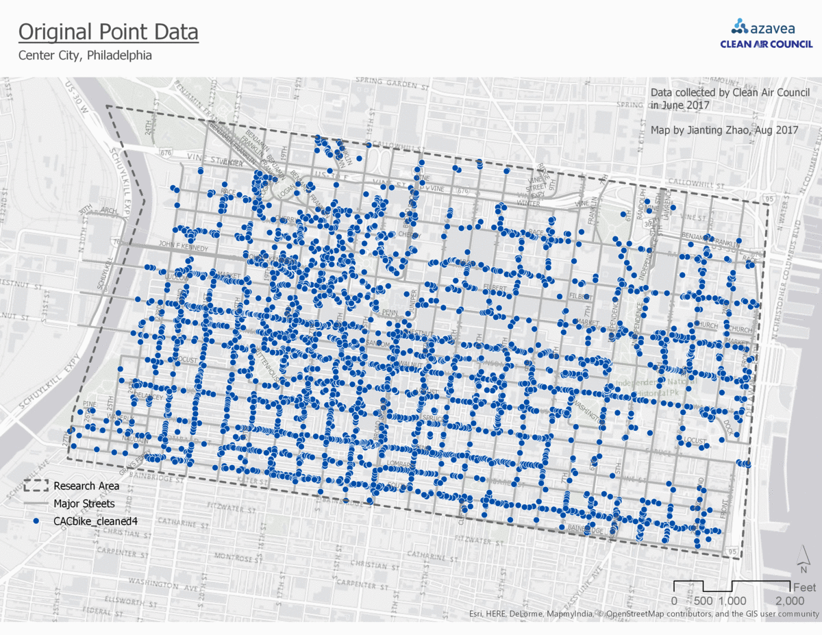
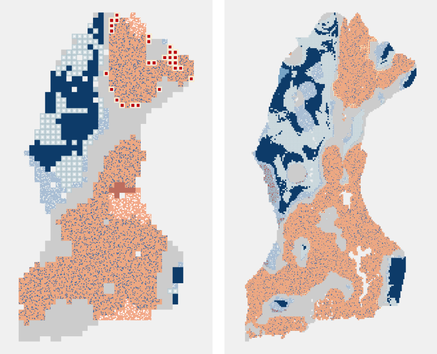
Comparison of 4 Point Data Aggregation Methods for Geospatial Analysis
This post is part of a series of articles written by 2017 Summer of Maps Fellows. Azavea’s Summer of Maps Fellowship Program is run by the Data Analytics team and provides impactful Data Analysis Services Grants for nonprofits and mentoring expertise to fellows. To see more blog posts about Summer of Maps, click here … One…
-
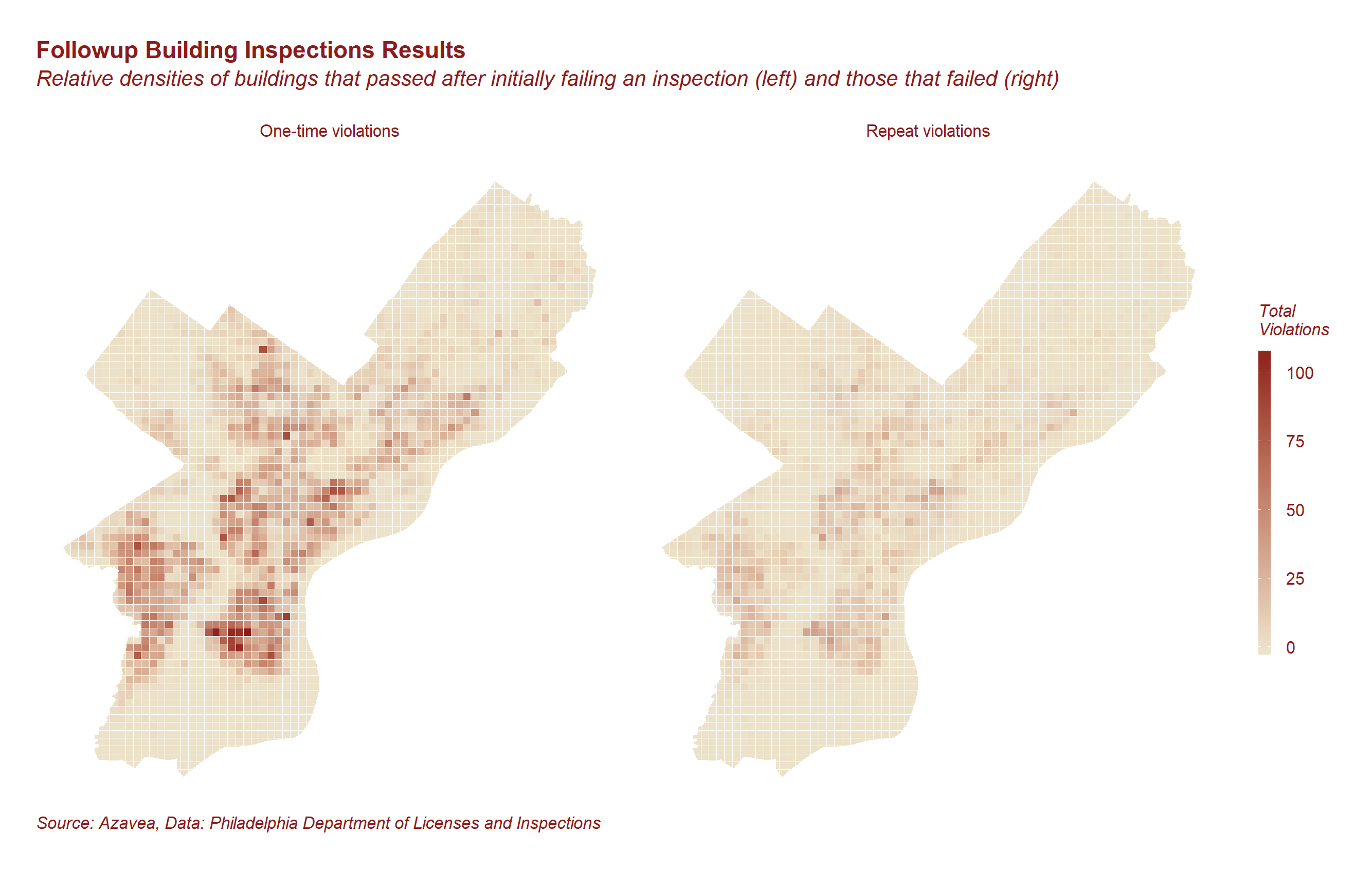
Predicting Building Code Compliance with Machine Learning Models
Which buildings should inspectors prioritize? We used machine learning models to predict building code compliance and address resource allocation questions.
-
Introducing GeoPySpark, a Python Binding of GeoTrellis
GeoTrellis is a Scala library for working with geospatial data in a distributed environment. While powerful, it has a limited user base due to the geospatial community’s preference for other languages such as Python and R. Bringing GeoTrellis to another language has thus been a requested feature of the community. Well, after nine months of…

-
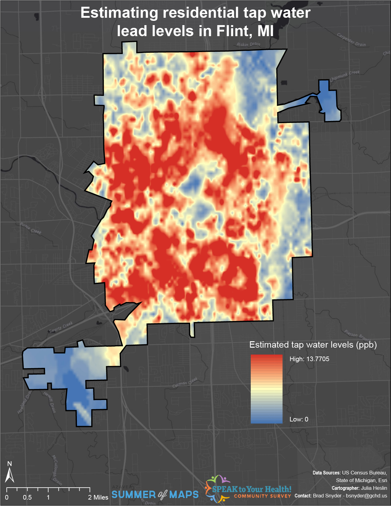
Interpolating Lead Levels from Tap Water Samples Following the Flint Water Crisis
This post is part of a series of articles written by 2017 Summer of Maps Fellows. Azavea’s Summer of Maps Fellowship Program is run by the Data Analytics team and provides impactful Data Analysis Services Grants for nonprofits and mentoring expertise to fellows. To see more blog posts about Summer of Maps, click here … The…
-
Emerging Hot Spot Analysis: Finding Patterns over Space and Time
This post is part of a series of articles written by 2017 Summer of Maps Fellows. Azavea’s Summer of Maps Fellowship Program provides impactful pro bono spatial analysis for nonprofits, while fellows benefit from Azavea mentors’ expertise. To see more blog posts about Summer of Maps, click here. Analyzing data over space and time can…
-
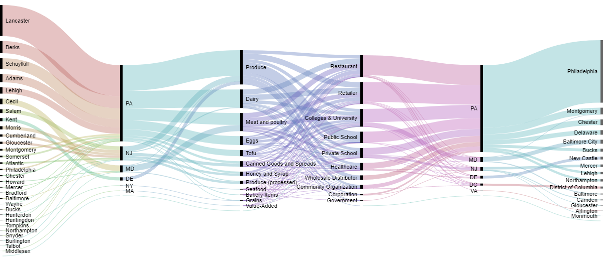
Sankey Diagrams: Six Tools for Visualizing Flow Data
This post is part of a series of articles written by 2017 Summer of Maps Fellows. Azavea’s Summer of Maps Fellowship Program provides impactful pro bono spatial analysis for nonprofits, while fellows benefit from Azavea mentors’ expertise. To see more blog posts about Summer of Maps, click here. One of the non-profits I am working…
-
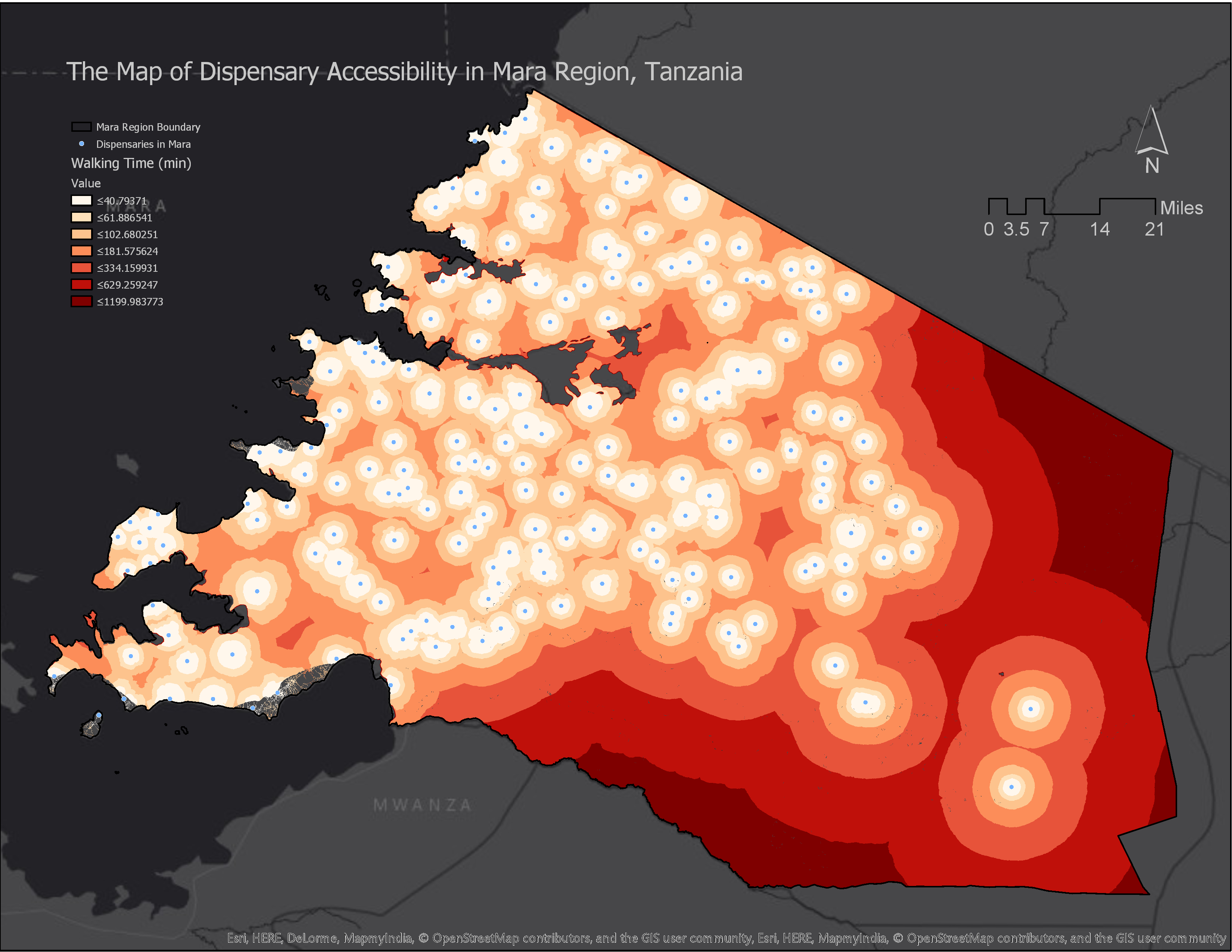
How to Calculate Location Accessibility with AccessMod 5
This post is part of a series of articles written by 2017 Summer of Maps Fellows. Azavea’s Summer of Maps Fellowship Program is run by the Data Analytics Team and provides impactful Data Analysis Services Grants for nonprofits and mentorship to fellows. To see more blog posts about Summer of Maps, click here. Mapping location…
-
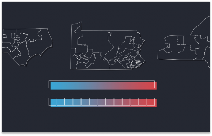
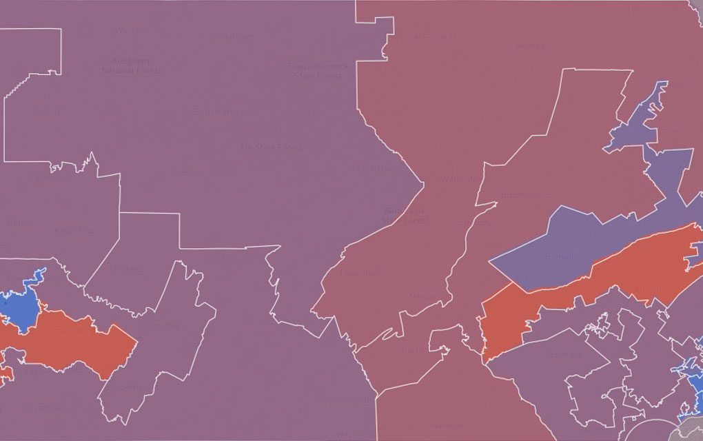
The Most Gerrymandered States Ranked by Efficiency Gap and Seat Advantage
Learn about our methodology for ranking the efficiency gap for each Congressional delegation in all 50 states and visualize the results.
-
The Evolution of Our Redistricting and Gerrymandering Work
In part 1 of our series on Azavea’s redistricting and gerrymandering work, we look at the history of our involvement in this space and what we’re currently working on. Gerrymandering, compactness, contiguity, the efficiency gap. These are the kinds of words that make a lot of redistricting nerds excited these days. Rarely does the application…
-
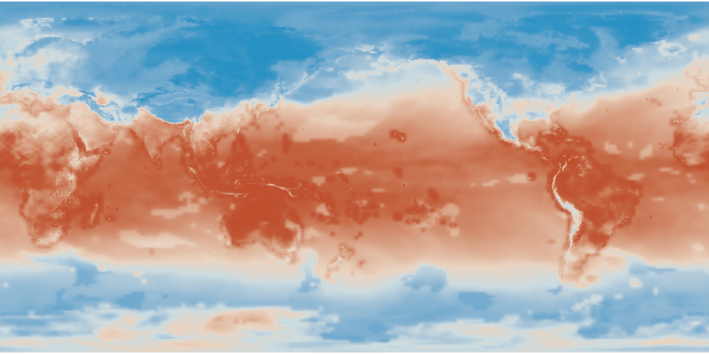
Reading and Visualizing NetCDF Climate Data with GeoTrellis
This blog postВ contains an example project that demonstrates how to read NetCDF climate projection data from S3 or a local filesystem into a Spark/Scala program using NetCDF JavaВ and how to manipulate the data using GeoTrellis. We are interested in reading datasets stored as NetCDF because it is a common format for storing large, global climate…