Research
<- Return to all blogs
-
Transfer Learning from RGB to Multi-band Imagery
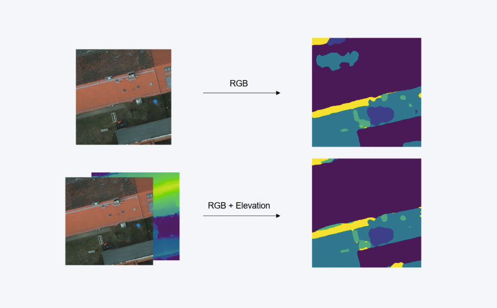
We used transfer learning to teach a model to take advantage of multi-band imagery without discarding the original RGB pre-training. This resulted in significant performance improvement.
-
Transfer Learning from RGB to Multi-band Imagery
We used transfer learning to teach a model to take advantage of multi-band imagery without discarding the original RGB pre-training. This resulted in significant performance improvement.
-
The Power of Types in Idris
Idris is a pure, statically-typed functional language with a powerful type system. Let’s explore writing code in Idris using type-driven development and interactive editing.

-
Introducing TileJSON.io, A Fast and Easy Way to View and Share Raster Tiles
TileJSON.io is an open source project by Azavea. It is an easy way to view and share raster tile sets using slippy map endpoints.
-
Six Ways we Fund Innovation
Without outside funding and given our commitment to openly sharing our knowledge, people often ask: How do you fund your innovation? We outline 6 main ways.
-
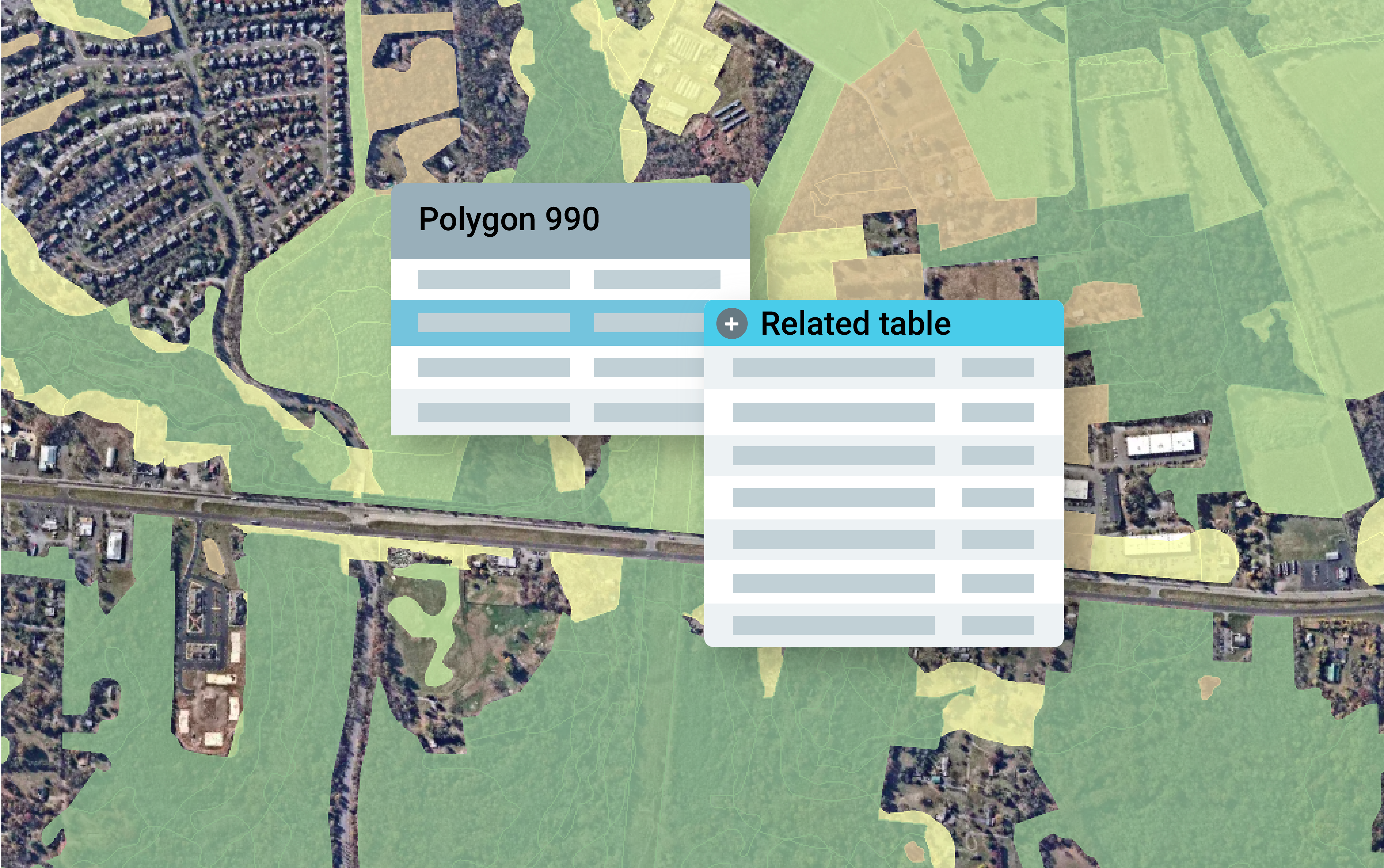
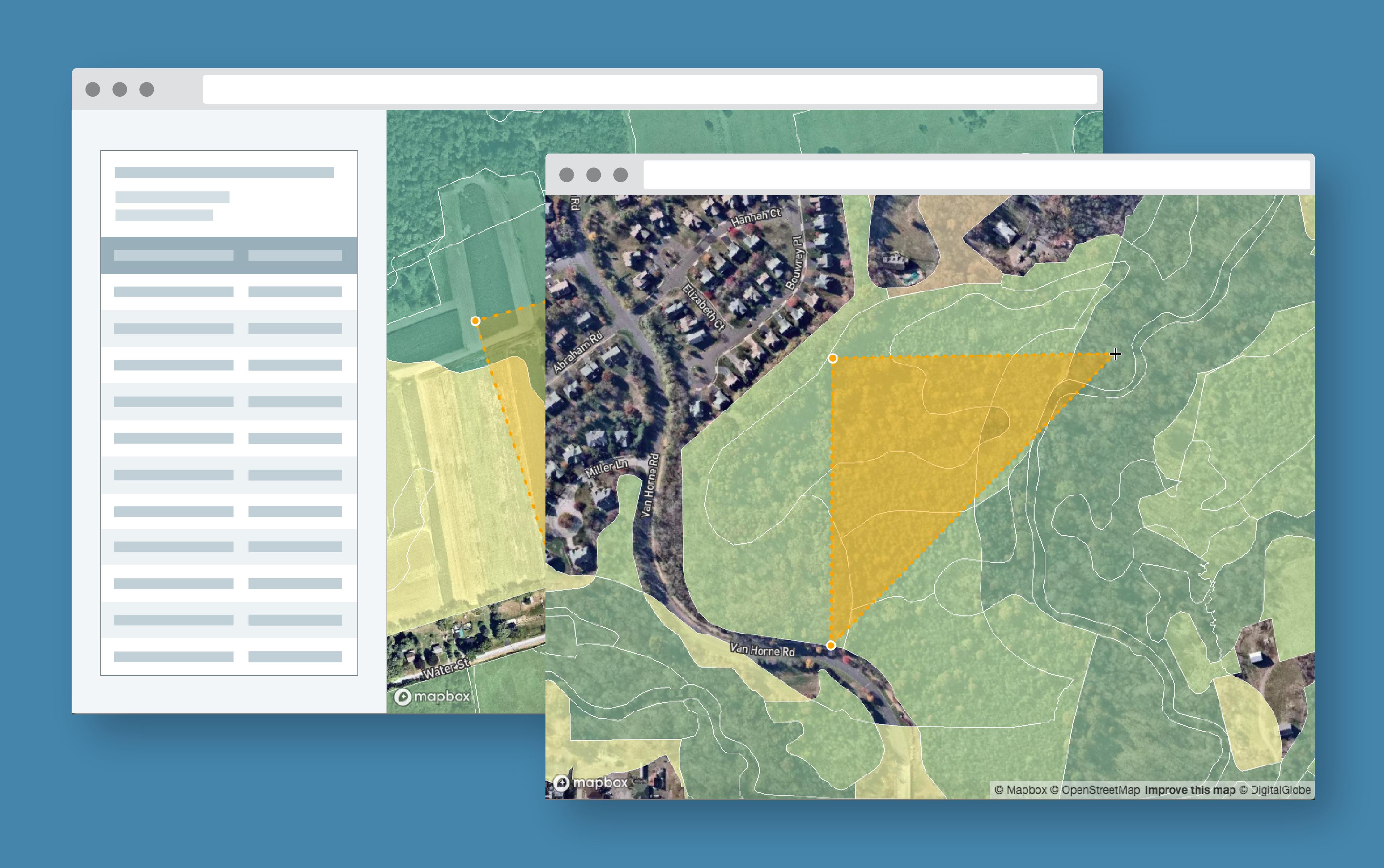
How to Convert Geodatabase Spatial Data and Related Tables to Vector Tiles
Use this open source data processing pipeline to convert geodatabase files to vector tiles for use in a web application.
-
Exploring Protected Wildlife Habitat for Every Property in New Jersey
This Azavea 10% Time project defines a process for converting big data files to vector tiles and allows a user to identify habitat areas in need of protection.
-
How to Build a Geoprocessing App with GeoTrellis and React
Follow this guide to set up a geoprocessing web application using GeoTrellis, Akka HTTP, and React.
-
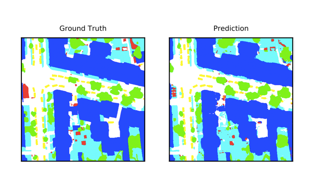
Deep Learning for Semantic Segmentation of Aerial and Satellite Imagery
This post describes how to use deep learning to do semantic segmentation on aerial and satellite imagery, experiments on the ISPRS Potsdam dataset, and how to visualize model predictions on a map.