Research
<- Return to all blogs
-
Cicero-NLP: using language models to extend the Cicero Database
We discuss how to make US Representative contact information easier to collect through automation using Natural Language Processing.
-
Cicero-NLP: using language models to extend the Cicero Database
We discuss how to make US Representative contact information easier to collect through automation using Natural Language Processing.
-
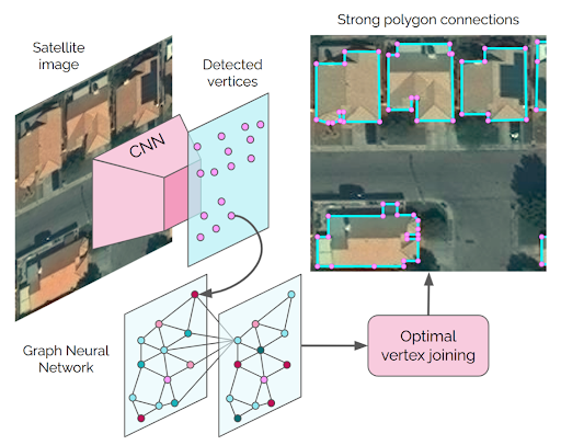
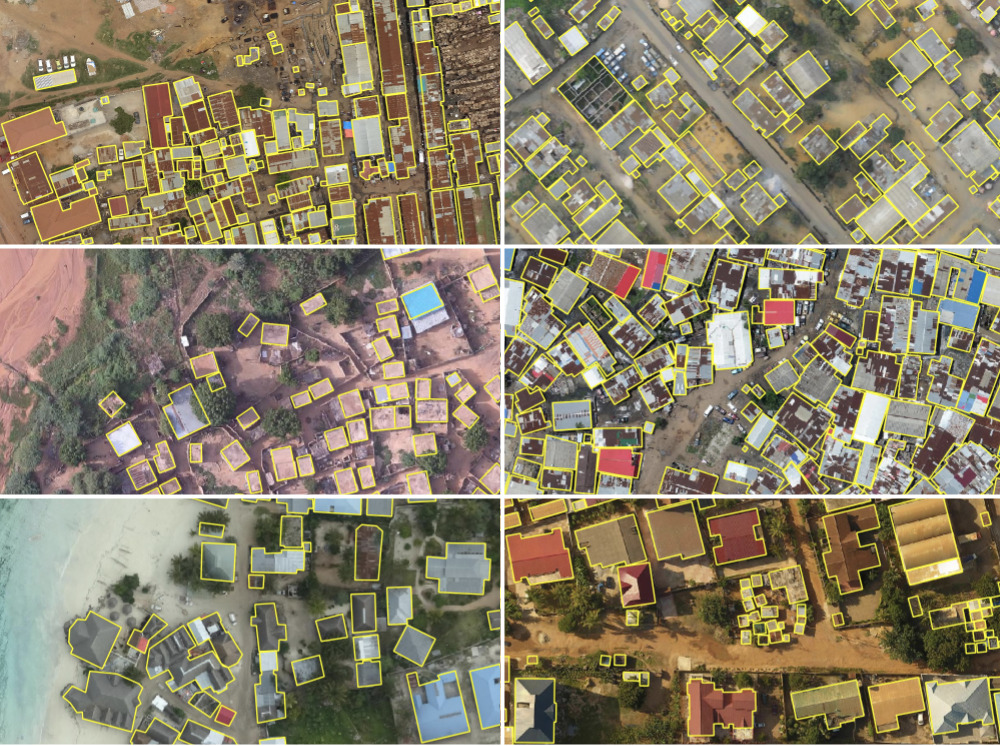
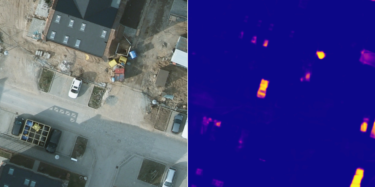
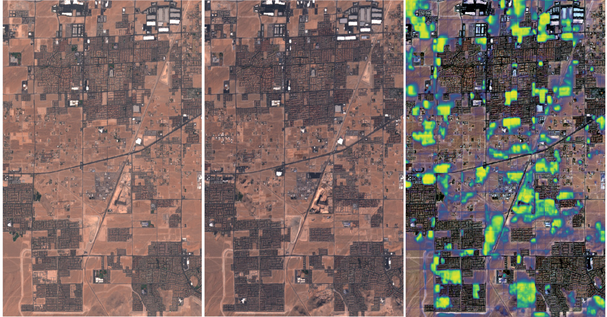
Automated Building Footprint Extraction (Part 3): Model Architectures
Reviewing model architectures for building footprint extraction including naive approaches, model improvement strategies, and recent research.
-
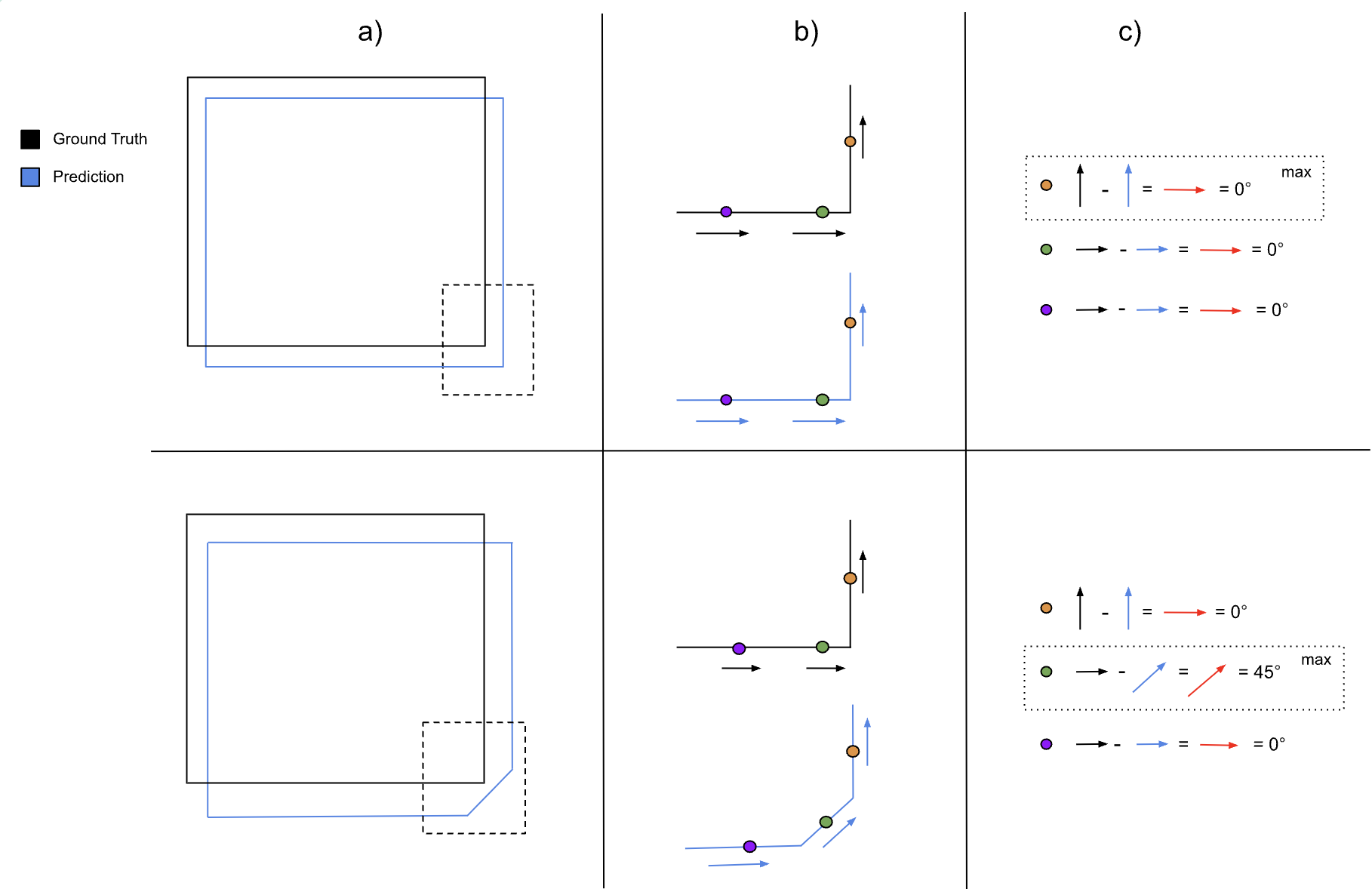
Automated Building Footprint Extraction (Part 2): Evaluation Metrics
In the second part of our Automated Building Footprint Extraction series, we review some evaluation metrics for building footprint extraction.
-
Automated Building Footprint Extraction (Part 1): Open Datasets
In the first installment of this three-part blog series, we summarize some of the latest research on automated building footprint extraction.
-
A Human-in-the-Loop Machine Learning Workflow for Geospatial Data
In this blog we demonstrate how an active learning approach can boost machine learning model performance with the human-in-the-loop workflow.
-
Change detection with Raster Vision
This blog explores the direct classification approach to change detection using our open-source geospatial deep learning framework, Raster Vision, and the publicly available Onera Satellite Change Detection (OSCD) dataset.
-
2022 Trends in Geospatial
Azavea’s CEO Robert Cheetham provides 6 trends he foresees in geospatial this year. These predictions are grounded in Robert’s personal experience and perspective as Azavea CEO.
-
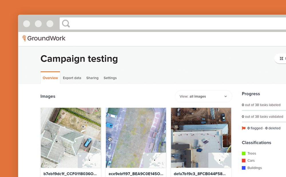
GroundWork Launches Campaigns
Need to create a training dataset that contains multiple images? GroundWork launches “Campaigns” to help you handle large datasets for machine learning.
-
Image Classification Labeling: Single Class versus Multiple Class Projects
When labeling for image classification is it faster to complete projects with single or multiple classes? We ran an experiment to find out.
-
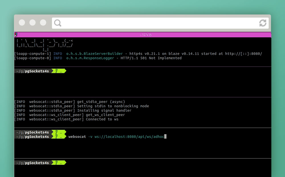
Notifications over Websockets with Http4s and Skunk
In an attempt to avoid relying on polling in a front-end application or third-party services, we attempt servicing asynchronous notifications over websockets using only PostgreSQL and Scala.