Geospatial Scaling Support
Strengthen your backend geospatial capabilities through customized infrastructure optimization, scaling, and acceleration.


What you need
As you juggle different organizational needs, youвҖҷre looking for a maintainable geospatial infrastructure solution so that you can focus on your core competencies. While you would like initial support to optimize your infrastructure, you also want to receive training to ensure that you can manage your own infrastructure down the line if you so choose.
What we bring to the table
We provide deep, senior level geospatial expertise to help you ramp up your capabilities. We will build and deploy geospatial infrastructure using core open-source software and, depending on your organizationвҖҷs needs, we can either maintain and operate your system or train your staff to operate in-house. WeвҖҷll train your staff as you hire more team members, ramp up your processes, and develop more capacity. Staff training for your team will take place through workshops, documentation, pairing, and availability for consulting.
At the end of the day, youвҖҷll own your entire system. This system doesnвҖҷt require ongoing fees; weвҖҷre passing on domain knowledge that will help your processes for years to come. This is possible because your custom solution will be built using open-source software.
What to expect
Our scaling support offering includes elements of our Strategic Geospatial Consulting and kicks off with a discovery phase where weвҖҷll put together an assessment and roadmap to ensure that the the final solution best meets your needs.
We also offer a robust FinOps service integrating financial accountability with cloud operations to optimize costs and maximize the value of your geospatial data solutions.
Sound like a good fit? Get on our calendar ->
Learn about some of the tools we’ll use
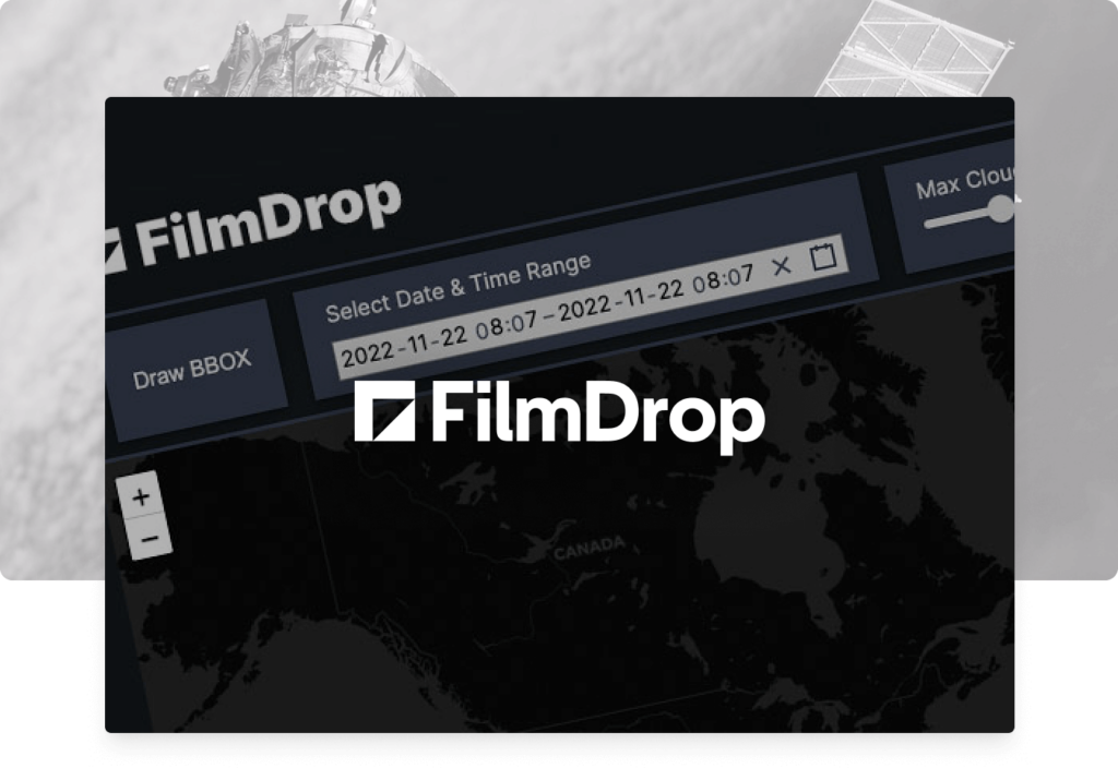
FilmDrop ->
Cloud-native geospatial processing suite.
FilmDrop is a suite of open source tools for ingesting, archiving, processing, analyzing and distributing geospatial data in the cloud.

Earth Search ->
Earth Search offers a public search and discovery API for Earth on AWS, AmazonвҖҳs registry of open geospatial datasets. Initial datasets include the entire USGS Landsat Collection 2 and ESA Sentinel-2 catalogs, Sentinel-1, Copernicus DEM, and NAIP with more datasets being added regularly.
Powered by FilmDrop
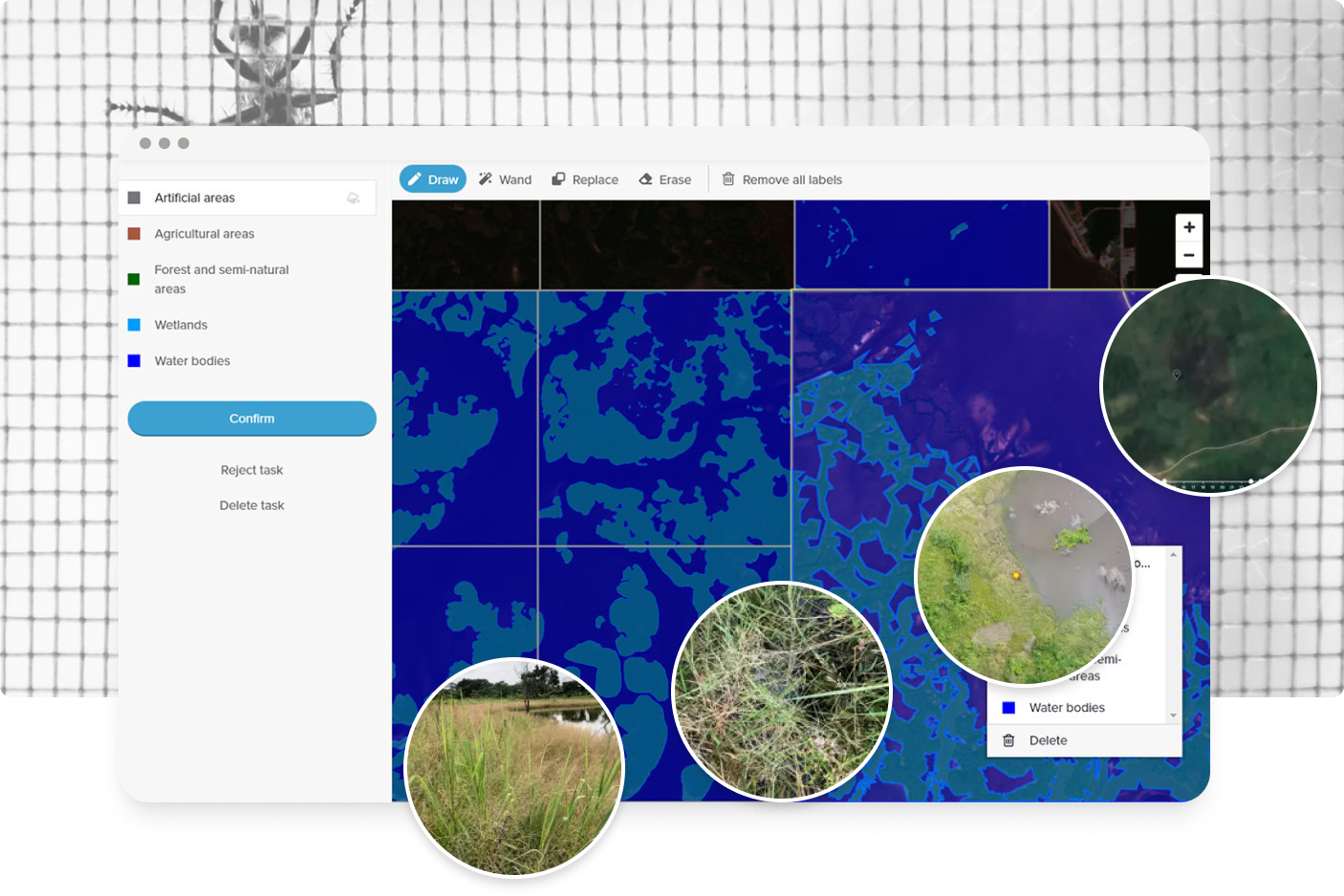
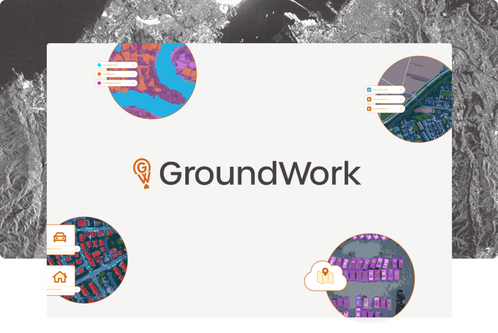
GroundWork ->
An annotation tool designed for geospatial data, including satellite, aerial, and drone imagery. GroundWork supports object detection, chip classification and semantic segmentation projects, ideal for creating training datasets for machine learning projects.
Raster Vision ->
Raster Vision is an open source library and framework that bridges the divide between the world of GIS and deep learning-based computer vision for satellite and aerial imagery.