Search and Discovery for Geospatial Data
Earth Search is a STAC compliant search and discovery API built using Element 84’s suite of Filmdrop services bringing petabytes worth of Geospatial Open Datasets from the Registry of Open Data on AWS to users while allowing them to quickly and easily interact with their data of interest.
Access the API, explore the map Console, or monitor new processing via the Dashboard.
API
A free-to-use STAC API that gives you a central search catalog and standardized metadata for open geospatial data on AWS.
Console
A map centric web application to explore data in the Earth Search API and visualize imagery from the API’s catalog.
Dashboard
A summary dashboard that shows what data is being processed and ingested into the API.
EARTH SEARCH API
Free-to-use STAC API
Earth Search gives you a central search catalog and standardized STAC metadata via a single API.

Access cloud-native datasets
Access cloud native datasets including the entire USGS Landsat Collection 2 and ESA Sentinel-2 catalogs, Sentinel-1, Copernicus DEM, and NAIP with more datasets being added regularly.
EARTH SEARCH CONSOLE
Web Map to Explore Open Earth Data
The Console provides a simple web application to browse metadata and imagery from the STAC API.

Console Features
Cloud Native
Access to cloud-native AWS datasets
Multiple Datasets
Choose between multiple imagery collections
Time Range
Search specific date ranges
% Cloud Cover
Set cloud cover threshold for search
Target Location
Limit search area via BBOX or geojson
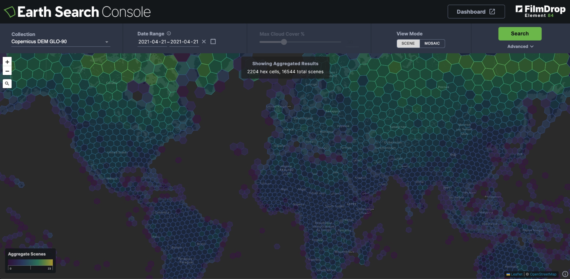
Aggregations
View total imagery coverage in aggregate
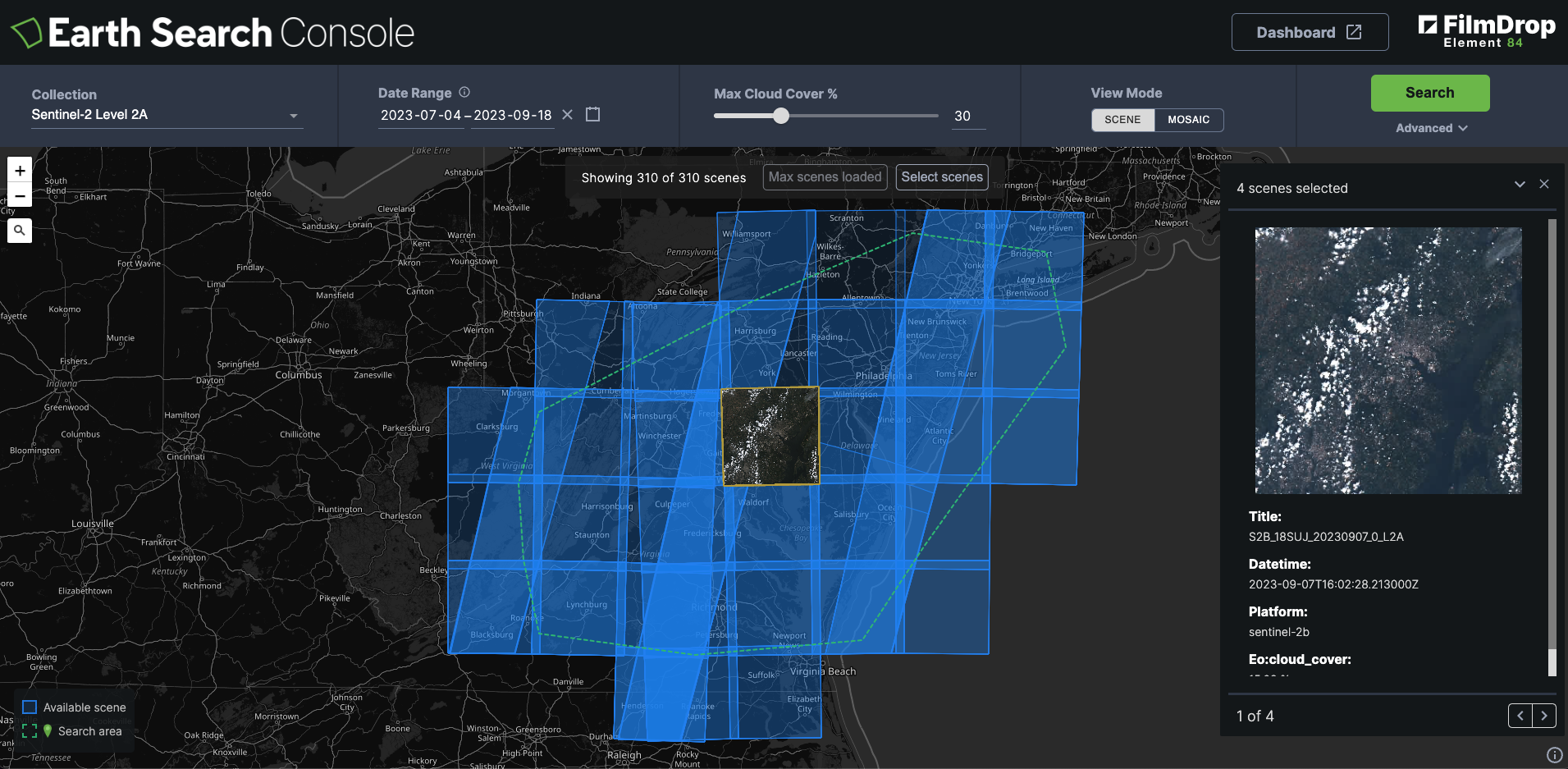
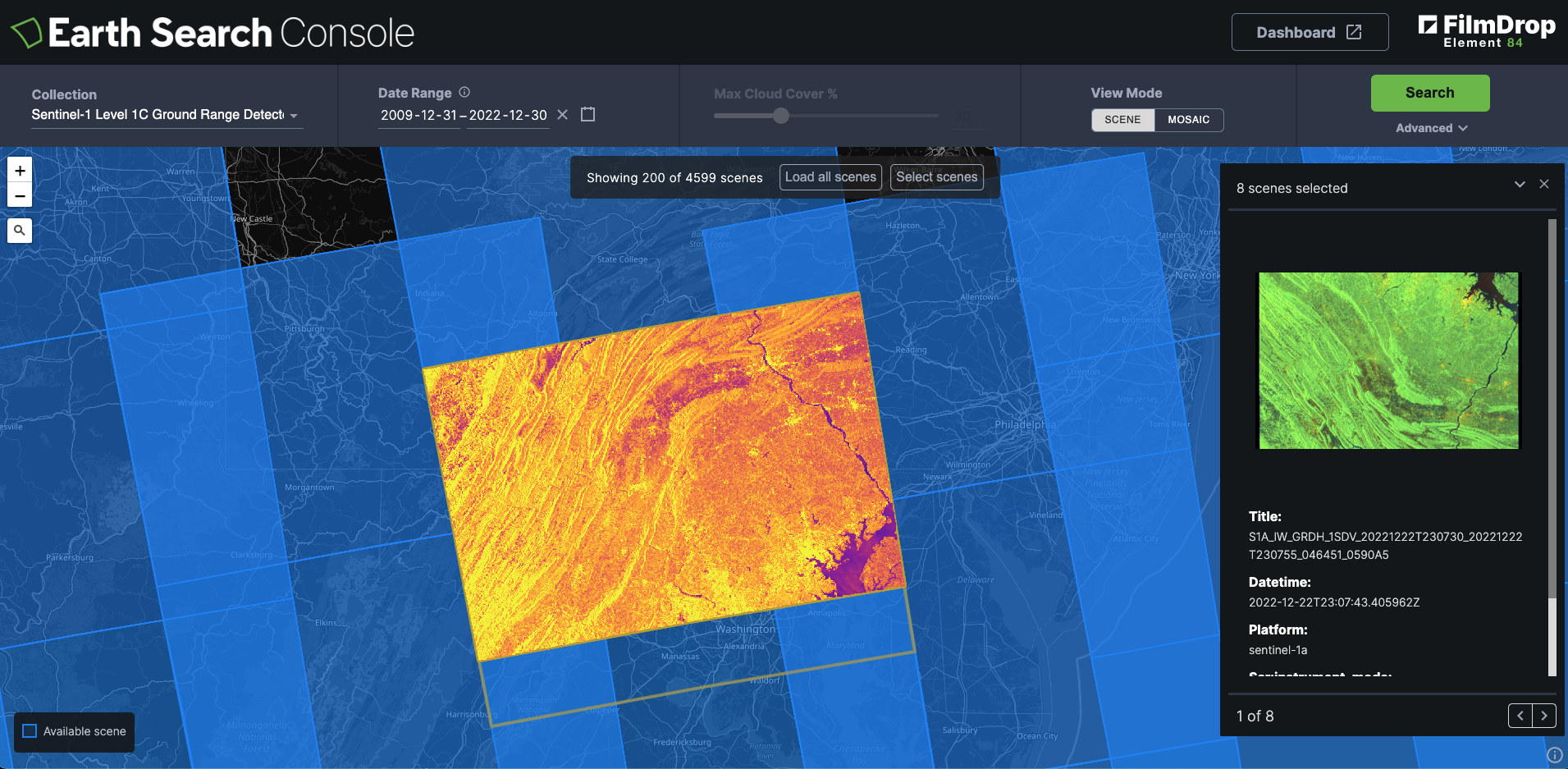
Metadata
Select individual scene footprints and metadata
Imagery Overlays
Visualize scene imagery overlaid on map
Mosaicing
Combine scenes to view on-the-fly mosaics
Open Source
Build from the open source FilmDrop-UI project
EARTH SEARCH DASHBOARD
Monitor Processing Status
The dashboard gives you a peak inside the pipelines running to ingest data into the Earth Search API.

Ingest Processing Dashboard
Want to see under the hood of the Earth Search API? Use the Earth Search Dashboard to view processing metrics and workflows that show status of new data being added into the STAC Collections available in the API.
Need your own Search and Discovery Solution for Geospatial Data?
CONTACT US
Powerful solutions to accomplish your goals
Contact us to learn more about Earth Search and how Filmdrop can enable your geospatial project.