All blog posts
<- View categories
-
Focus
I’ve struggled with what I should write about for my first e84 blog post. You see, I’m not your typical high-tech employee. I don’t have a computer science degree. I’m not a math nut. I’ve never solved a Rubik’s Cube. That being said, I’ve got experience ranging a wide gamut of disciplines that I’ve managed…
-
Functional Programming for the Functionally Challenged (Like Me) – Part 3
In the previous installment of our introduction to functional programming we looked at reading values from nested data structures.nIn this final post we look at the flip side of working with nested data structures, updating them. If you have not read the previous post yet and are not familiar Elixir, you might want to read…
-
Meet Hopeworks: the Camden nonprofit offering GIS and web development training to youth
In this post we spotlight Hopeworks, a Camden-based nonprofit offering GIS and web development training for youth.

-
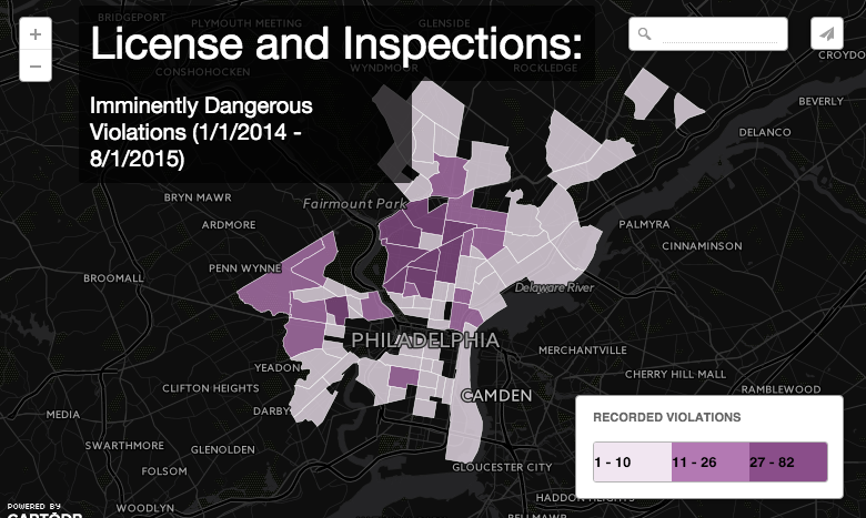
Using PostGIS to Summarize Philadelphia Inspections Data
In this post we detail our experience using PostGIS to summarize Philadelphia Inspections Data.
-
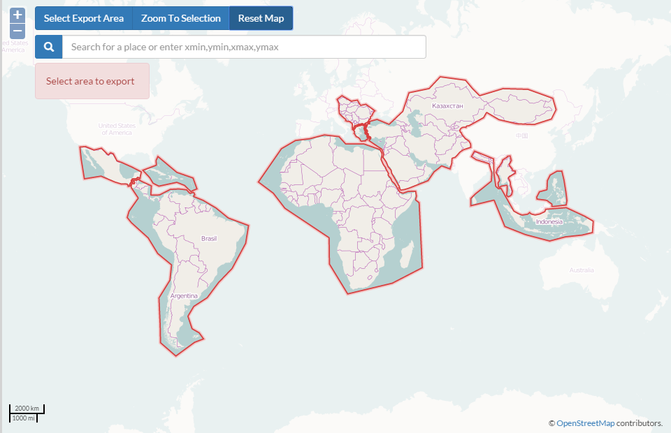
Tools for Getting Data out of OpenStreetMap and into Desktop GIS
In this post we discuss tools used to get data out of OpenStreetMap, and into Desktop GIS.
-
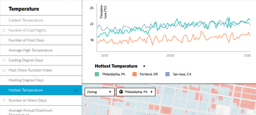
Research Grant for $1.5 Million Awarded to Develop Web-based Climate Change Impact Assessment Service
Accessible climate change analysis tools, like this climate change impact assessment service, will help local decision-makers proactively manage disaster risk, ensure access to safe water and food, and strengthen preparedness and response strategies.
-
Testing with VCR and Token Authentication
If you are using VCR to record/playback HTTP requests for your Rails tests, you may run into problems if your cassettes use tokens to authenticate with those services. VCR uses a RequestMatcher to determine if an outgoing request (and response) already exist in a cassette. Upon finding a match, the test will use the response…
-
Major Research Grant Awarded for Climate Change Data Service
We detail a recent Small Business Innovation Research (SBIR) grant we were awarded from the U.S. Department of Energy for our climate change data service.
-
Functional Programming for the Functionally Challenged (Like Me) – Part 2
In the last post we looked at functional approaches to solving problems typically solved using loops in imperative languages. These problems centered around list-like data structures such as arrays or vectors. In this post we will look at more complicated nested data structures.
-
Proto REPL: A new Clojure REPL for the Atom Editor
I’d like to introduce a new Clojure REPL, Proto REPL, that I created as a plugin to the Atom editor. Proto REPL lets you develop Clojure applications in Atom using an interactive REPL driven development experience. nn nn Proto REPL Features nn n Send blocks of code or selections from an editor tab to the…