All blog posts
<- View categories
-
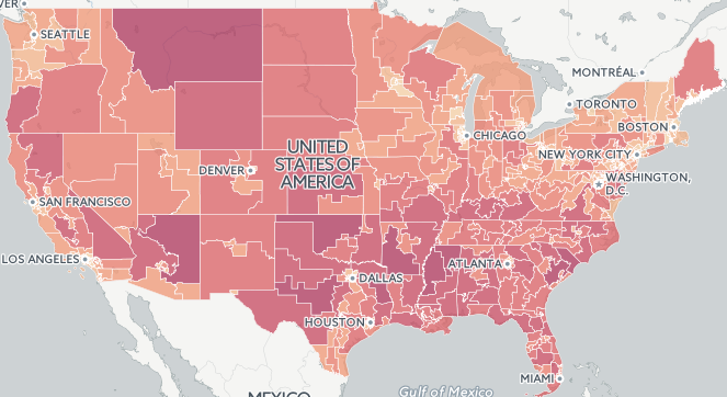
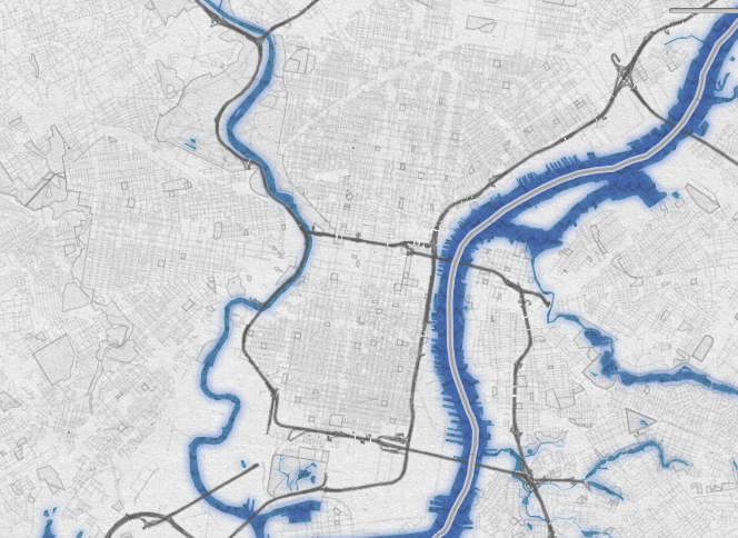
2015 Fatal Crash Data by Congressional District Released
In this post, we take a look at the geography of fatal crashes by Congressional district in the U.S in response to the recent release of the 2015 Traffic Fatalities data and call to action.
-
2015 Fatal Crash Data by Congressional District Released
In this post, we take a look at the geography of fatal crashes by Congressional district in the U.S in response to the recent release of the 2015 Traffic Fatalities data and call to action.
-
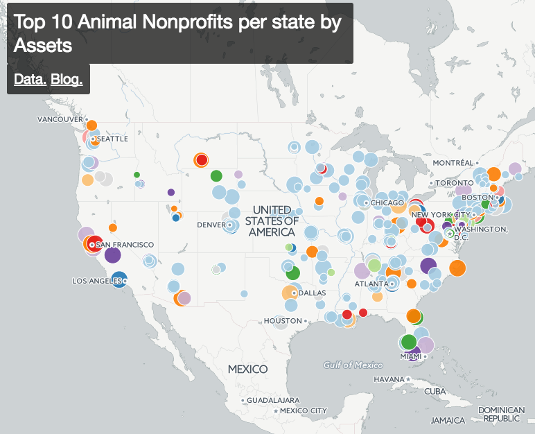
Getting Started Exploring All 1.5 Million Nonprofits in the US
In this post we discuss how to find and categorize data about all of the 1.5 million US nonprofits.
-
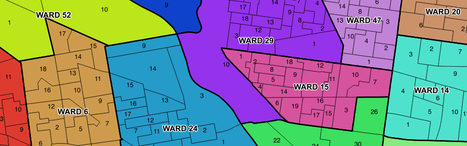
Updated Philadelphia Political Ward Data on OpenDataPhilly
In this post, we discuss our findings after compiling historic Philadelphia political ward data and ward division data from different sources.
-
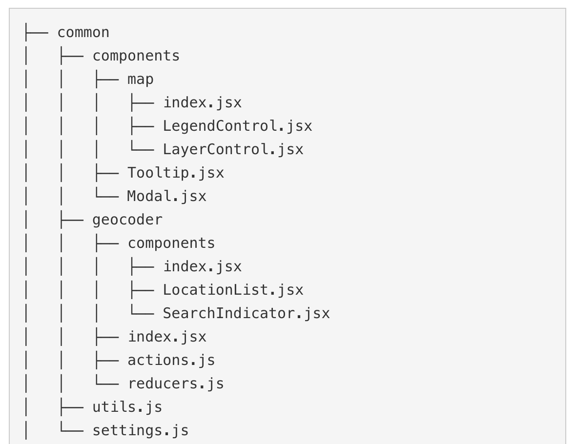
Civic Apps Team React/Redux Project Structure
In this blog, we discuss our experience moving to using React/Redux and Webpack to build our JavaScript applications.
-
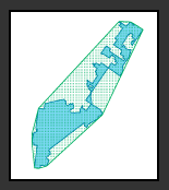
Measuring District Compactness in PostGIS
In this blog we discuss strategies for measuring district compactness in PostGIS.
-
Serving Local Mapbox Vector Tiles with Docker
In this post we outline how to serve local Mapbox vector tiles with Docker.
-
Using Python’s LXML in Amazon Lambda
In this post, we detail our experience using Python’s LXML in Amazon Lambda.

-
GeoTrellis 0.10.0 is released
This post details the GeoTrellis 0.10 release including all significant changes and improvements.
-
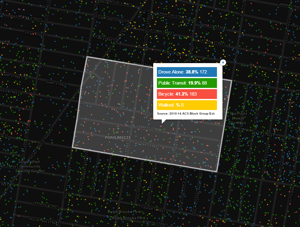
How Philadelphians Get To Work: Calculating Mode Share and Dot Density Maps in CartoDB
In this post we calculate mode share and dot density maps in CartoDB to depict how Philadelphians get to work.
-
Proto REPL – Updates to the Clojure REPL for Atom
Proto REPL is a Clojure REPL for the Atom Editor that I introduced in a blog post last October. When I introduced Proto REPL, I wrote “The future of interactive development is going to be visual.” and that “ATOM is at its heart a web browser that means you can use the combination of HTML/CSS/JavaScript…