All blog posts
<- View categories
-
The 2025 Geospatial Tech Radar: Agentic AI, EO Embeddings, and Cloud-Native Maturity
We analyze trends and highlights from the third iteration of our Geospatial Tech Radar including Agentic AI and MCP, EO Foundation Models and Embeddings, and the solidification of Cloud-Native Geospatial.
-
The 2025 Geospatial Tech Radar: Agentic AI, EO Embeddings, and Cloud-Native Maturity
We analyze trends and highlights from the third iteration of our Geospatial Tech Radar including Agentic AI and MCP, EO Foundation Models and Embeddings, and the solidification of Cloud-Native Geospatial.
-
STAC: A Retrospective, Part 2 (Why STAC was Successful)
In Part 1 of this series we covered the origin story of STAC, exploring the history and the initial sprints that created the spec. Now, it’s time to cover the how and the why of its success.
-
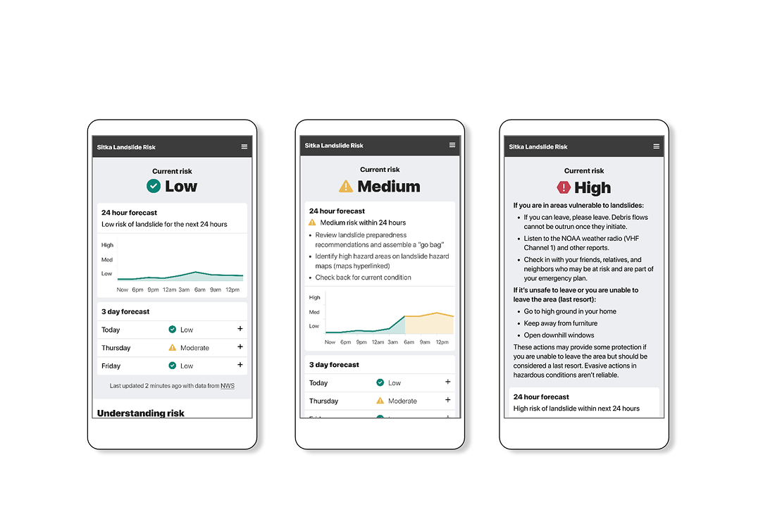
Designing risk visualizations: why appropriate complexity mattersВ
In this blog I detail some case studies that have been top-of-mind recently to demonstrate the importance of appropriate complexity, and how it can contribute to meaningful action when applied with intention, particularly in the context of risk analysis.В
-
Mobilizing Metadata; using STAC to Manage Risk in the Reinsurance Industry
Data doesn’t have any value unless you can use it… and trust it. Users need to quickly access data and know where it came from. This is especially true with the integration of AI, making quick access more achievable but data provenance more opaque. This is where STAC comes in. The reinsurance industry uses climate…

-
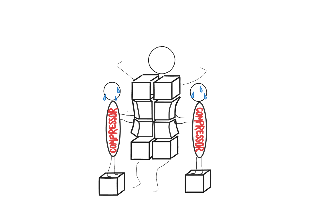
Beyond the default: a modern guide to raster compression
We discuss community concerns surrounding raster compression and key metrics for evaluating compression effectiveness.
-
Introducing Natural Language Geocoding v0.1.0: An LLM-Enabled Geocoding Database
The landscape of geospatial AI is rapidly evolving. Many organizations are building LLM-powered solutions that tackle complex geospatial problems and answer sophisticated questions about our planet. These agentic approaches allow LLMs to autonomously select from toolsets that include geospatial tools, Earth Observation (EO) catalogs, and EO data processing capabilities. The result? Systems that can process…
-
Chunks and Chunkability: An Origin Story
If you accept that we are living through the Tyranny of the Chunk, then you might be wondering how we got to this place. Who created the first chunks and what was their motivation? As we explore the history of different data formats we’ll see recurring patterns of thinking around how much information to consolidate…
-
Chunks and Chunkability: Tyranny of the Chunk
We discuss our attempt to understand chunks and chunking more deeply including where we are today and where we might go from here.
-
Perceived Gaps in Earth ObservationВ
At Element 84, our team looks forward to the Spring season and the return of a busy conference schedule every year. Our time attending, presenting, and learning at conferences helps us to feel connected and plugged into trends in the geospatial industry and beyond. It also allows us to receive feedback on our team’s latest…

-
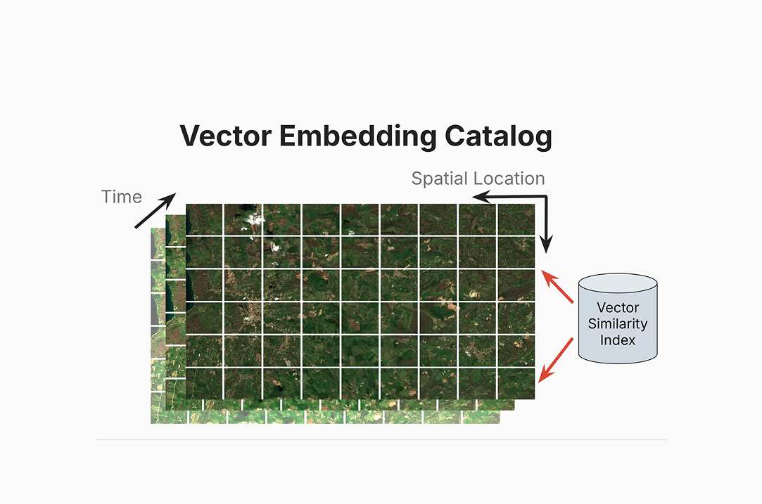
Why We’re Talking About a Centralized Vector Embeddings Catalog Now
We discuss our detailed white paper in which we make the case for how Earth Observation (EO) data providers such as NASA can dramatically improve access to their data by creating a centralized vector embeddings catalog, in addition to the more standard data catalogs that they already maintain.