Author: Adeel Hassan
<- Return to all blogs
-
Queryable Earth Demo Update: Now with Change Detection!
We detail how we used our research surrounding queryable Earth and natural language geocoding to demonstrate data accessibility in an intuitive and interactive way – and how you might be able to harness some of the same ideas in your own work.
-
Queryable Earth Demo Update: Now with Change Detection!В
We detail how we used our research surrounding queryable Earth and natural language geocoding to demonstrate data accessibility in an intuitive and interactive way – and how you might be able to harness some of the same ideas in your own work.В
-
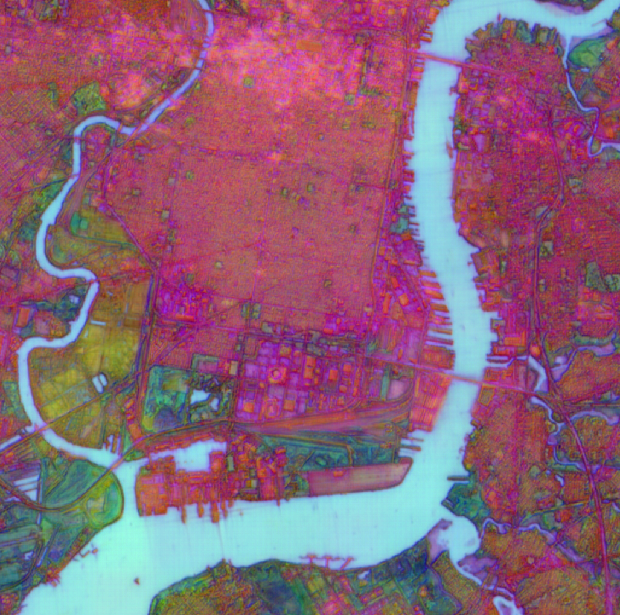
Exploring AlphaEarth Embeddings
Earlier this year, in July 2025, Google DeepMind contributed to the conversation on Earth Observation (EO) foundation models and vector embeddings by releasing a dataset of EO vector embeddings generated by their new AlphaEarth Foundations (AEF) model. Originally released only inside Google Earth Engine, these embeddings were finally made publicly and freely available on Source…
-
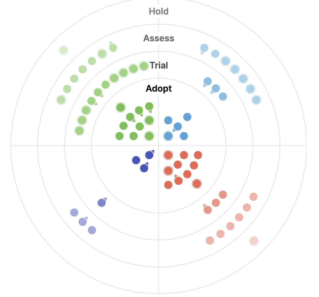
The 2025 Geospatial Tech Radar: Agentic AI, EO Embeddings, and Cloud-Native Maturity
We analyze trends and highlights from the third iteration of our Geospatial Tech Radar including Agentic AI and MCP, EO Foundation Models and Embeddings, and the solidification of Cloud-Native Geospatial.
-
Why We’re Talking About a Centralized Vector Embeddings Catalog Now
We discuss our detailed white paper in which we make the case for how Earth Observation (EO) data providers such as NASA can dramatically improve access to their data by creating a centralized vector embeddings catalog, in addition to the more standard data catalogs that they already maintain.
-
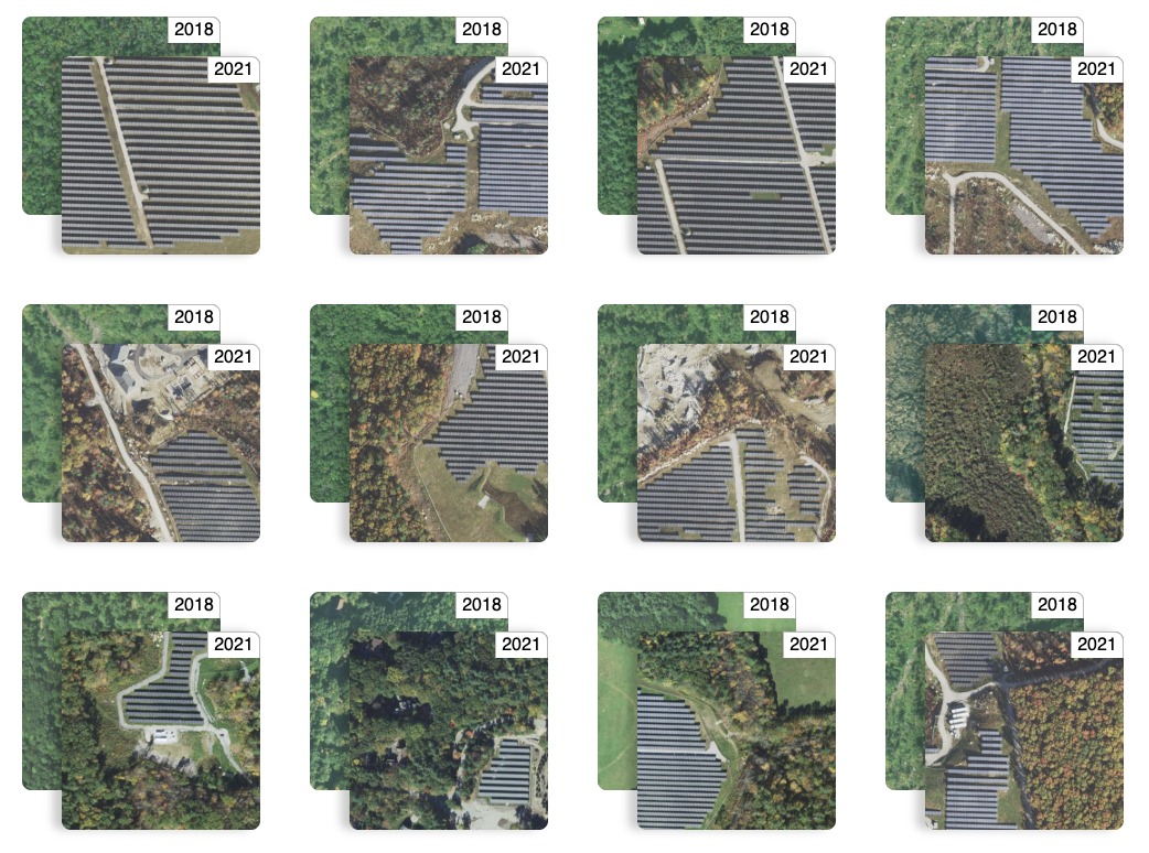
Finding Changes on the Earth with Natural Language
We discuss our work with Natural Language Driven Geospatial Change Detection with Vector Embeddings. This technology builds on our ongoing development of generative AI and vision models that enables users to explore our world through natural language queries.

-
Segmenting Sandstorms in Satellite Imagery
In this blog, we walk through our approach to segmenting sandstorms in satellite imagery, evaluate the quality of our results, and compare them against existing solutions.

-
Building a queryable Earth with vision-language foundation models
We take a close look at two such remarkable VLMs that have come out in the past few months and, using these models, we build a prototype “queryable Earth” functionality that allows retrieving images along with their geolocations using text queries over a large geographical area.

-
Streamlining search-and-rescue operations using machine learning on the edge
In this blog, we discuss various improvements that we have made to the proposed workflow first discussed in our previous blog post focused on edge processing of drone imagery for search-and-rescue.
-
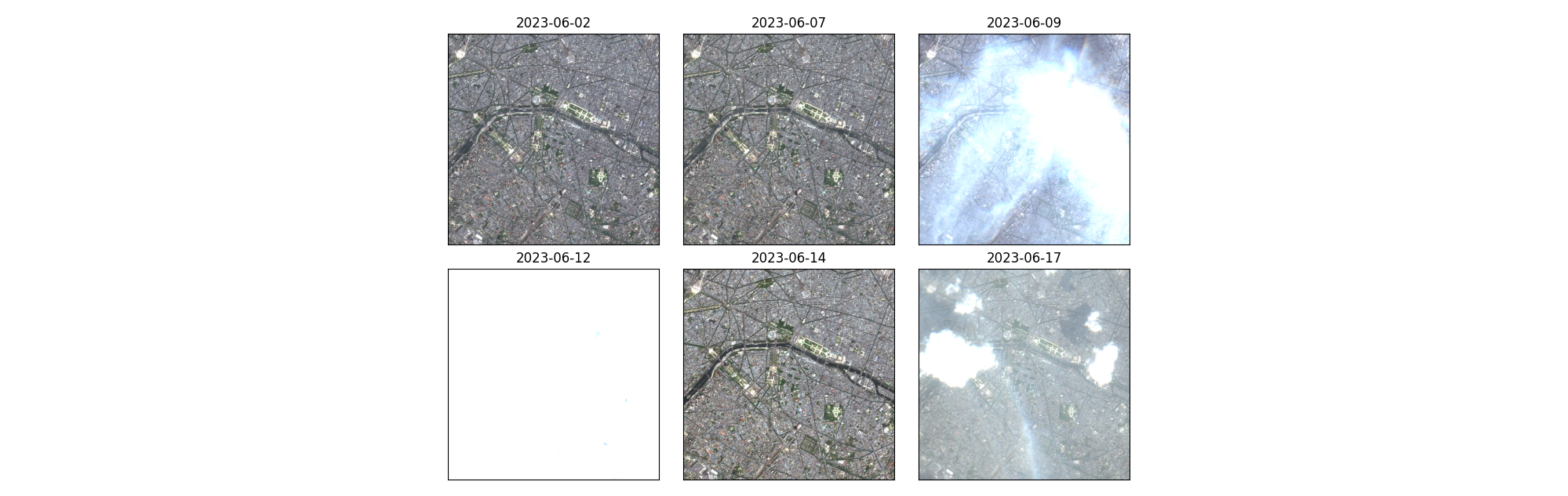
Exploring unsupervised change detection with Sentinel-2 vector embeddings
In this blog post, we explore the application of a foundation model pre-trained on Sentinel-2 imagery, to the downstream task of change detection.В
-
Introducing Raster Vision v0.21
In this post we highlight the major changes rolled out in the latest update of Raster Vision, our open-source ML library.