Summer of Maps
<- Return to all blogs
-
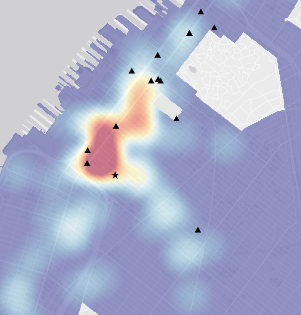
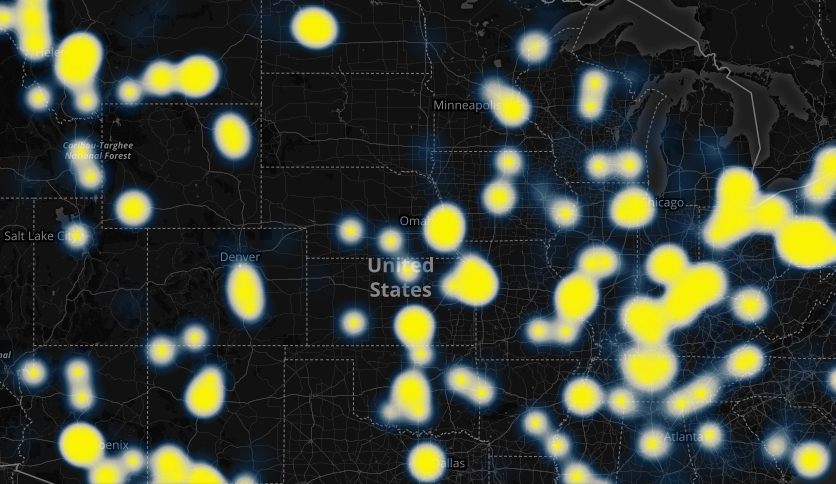
Emerging Hot Spot Analysis: Finding Patterns over Space and Time
This post is part of a series of articles written by 2017 Summer of Maps Fellows. Azavea’s Summer of Maps Fellowship Program provides impactful pro bono spatial analysis for nonprofits, while fellows benefit from Azavea mentors’ expertise. To see more blog posts about Summer of Maps, click here. Analyzing data over space and time can…
-
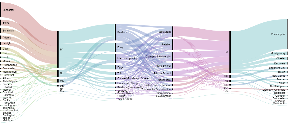
Sankey Diagrams: Six Tools for Visualizing Flow Data
This post is part of a series of articles written by 2017 Summer of Maps Fellows. Azavea’s Summer of Maps Fellowship Program provides impactful pro bono spatial analysis for nonprofits, while fellows benefit from Azavea mentors’ expertise. To see more blog posts about Summer of Maps, click here. One of the non-profits I am working…
-
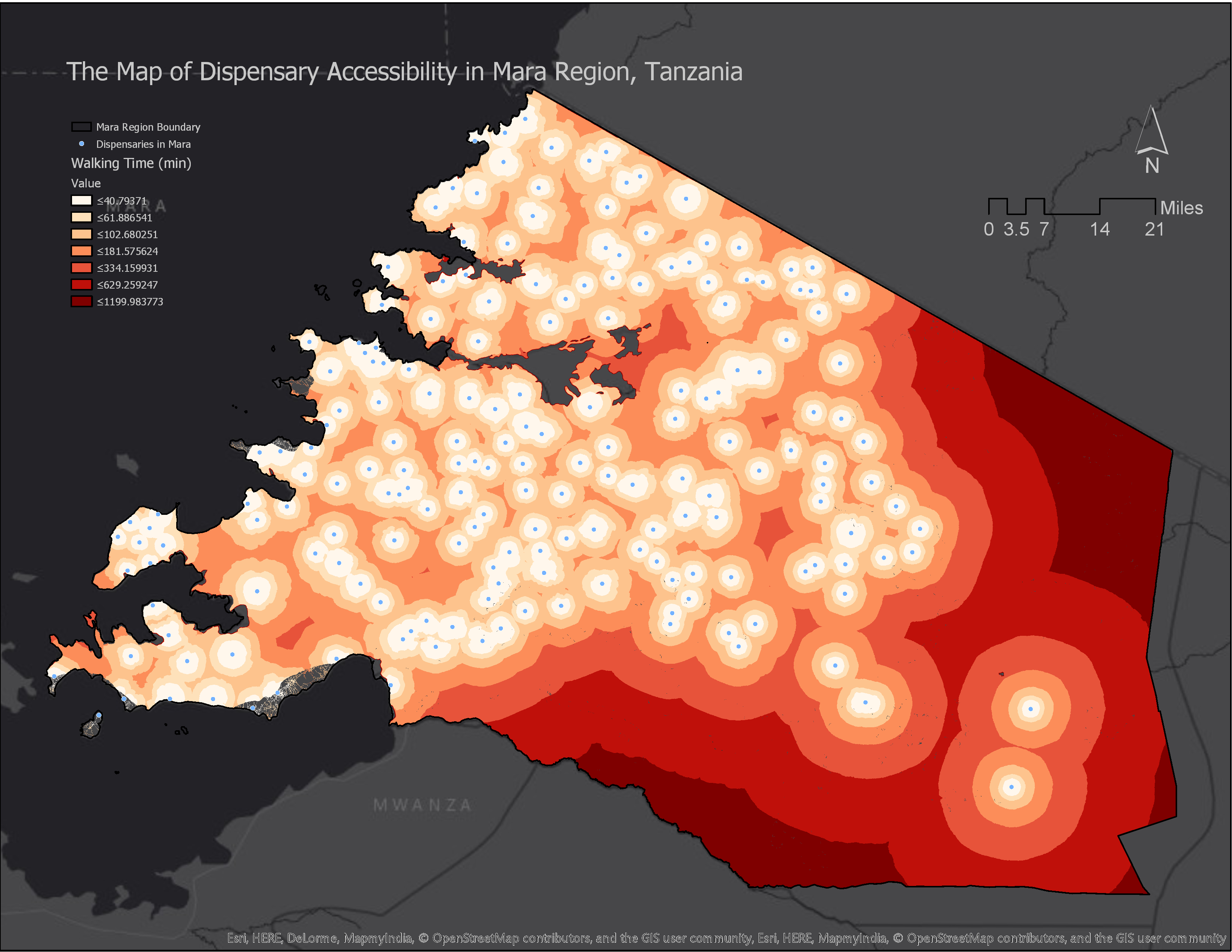
How to Calculate Location Accessibility with AccessMod 5
This post is part of a series of articles written by 2017 Summer of Maps Fellows. Azavea’s Summer of Maps Fellowship Program is run by the Data Analytics Team and provides impactful Data Analysis Services Grants for nonprofits and mentorship to fellows. To see more blog posts about Summer of Maps, click here. Mapping location…
-
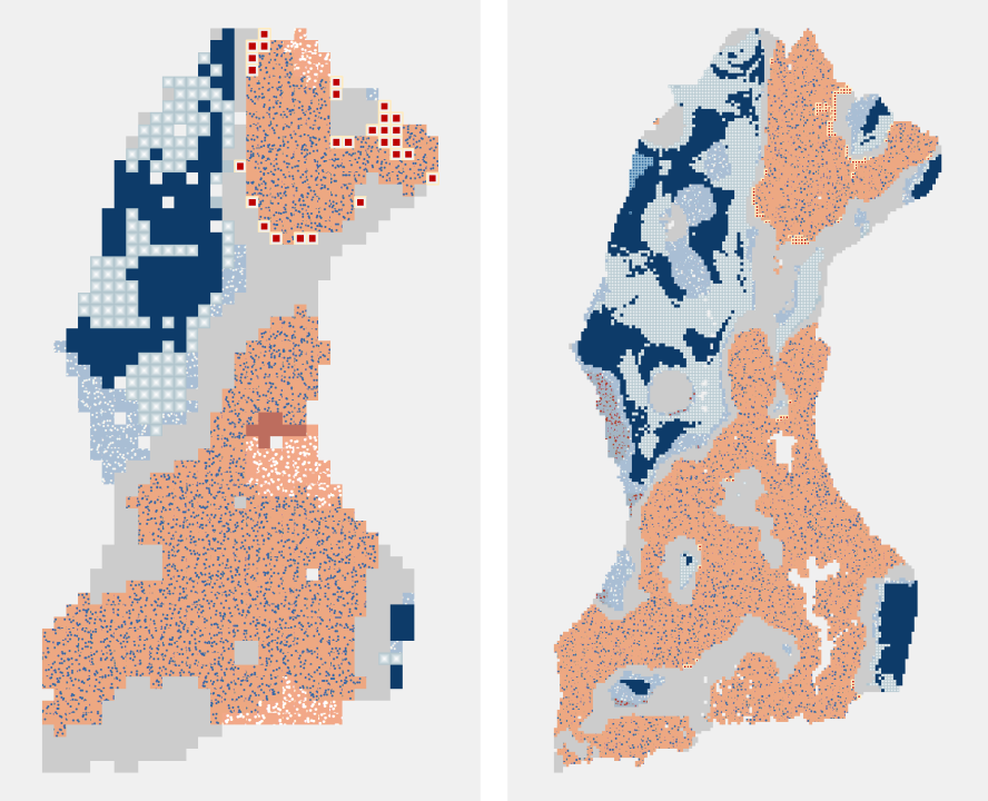
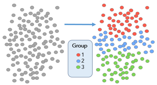
Defining Communities with ESRI’s Grouping Analysis Tool
In this post, we discuss how to define communities with ESRI’s grouping analysis tool, a powerful method aiding with data comprehension.
-
Building Interactive D3 Dashboards with CARTO Web Maps
This post details the design process we used to build a D3 dashboard, highlighting some of the key pieces of code needed to get CARTO and D3 talking to one another.
-
Creating an Interactive Visualization of Air Pollution for a Museum
This post describes our design process and the evolution of an interactive application relating to air pollution monitoring in a museum.
-
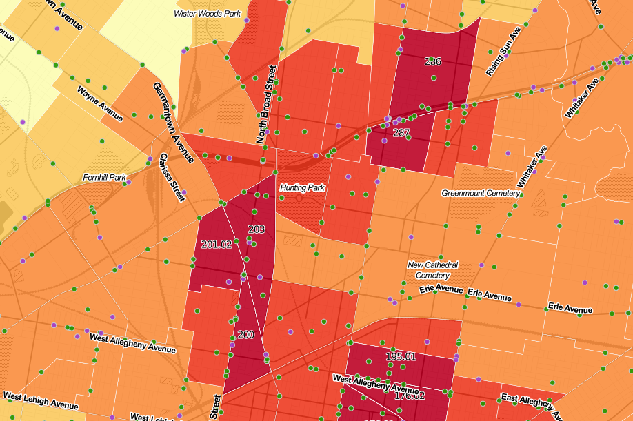
Geography of Crashes in Philadelphia
In this post, we analyze the relationship between severe road crashes, the geography of crashes, and demographics.
-
Using NAIP Imagery and a Texture Raster to Model the Urban Forest
This post walks through a method to help increase accuracy of classification by using a texture raster to distinguish between trees and other vegetation.

-
Creating a Tree Planting Prioritization Model in QGIS
In this post, we detail our experience creating a tree planting prioritization model in QGIS.

-
Measuring Access with Network Distances
Now in its fourth year, Azavea’s Summer of Maps Program has become an important resource for non-profits and student GIS analysts alike. Non-profits receive pro bono spatial analysis work that can enhance their organizational decision-making processes and programmatic activities, while students benefit from Azavea mentors’ expertise. This year, three fellows worked on projects for six organizations that spanned…