Open Source
<- Return to all blogs
-
Load Testing a TMS Tile Server with k6.io
k6.io provides a flexible base for load testing with a convenient scripting language, and the quickstart docs will get you pretty far, but testing with a session of TMS requests had some unique challenges.
-
Load Testing a TMS Tile Server with k6.io
k6.io provides a flexible base for load testing with a convenient scripting language, and the quickstart docs will get you pretty far, but testing with a session of TMS requests had some unique challenges.
-
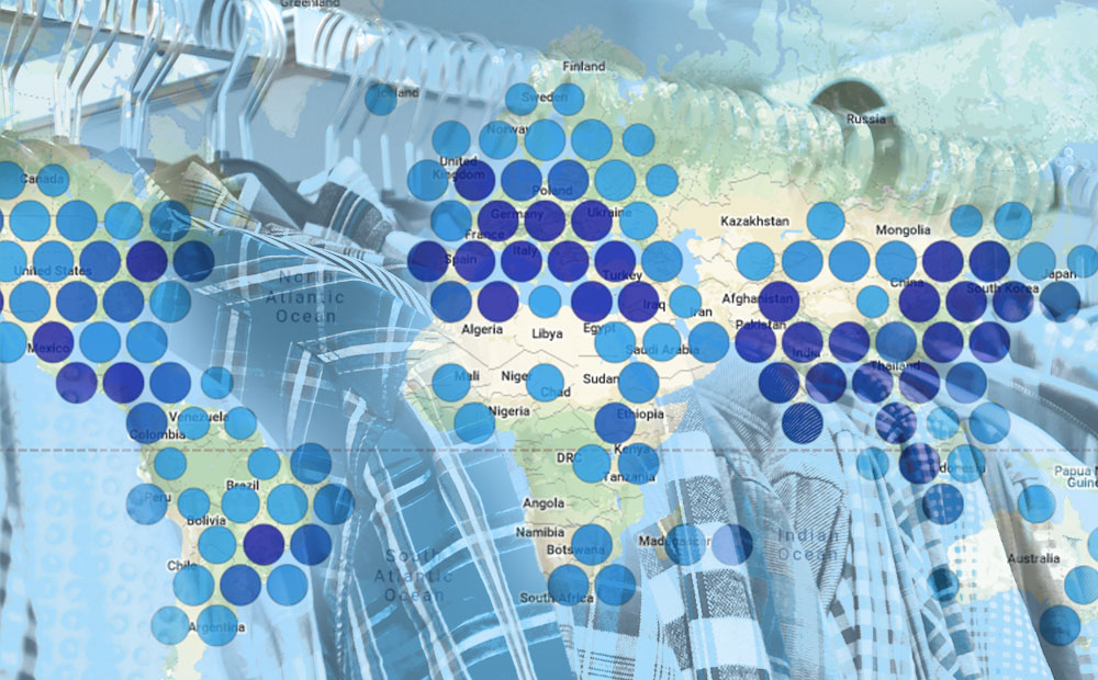
Bringing Open Data to the Apparel Industry
We chatted with the Open Apparel Registry team about how open data and open source are becoming a larger part of the apparel industry.
-
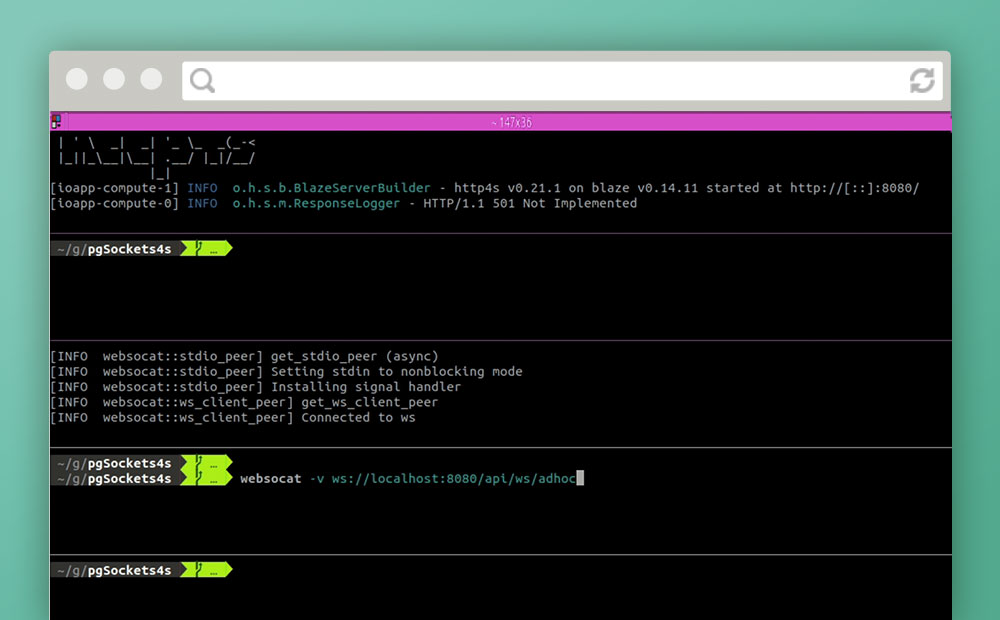
Notifications over Websockets with Http4s and Skunk
In an attempt to avoid relying on polling in a front-end application or third-party services, we attempt servicing asynchronous notifications over websockets using only PostgreSQL and Scala.
-
Betting Big on the Spatiotemporal Asset Catalog (STAC) Standard
We’re investing heavily in the STAC specification – including building a STAC-compatible Python library and server as well contributing to the Label Extension. We’re hoping this work will help accelerate adoption across the geospatial engineering community more broadly.

-
Introducing PySTAC: A Core Library for SpatioTemporal Asset Catalogs
PySTAC is a Python library for reading, writing, and manipulating SpatioTemporal Asset Catalogs. PySTAC 0.3 is now released and ready to use!

-
GeoTrellis 3.0 Release
GeoTrellis 3.0 includes feature additions and improvements that make it easier to read raster data from a variety of formats and sources, and support COG’s.

-
STAC: Creating an Ecosystem of SpatioTemporal Assets
STAC is creating an ecosystem of interoperable spatiotemporal assets. Learn how Azavea has contibuted and about future steps for the specification.

-
Using the Dedupe Machine Learning Library for Cleaning and Matching Data
To deal with issues of apparel facility list data quality and scale quickly and efficiently we need a machine learning tool that can capture the knowledge of domain experts, find commonalities in jumbled text, and confidently compare large lists without the need to compare each individual entry.
-
Connecting Data and People with the Open Apparel Registry
Since its launch on March 28, the Open Apparel Registry (OAR) has grown to include over 18,300 facilities in 92 countries. We’ve already heard of a few fascinating use cases where data from the OAR contributed to decision making by brands and facilities.

-
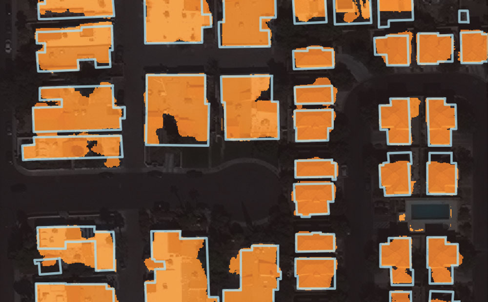
Using Noisy Labels to Train Deep Learning Models on Satellite Imagery
How do noisy labels affect the accuracy of a deep learning model? We added different amounts of noise to the SpaceNet Vegas buildings dataset and trained some models to find out.