Machine Learning
<- Return to all blogs
-
Managing Data Labeling for Machine Learning Projects
Responsible for the data labeling for a machine learning project? Here are some insights we’ve developed while managing data labeling for machine learning.
-
Managing Data Labeling for Machine Learning Projects
Responsible for the data labeling for a machine learning project? Here are some insights we’ve developed while managing data labeling for machine learning.
-
Three Lessons from Running an Imagery Labeling Competition
We joined with Radiant Earth at the Cloud Native Geospatial Sprint to run a labeling competition for non-technical folks. This resulted in over 2.3 million square kilometers mapped and lots of lessons learned.
-
The Business Case for Raster Vision
Raster Vision is the interface between the fields of earth observation and deep learning, making it easier to apply novel computer vision techniques to geospatial imagery of all types. Joe lays out how it can be implemented in your organization and give you a competitive advantage.
-
3 Tips to Optimize Your Machine Learning Project for Data Labeling
Mining the knowledge and expertise of your data labeling team will improve the data quality of your machine learning project and increase your team’s productivity.
-
SpaceNet Data Now Available in GroundWork
Incorporate high-resolution satellite imagery into your labeling projects for free.

-
Image Classification Labeling: Single Class versus Multiple Class Projects
When labeling for image classification is it faster to complete projects with single or multiple classes? We ran an experiment to find out.
-
Can AI Reduce Harm to Children?: Gabriel Fernandez and the Case for Machine Learning
Could AI have saved Gabriel Fernandez’s life? Data and social scientists argue that machine learning might have kept him alive. What exactly is this potentially life-saving AI? Learn more about predictive risk modeling, how governments currently use similar AI, and the ethical questions such work raises.

-
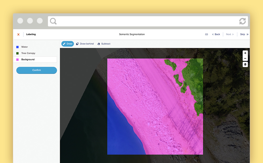
Labeling Satellite Imagery for Machine Learning
Definitions and visuals of the most common ways to label satellite imagery for machine learning. Includes tips for managing annotations for each type.
-
America’s Cities are Sitting on a Gold Mine of Machine Learning TrainingВ Data
Cities may not know it, but by nature of collecting and maintaining various datasets, they are sitting on a treasure trove of machine learning-ready training data.

-
The Future of Machine Learning AMA
3 of our machine learning engineers answer your questions about the future of machine learning.