GeoTrellis
<- Return to all blogs
-
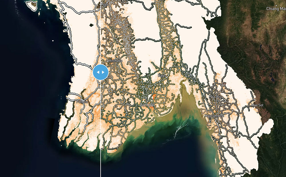
Calculating Rural Road Access Globally Using Open Datasets
We used three open datasets to calculate the number of people in the world who do not have sufficient access to a road in an effort to move forward the conversation on the Rural Access Indicator (RAI).
-
Calculating Rural Road Access Globally Using Open Datasets
We used three open datasets to calculate the number of people in the world who do not have sufficient access to a road in an effort to move forward the conversation on the Rural Access Indicator (RAI).
-
GeoTrellis 3.0 Release
GeoTrellis 3.0 includes feature additions and improvements that make it easier to read raster data from a variety of formats and sources, and support COG’s.
-
Introducing WMS and WCS Support for GeoTrellis and Raster Foundry
Raster Foundry and GeoTrellis now support WMS and WCS standards, enabling streamlined workflows that utilize multiple data sources.
-
Mapping Africa: Crowdsourced Machine Learning
We leveraged our ability to process raster imagery, our open sources libraries, and our knack for machine learning to map agricultural fields in Africa.
-
Generating Pyramided Tiles from a GeoTIFF using GeoTrellis
A tutorial for generating pyramided map tiles (also called Slippy Map tiles) from a GeoTIFF using GeoTrellis, which can be used in Leaflet or OpenLayers.
-
Trajectory of Geospatial Open Source Innovation Discussed at FOSS4G NA
Earlier this month, we presented, exhibited, and attended talks at FOSS4G NA in St. Louis. Read our recap of events and view the slides from our presentations.

-
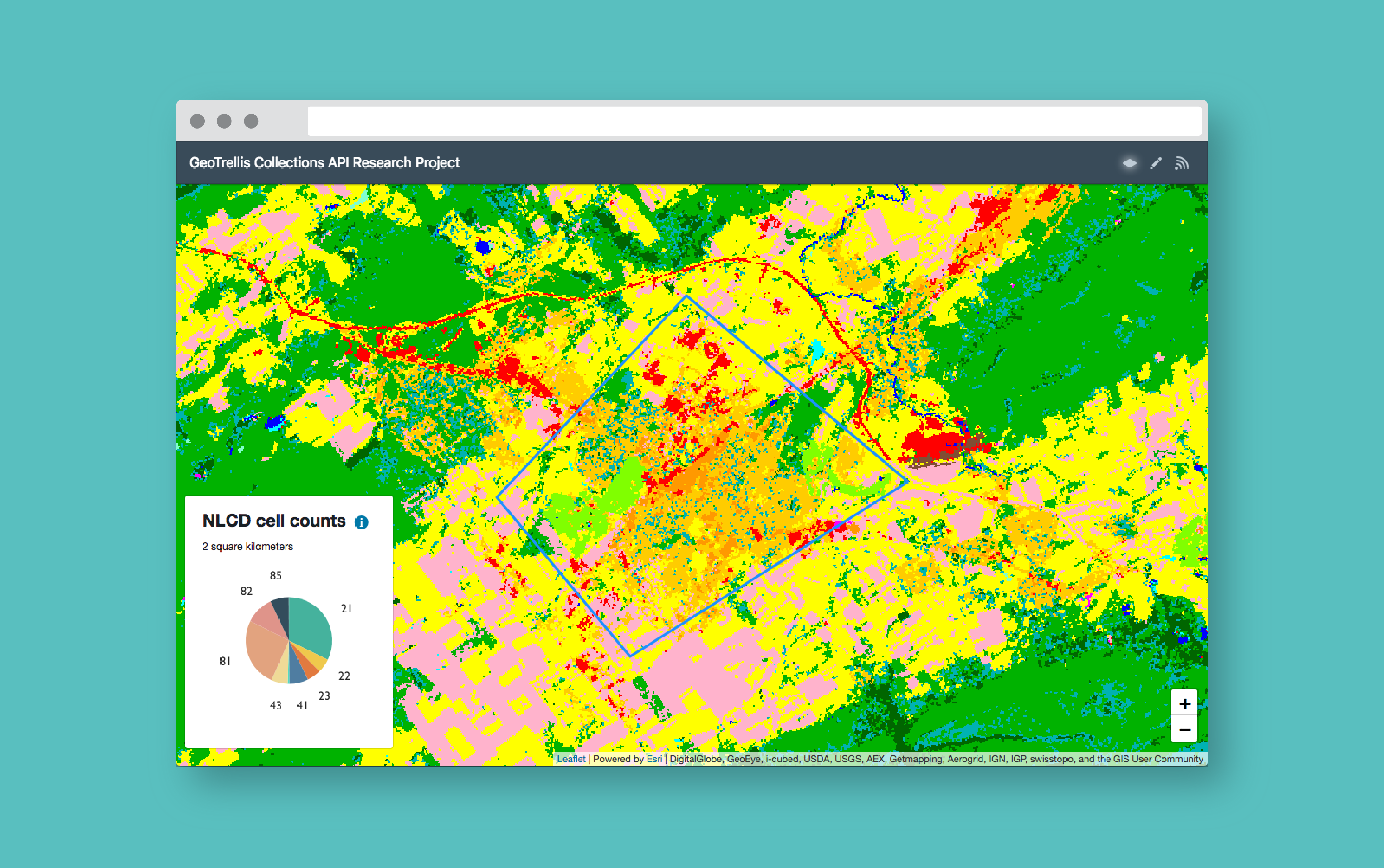
How to Build a Geoprocessing App with GeoTrellis and React
Follow this guide to set up a geoprocessing web application using GeoTrellis, Akka HTTP, and React.
-
Weighing Scalaz vs Cats Scala Libraries for GeoTrellis
After a thorough research period that compared the Scalaz and Cats libraries in depth, GeoTrellis has decided to use the Cats library. Find out why…

-
GeoTrellis 1.2 Release: New Features & Optimizations
LocationTech GeoTrellis, library that enables distributed processing of geospatial raster data, reached a new milestone in the development timeline.
-
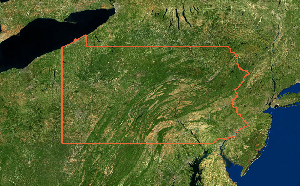
Climate Change Projections for Excessive Heat Days at Arizona Airports
We used GeoPySpark, Python binding for GeoTrellis, to analyze climate change data and determine Arizona airports at risk for excessive heat days.