Not too long ago, we introduced Queryable Earth, a public demo that allows users to search Earth Observation (EO) using natural language queries such as “show me new football fields around Boston”. Queryable Earth showed how far you can go in terms of extracting insights from EO data by simply using vector embeddings. But, while useful, it is also limited in important ways: it is a simple search box and it is one-shot; there is no way to say “now compare that to five years ago” or “count them” or “put it in a report I can share.” Because the most interesting questions people want to ask are usually entire workflows rather than single lookups, we set out to make Queryable Earth conversational and agentic. In creating Agentic Queryable Earth, we’ve created a general-purpose geospatial analysis platform you can actually talk to.
Agentic Queryable Earth isn’t open to the public yet, but we will be opening private bata testing access soon and are looking forward to sharing more details about its development.
How we got here: Natural Language Geocoding and the Original Queryable Earth
Queryable Earth sprang from the simple idea that modern vision-language models could make satellite imagery searchable with plain language. Our first Queryable Earth-related post showed this working at scale across the entire state of Massachusetts, retrieving good matches for queries as specific as “a single tree in an empty field.” From there it grew. We combined Queryable Earth with Natural Language Geocoding, released public demos, and added change detection and LLM-generated image captions (pairing the original SkyCLIP vision model with descriptions written by Anthropic Claude models).
In general, our experiments with Queryable Earth demonstrate that most questions worth answering are multi-step. Find the thing, then compare it over time, then quantify it, then summarize it, and so on. A single answer is just a starting point, but what people want is the whole analysis.
Agentic Queryable Earth
Agentic Queryable Earth is a conversational assistant that can plan a task, call specialized geospatial tools, chain their outputs together, run its own analysis, and hand back a traceable answer.
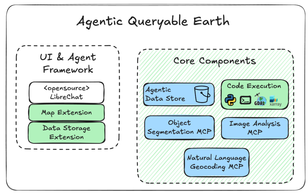
Rather than build a chat interface, conversation history, user accounts, and file handling from scratch, we built on LibreChat, the open-source AI platform. That decision was informed by our work helping NASA build and scale ChatGSFC, a LibreChat-based tool now used by almost 10,000 people across the agency. Through our work with ChatGSFC, we learned that composable, open building blocks beat rigid, single-purpose apps. Agentic Queryable Earth applies the same philosophy to geospatial work.
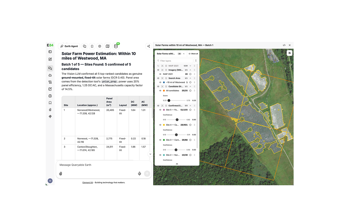
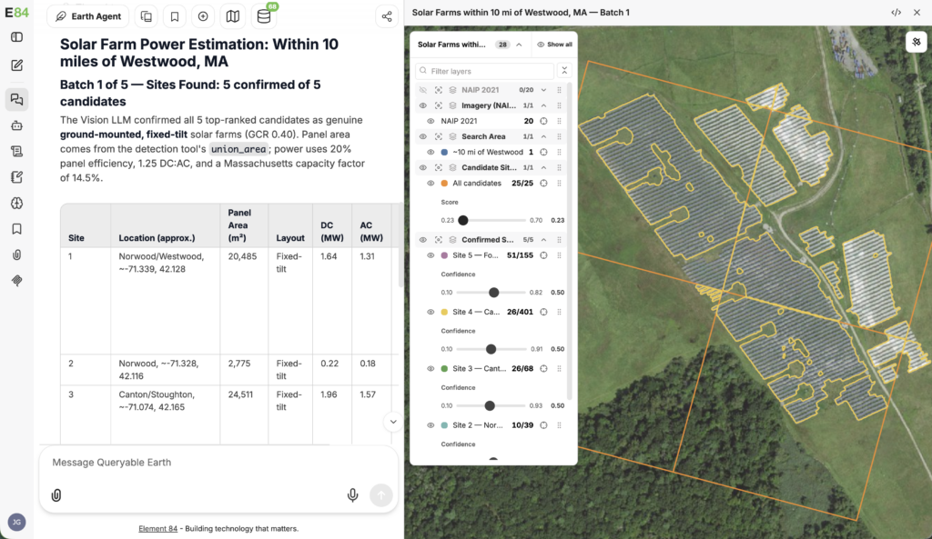
This composability is what makes it powerful. It can be configured to specialize in any particular task by specifying the right set of Model Context Protocol (MCP) tools, skills, or instructions. While Queryable Earth could find “new solar farms within 5 miles of Worcester, MA,” Agentic Queryable Earth can go further and not only delineate the solar arrays in each solar farm but also estimate and tabulate their power outputs.
Overcoming context limits with Agentic Data Storage
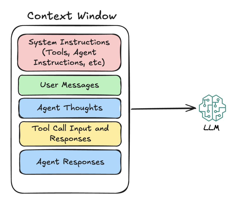
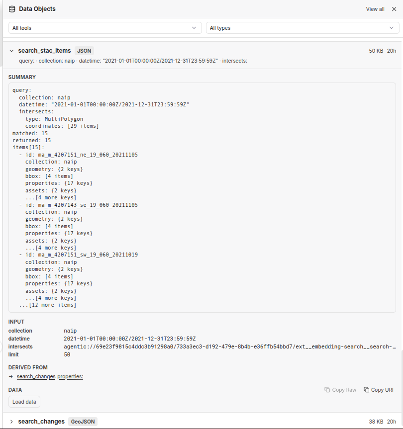
A relatively banal, but nonetheless important, hurdle that LLM-based agents face is the limited size of the LLM’s context window. This is especially relevant in geospatial workflows where the context window can quickly fill up with raw data, such as large GeoJSON dumps, that is not actually useful for the LLM to look at in its entirety. Our answer to this is something we call Agentic Data Storage. Agentic Data Storage acts as a transparent layer between the agent and its tools, automatically storing large data artifacts to a persistent storage and forwarding lightweight summaries and pointers to the agent that it can more easily reason about and use downstream. The agent can inspect what’s there — ask what fields exist, what values are present — and pull just the portions it actually needs to make its next decision. The agent gets efficient, on-demand information about the data and what has happened so far, rather than being force-fed a giant API response.
In addition to storing data, Agentic Data Storage also automatically records provenance information about how — and with what input data — each data artifact was produced, so that instead of an AI black box, you get a complete chain of custody that you can inspect and reproduce.
Continuing to evolve Queryable Earth
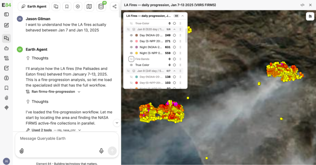
One of the most exciting things about this new Agentic Queryable Earth is its ability to integrate with external tools and data sources, taking advantage of other efforts in the wider geospatial community.
Earlier this month, Element 84 was excited and honored to contribute to a panel about open data access at the AI For Good Summit in Geneva, Switzerland alongside thought leaders in intentional, accessible, AI. During our panel we had the opportunity to share several use cases demonstrating complex problem solving through Queryable Earth and its integration with the newly announced AWS Registry of Open Data (RODA) MCP server to which we got early access.
We have also integrated the NASA EarthData MCP server that NASA recently put into production that will allow Agentic Queryable Earth to make use of the many thousands of datasets indexed in the NASA CMR catalog.
We’re looking forward to continuing to experiment with potential use cases for Queryable Earth as we introduce additional functionality, and we will be opening up access to private beta testing soon. Stay tuned for more information coming this Fall, and feel free to reach out to our team directly to participate in testing, receive your own demo, or to continue this conversation further in the meantime.