All blog posts
<- View categories
-
STAC Labeling Competition — Video Recap
Hear from labeling competition participants on why this diverse group of people came together, from across the world, to collaborate on a hallmark training dataset compliant with the STAC standard.
-
STAC Labeling Competition — Video Recap
Hear from labeling competition participants on why this diverse group of people came together, from across the world, to collaborate on a hallmark training dataset compliant with the STAC standard.
-
A Day in the Work-Life in 2020
2020 was awful. Who was accessible changed radically. We, and the people around us, by necessity took on different roles. Including at work.

-
E84 at the 2020 AGU Fall Meeting
As we wrap up 2020, we are looking forward to the 2020 American Geophysical Union (AGU) Fall Meeting, the largest meeting of geoscientists in the world. #AGU20 is scheduled from 1-17 December and in this remote format will accommodate over a thousand hours of virtual content to minimize conflicts while maximizing global engagement! The theme for…
-
Managing Data Labeling for Machine Learning Projects
Responsible for the data labeling for a machine learning project? Here are some insights we’ve developed while managing data labeling for machine learning.
-
A Guide for Grantmakers: How to Evaluate Software Development Proposals
Grantmaking organizations are often asked to fund software development, but are unsure of how to evaluate the scope, budget, or potential impact of these types of projects. We created this list of the key questions to ask when evaluating a software development proposal.

-
Run-Time Type Checking in TypeScript with io-ts
In this post, we’ll be using some advanced TypeScript libraries to help us stay type-safe even in the face of unknown inputs. In order to get the most from this post, I recommend having a basic understanding of TypeScript.
-
Top 5 Data Visualization Practices: A Case for Effectively Communicating Information About US Wildfire Risk
Data visualization is key to making data useful. We look at the example of the USDA Forest Service Wildfire Risk dashboard to highlight best practices for nonprofit and government leaders when designing compelling data visualizations.

-
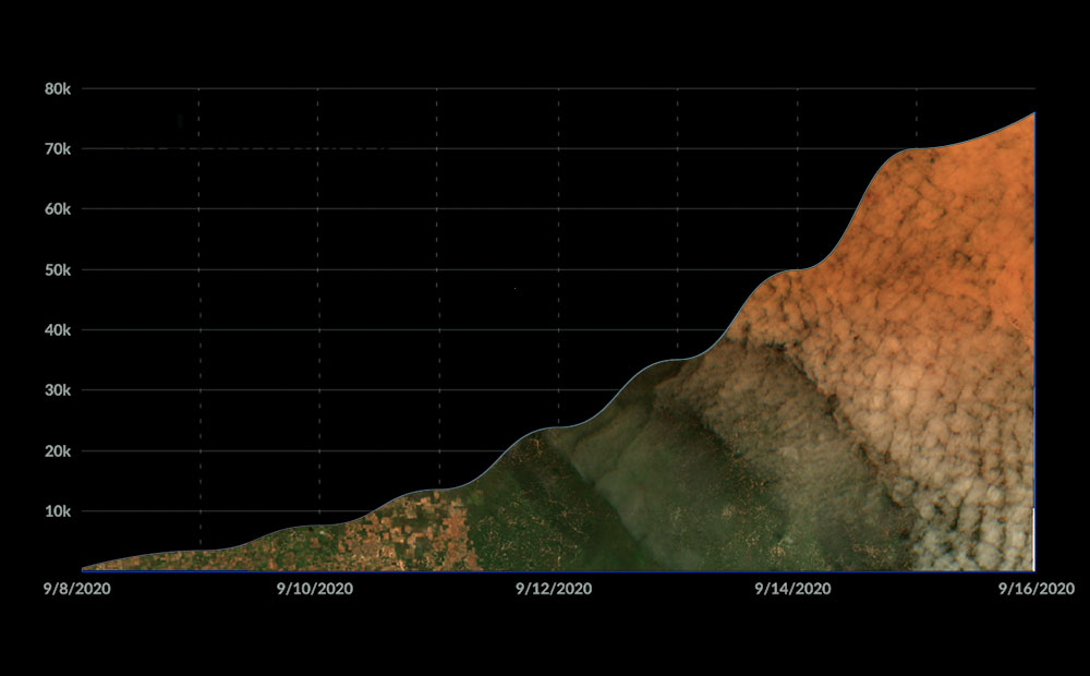
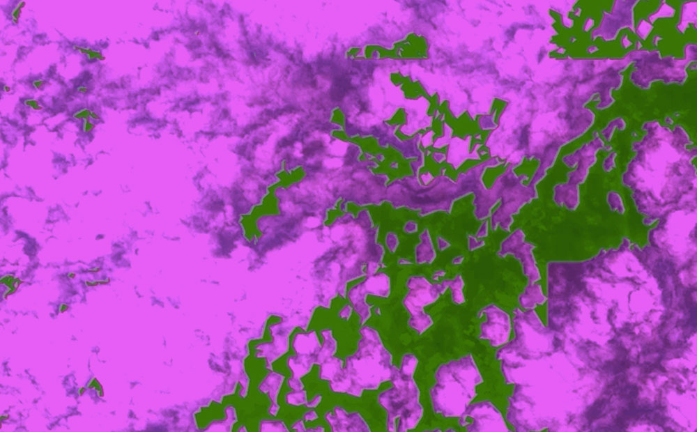
Three Lessons from Running an Imagery Labeling Competition
We joined with Radiant Earth at the Cloud Native Geospatial Sprint to run a labeling competition for non-technical folks. This resulted in over 2.3 million square kilometers mapped and lots of lessons learned.
-
Sentinel-2 Cloud-Optimized GeoTIFFs Now Available on AWS Registry of Open Data
This week, in collaboration with Geoscience Australia, we released our Sentinel-2 Cloud-Optimized GeoTIFF (COG) dataset on AWS Open Data. Our collection contains all 11.4 million scenes from the Sentinel-2 Public Dataset, except the JPEG2000 (JP2K) files are all converted to COGs. Our dataset is continuously updated to mirror the growth of the public Sentinel-2 data…
-
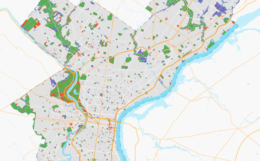
How Can OpenStreetMap be Used to Track UN Sustainable Development Goals?
We learned that OpenStreetMap is a great source of data for tracking SDG indicator 11.7.1. OSM provides data on public open or green spaces in cities that is similar in quality to more “official” sources like municipal Open Data portals, and collecting the data from OSM requires relatively little effort.