Queryable Earth
<- Return to all blogs
-
Queryable Earth Demo Update: Now with Change Detection!
We detail how we used our research surrounding queryable Earth and natural language geocoding to demonstrate data accessibility in an intuitive and interactive way – and how you might be able to harness some of the same ideas in your own work.
-
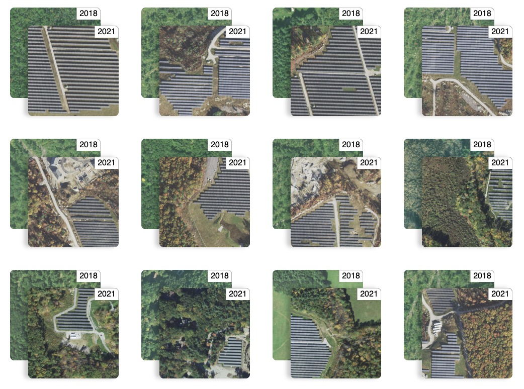
Queryable Earth Demo Update: Now with Change Detection!В
We detail how we used our research surrounding queryable Earth and natural language geocoding to demonstrate data accessibility in an intuitive and interactive way – and how you might be able to harness some of the same ideas in your own work.В
-
Building a queryable Earth with vision-language foundation models
We take a close look at two such remarkable VLMs that have come out in the past few months and, using these models, we build a prototype “queryable Earth” functionality that allows retrieving images along with their geolocations using text queries over a large geographical area.
