Open Source
<- Return to all blogs
-
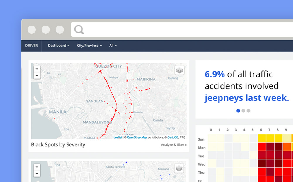
Reducing Road Crashes with DRIVER
Over 1.3 million people are killed on the world’s roads every year. More than 30 million suffer life-changing injuries. Based on current trauma levels an estimated 400 million people will be killed or injured between now and 2030. Source: IDB Road crashes are a leading cause of death globally, but these deaths occur mostly in…
-
How We Select Projects
As a mission-based organization, how we select the projects we pursue is an ongoing conversation at Azavea. We share our thought process here.
-
Raster Vision: A New Open Source Framework for Deep Learning on Satellite and Aerial Imagery
Azavea is pleased to announce the release of Raster Vision, a new open source framework for deep learning on satellite and aerial imagery.

-
Three (Earth) Observations from Sat Summit 2018
Here are our key takeaways from SatSummit and some thoughts to help drive innovation related to earth observation data toward impactful solutions.
-
Tilegarden: Serverless Tile Rendering with AWS Lambda
This 2018 Azavea Open Source Fellowship project enables serverless Lambda-based raster and vector tile generation from PostGIS data.

-
Introducing Grout: a Flexible-Schema Framework for Geospatial Apps
Grout is an open source framework that empowers non-technical administrative users to directly define and modify data at the core of their application.
-
How to Save a Mapbox GL Web Map Extent as an Image
Learn how to generate a Data URL or image file of the current map extent from a Mapbox GL Web Map.
-
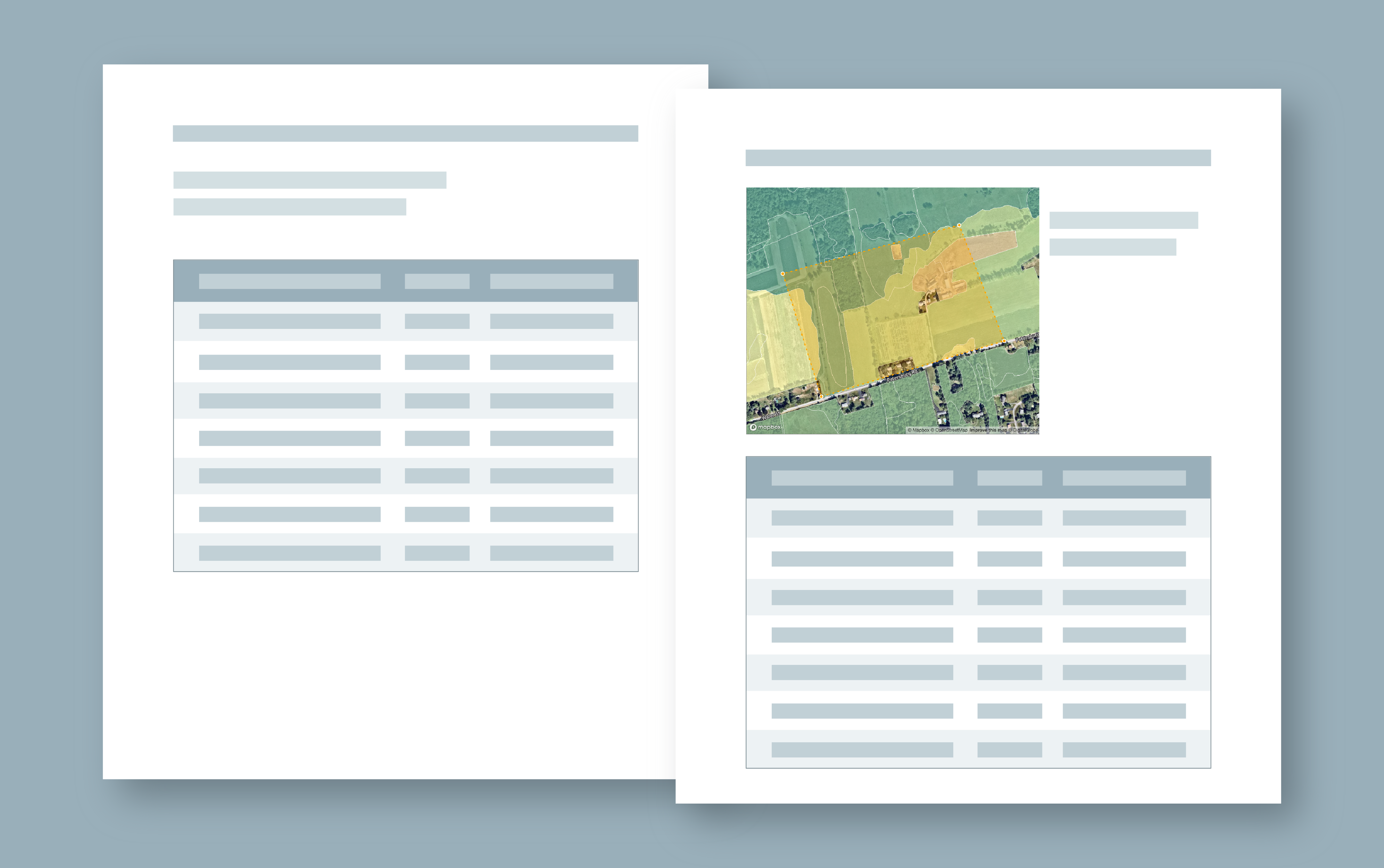
How to Convert Geodatabase Spatial Data and Related Tables to Vector Tiles
Use this open source data processing pipeline to convert geodatabase files to vector tiles for use in a web application.
-
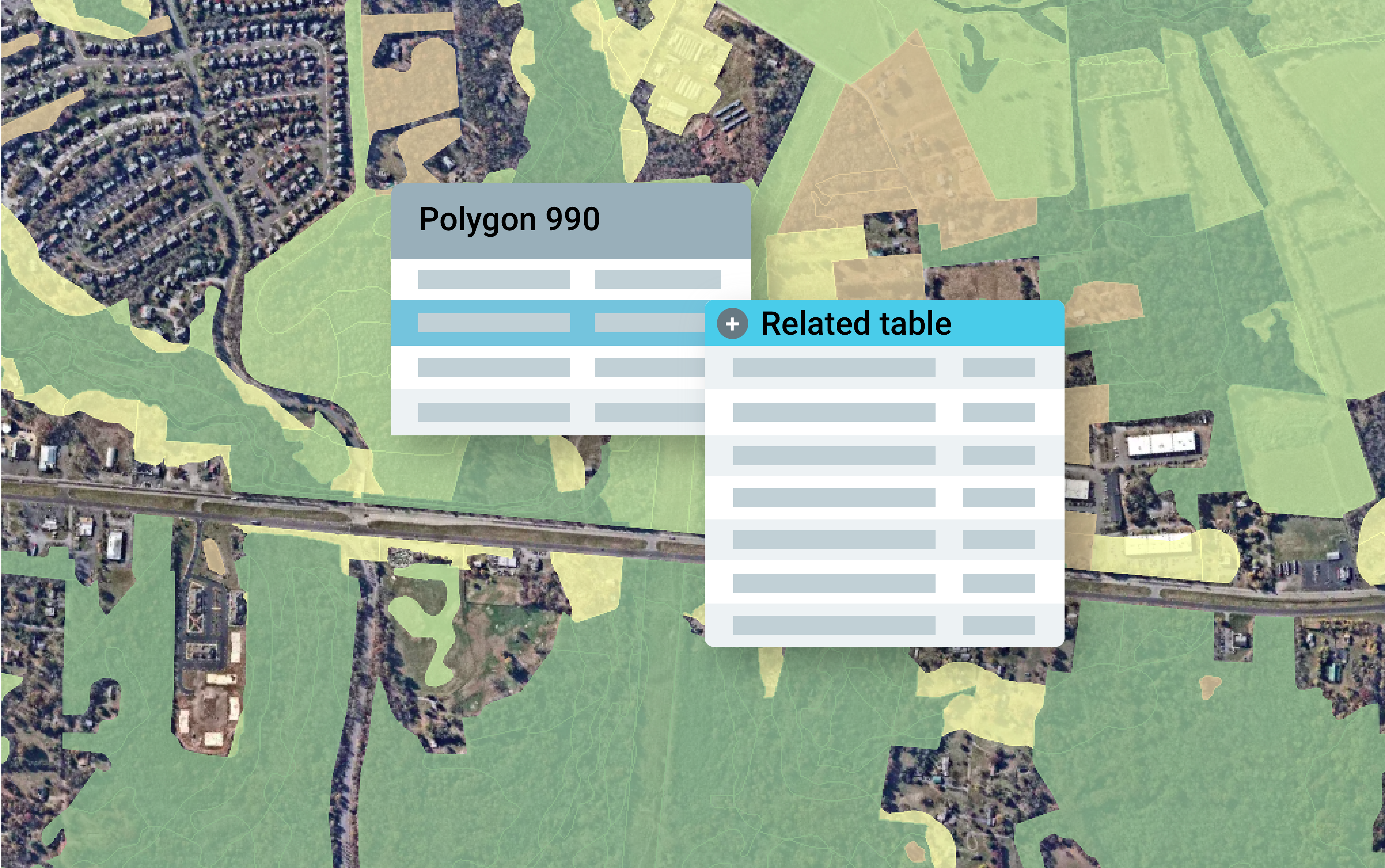
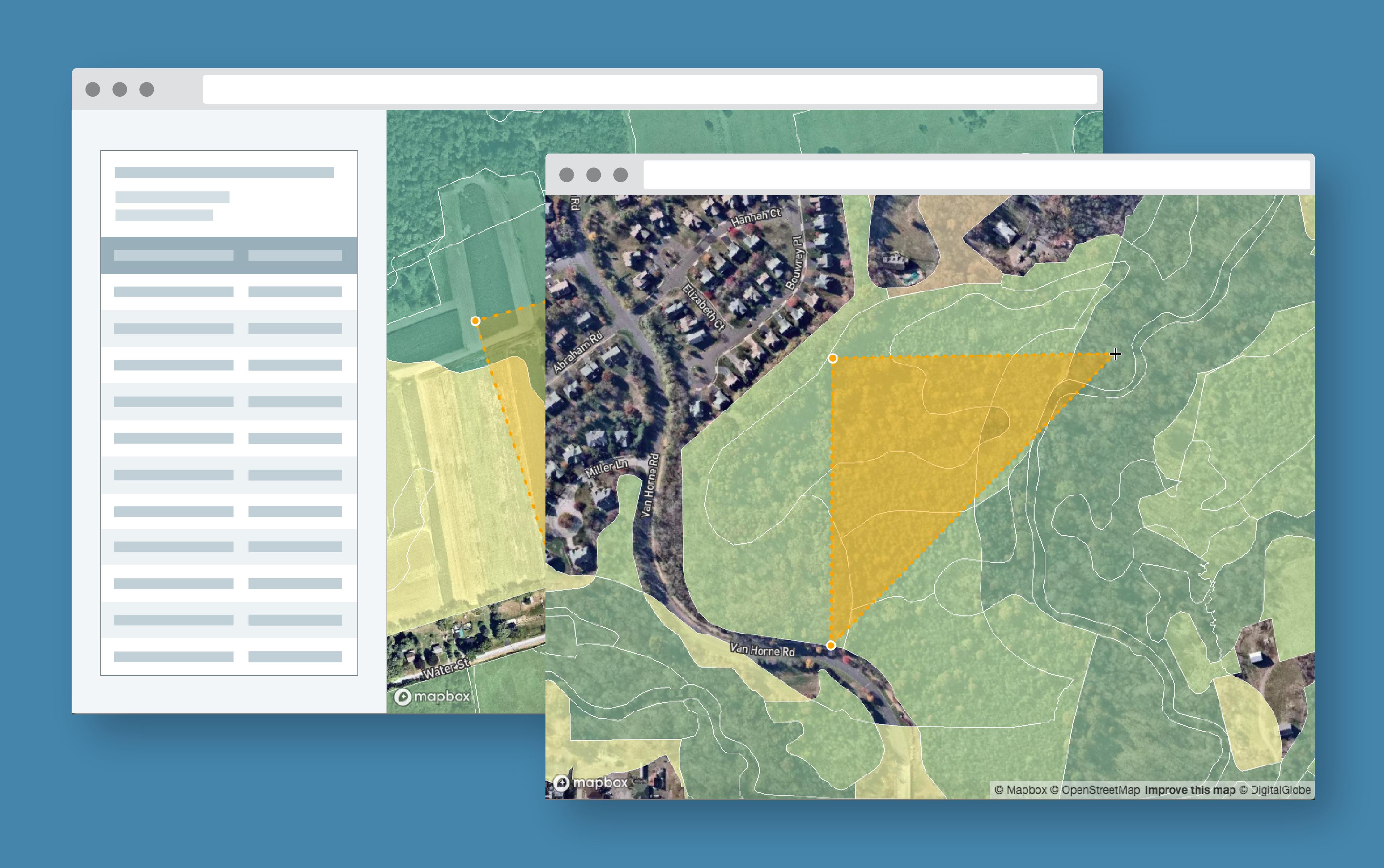
Exploring Protected Wildlife Habitat for Every Property in New Jersey
This Azavea 10% Time project defines a process for converting big data files to vector tiles and allows a user to identify habitat areas in need of protection.
-
Provisioning ACM Certificates on AWS with Terraform
Learn how to create and validate certificates with a reusable Terraform module.