Open Source
<- Return to all blogs
-
Developing Countries, Capacity Building, and SDGs
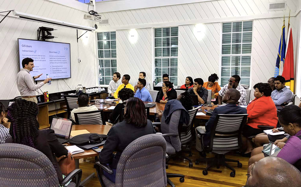
Utilizing earth imagery to achieve all 17 UN SDGs by 2030 will take considerate effort. In order to do this effectively, we must include training and capacity building in our solutions.
-
Developing Countries, Capacity Building, and SDGs
Utilizing earth imagery to achieve all 17 UN SDGs by 2030 will take considerate effort. In order to do this effectively, we must include training and capacity building in our solutions.
-
Using Cloud-Optimized GeoTIFFs (COGs) for More Efficient Web App Architecture
Cloud-Optimized GeoTIFFs (COGs) are geoTIFFs hosted on a cloud or file server, and are optimized for remote reads. They proved useful in a recent project.
-
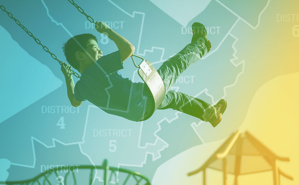
Scoring Philadelphia’s City Council Districts for Children’s Health and Well-being
Scoring Philadelphia City Council districts on assets and risks using a weighted spatial analysis model in R and Python.
-
Raster Vision 0.9 Release Candidate
This release of Raster Vision includes bug fixes, an easier setup, improved performance, and the ability to train models off of labels in OSM.
-
Aster Vision – A New Open Source Framework for Deep Learning on Astrospatial Imagery and Space Exploration
Aster Vision is an open source machine learning library for analyzing huge troves of astrospatial data and finding habitable planets around nearby stars.

-
Introducing the Open Apparel Registry
We are excited to announce the launch of the Open Apparel Registry, an open source global map of garment producing facilities.
-
Lessons on tree-shaking Lodash with Webpack and Babel
Tree-shaking lodash can reduce the size of your JavaScript bundle, but it requires that a few conditions are met along the way to implementing it.

-
Introducing TileJSON.io, A Fast and Easy Way to View and Share Raster Tiles
TileJSON.io is an open source project by Azavea. It is an easy way to view and share raster tile sets using slippy map endpoints.
-
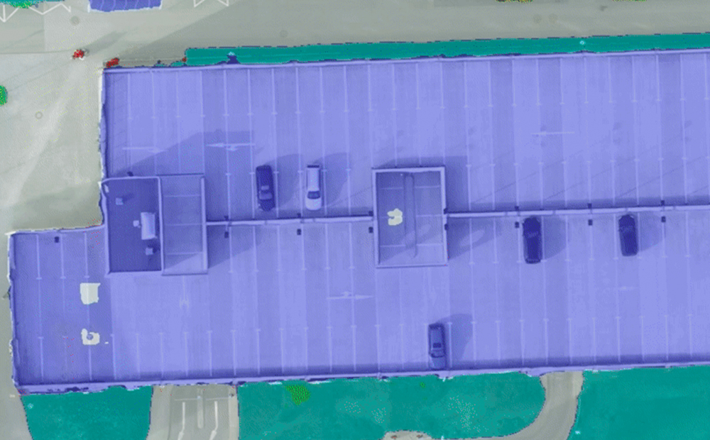
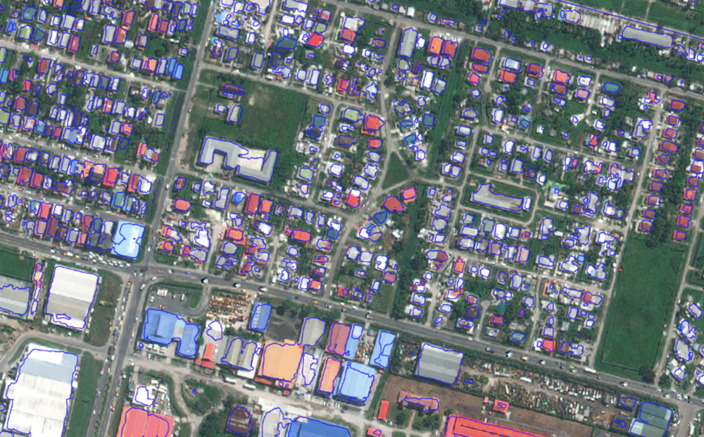
Mapping Africa: Crowdsourced Machine Learning
We leveraged our ability to process raster imagery, our open sources libraries, and our knack for machine learning to map agricultural fields in Africa.
-
Accuracy is in the Eye of the Beholder
Accuracy in deep learning models is not as cut and dry as many present it to be. We examine several examples where accuracy is more of a judgment call.