Civic Apps
<- Return to all blogs
-
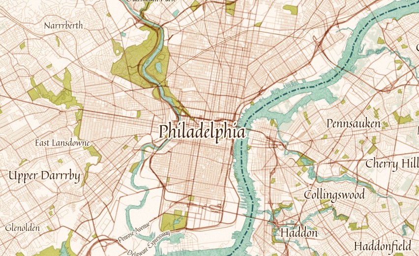
Generating Pyramided Tiles from a GeoTIFF using GeoTrellis
A tutorial for generating pyramided map tiles (also called Slippy Map tiles) from a GeoTIFF using GeoTrellis, which can be used in Leaflet or OpenLayers.
-
Generating Pyramided Tiles from a GeoTIFF using GeoTrellis
A tutorial for generating pyramided map tiles (also called Slippy Map tiles) from a GeoTIFF using GeoTrellis, which can be used in Leaflet or OpenLayers.
-
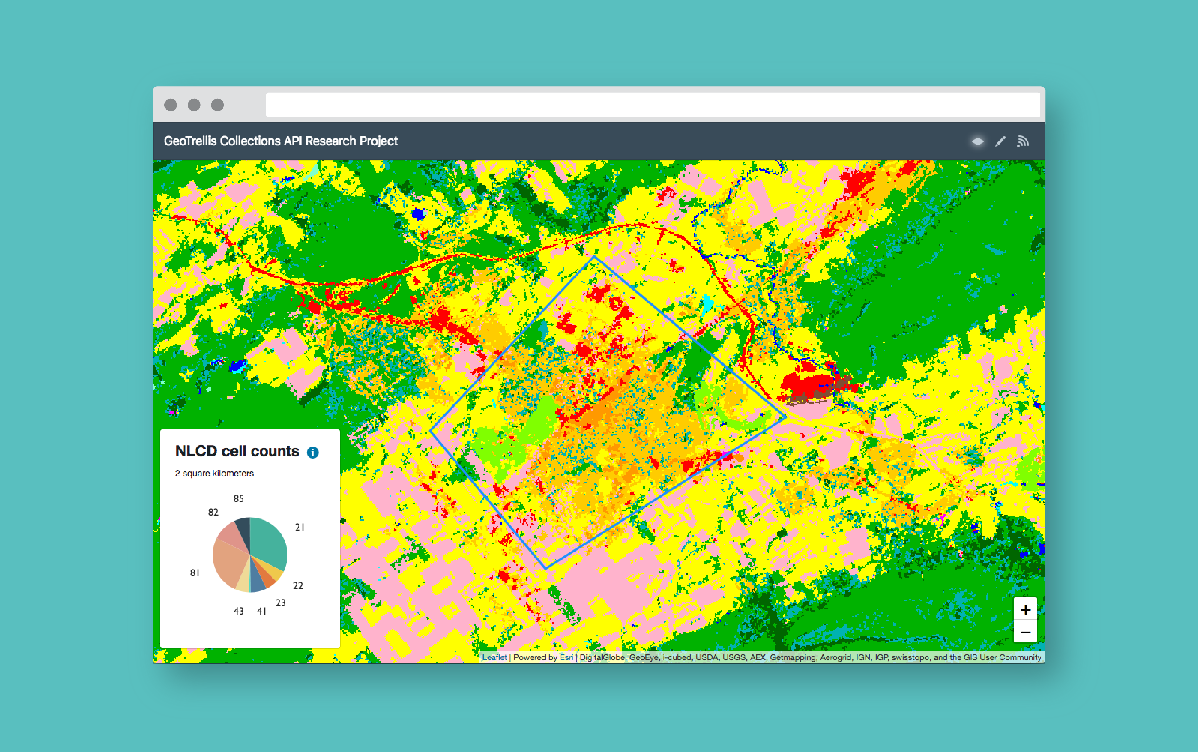
How to Build a Geoprocessing App with GeoTrellis and React
Follow this guide to set up a geoprocessing web application using GeoTrellis, Akka HTTP, and React.
-
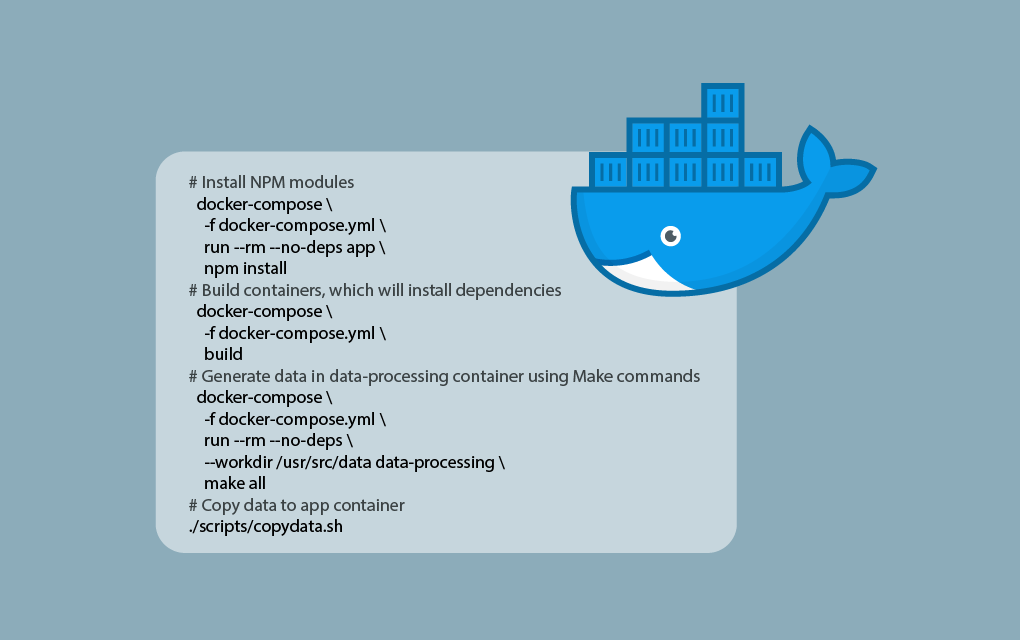
Repeatable Data Processing Workflows with Docker and Make
View the code and methods for how we used Docker and Make to create data processing workflows that match the rigor of our software development workflows.
-
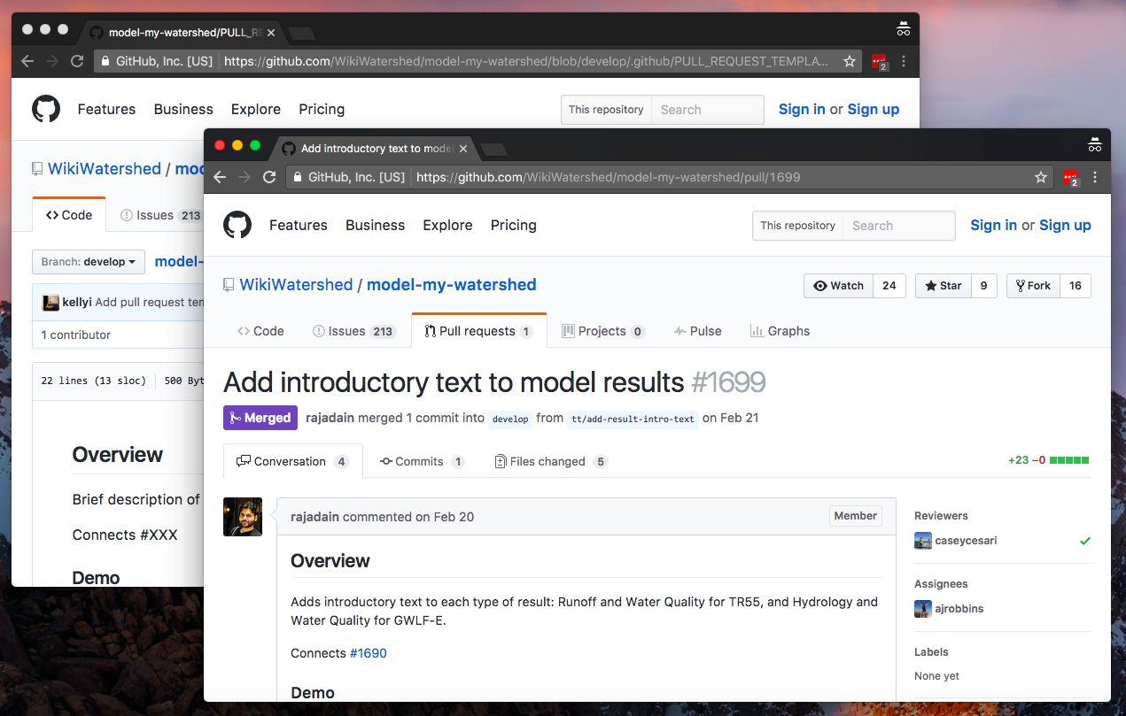
GitHub Pull Request Template Workflow
Being a professional services team, we at Civic Apps work on a number of projects in parallel in various stages of completion. They range in age (brand new projects to 6 year old legacy codebases), size (from simple single page apps to complex multi-tier systems), and technology (JavaScript, Python, Scala, C#). We use a number…
-
Getting Started with React and Leaflet
This blog post offers a brief tutorial for beginningВ to use React with Leaflet.

-
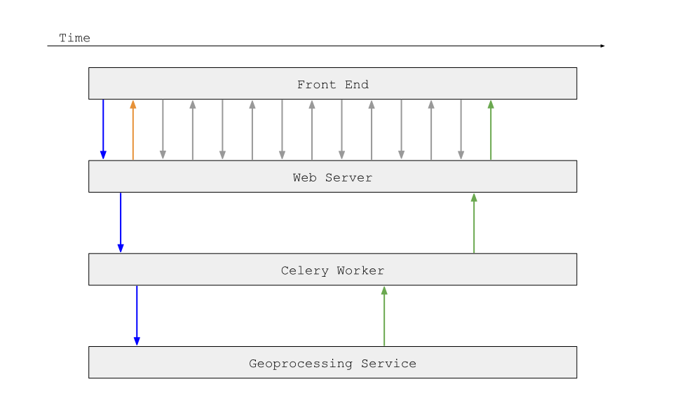
How to Build Asynchronous Workflows in a Geospatial Application
In this post, we discuss the ins and outs of making a large system asynchronous.
-
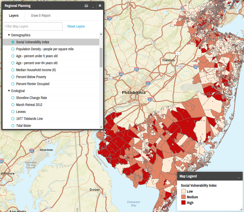
Outline of JavaScript Framework for Mapping Plugin Inspired by React.js
This article presents a high level technical overview for the implementation of the Regional Planning plugin for the Coastal Resilience GeositeFramework.
-
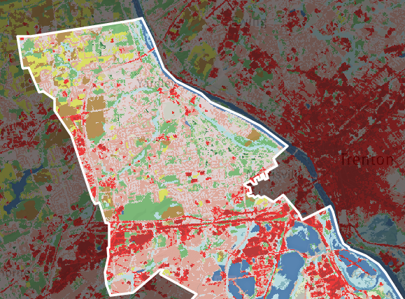
Model My Watershed: Tool for Analysis of Land Use Change Impacts
In this post, we discuss Model My Watershed, a tool designed to analyze land use change impacts.
-
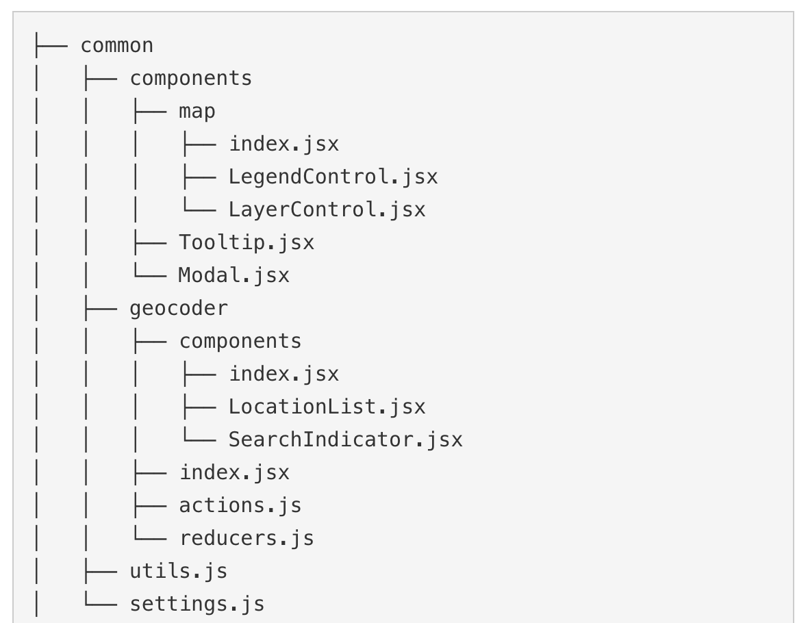
Civic Apps Team React/Redux Project Structure
In this blog, we discuss our experience moving to using React/Redux and Webpack to build our JavaScript applications.
-
Converting Mapbox Studio Vector Tiles to Rasters
In this blog post, we detail our experience converting Mapbox Studio Vector Tiles to Rasters.