In small, rural or underfunded communities, water utilities often don’t have the tooling they need to capture their water boundaries digitally. This makes it harder for them and other stakeholders to coordinate water services, plan for improvements, apply for grants, comply with regulations, and understand the populations being served. To solve for this issue we collaboratively designed and developed BoundarySync, a free and open source tool that streamlines water boundary maintenance, with partners including Internet of Water, NCRWA, EPIC, and NCDEQ. The tool is initially focused on North Carolina and now live — anyone can request access from the Internet of Water Coalition to get an account.
Going into the work, our team began by asking a few core questions:
- How might we create a one-stop system that reflects accurate up-to-date boundaries?
- How might we gather and maintain boundary information we need to properly allocate resources?
- More broadly, how might we support rural water utilities? How might the tool support their needs?
Our utilities boundary tracking tool development process
Discovery phase: understanding our audience and goals
In our discovery process, we work to develop an understanding of our target audiences through stakeholder workshops and user interviews. In this project that was particularly key, as the incoming hypothesis (that boots on the ground stakeholders would be the primary users) turned out to be incorrect. Those users rarely had access to work computers and weren’t directly tasked with boundary updates. Instead, our research uncovered that administrators were the primary users. These discussions emphasized the need for administrators to be able to digitize paper maps from field employees, still resulting in a digital tool, but with different requirements.
Design: ensuring usability with specific use cases in mind
Once we had a more comprehensive understanding of our stakeholders’ needs, our team developed wireframes and flow diagrams alongside the clients and contributing engineers. After a series of collaborative iterations, the resulting designs underwent usability testing with stakeholders via a paper prototype. By completely removing the digital element during these tests, the testing process was able to be conducted during a meeting where participants did not have computer access which allowed more comprehensive feedback.
Implementation: Leveraging open source components
Throughout this process designers used Chakra components in Figma, which made it easier for engineers to translate the designs on the development side. By ensuring developer involvement during the design process, there was a straightforward handoff when it was time for implementation.В Not only did this make the process smoother and the designs match implementation precisely, it also kept our costs affordable for the client by making the process more efficient.
BoundarySync Results
For utility companies in rural areas, this tool represents a large step forward in accessibility for boundary mapping. BoundarySync is free and open source, and can be configured with SSO which allows for added customization.
Users are able to:
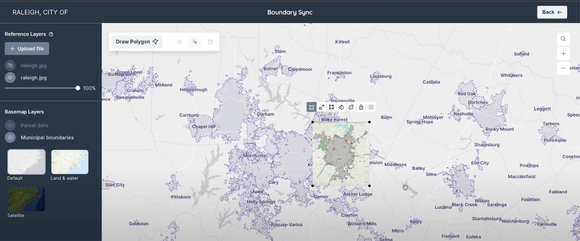
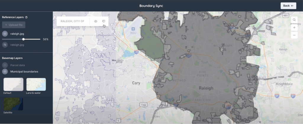
- Create digital boundaries, either freehand or by tracing paper maps
- Upload and overlap PDFs
- Submit their boundaries to administrators for approval and feedback
- Download shapefiles of their boundaries from the tool
- Share data directly with neighbors
- Approve boundaries, request changes, and submit questions and edits between users

Most importantly, this tool was a truly collaborative effort developed with contributions from passionate individuals across an impressive coalition of organizations. Our hope for this application is that it will be adopted in rural communities across the country as a tool for increasing water data and reducing costs that often come with comprehensive boundary tracking. And, while designed for small communities, the tool is robust enough to support large states as well, particularly if they choose to integrate it into their existing systems. It can also help them reduce costly subscription tooling, thereby directly benefitting the communities served by the utility.
“We hope that states and municipalities take notice of this tooling and see that digitizing service area boundaries can be simple and efficient. The tool supports a review process that would be cumbersome and time-consuming to do manually, or would require expensive software subscriptions. Instead, this tool can help anyone in water management improve their operations and ultimately better serve their communities. We are grateful that we had the opportunity to work on such an impactful project.” -Catherine Oldershaw Climate Unit Director
This work was possible because of the bold ideas that came from our partners. If you have a meaningful mission and are wondering whether digital tools can help further your goals, we’d love to hear from you!