All blog posts
<- View categories
-
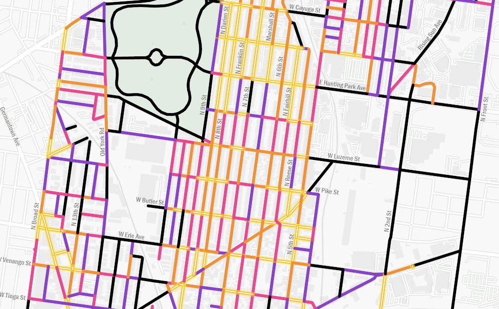
Using GIS to Guide Philadelphia’s First Neighborhood-Level Forestry Plan
The adoption of Philadelphia’s Urban Forest Strategic Plan and Hunting Park’s Forestry Plan presents a unique opportunity to address the need for equitable tree planting and the reduction of heat vulnerability, as these two plans are the city’s first cohesive attempts to prioritize and manage its urban forest.
-
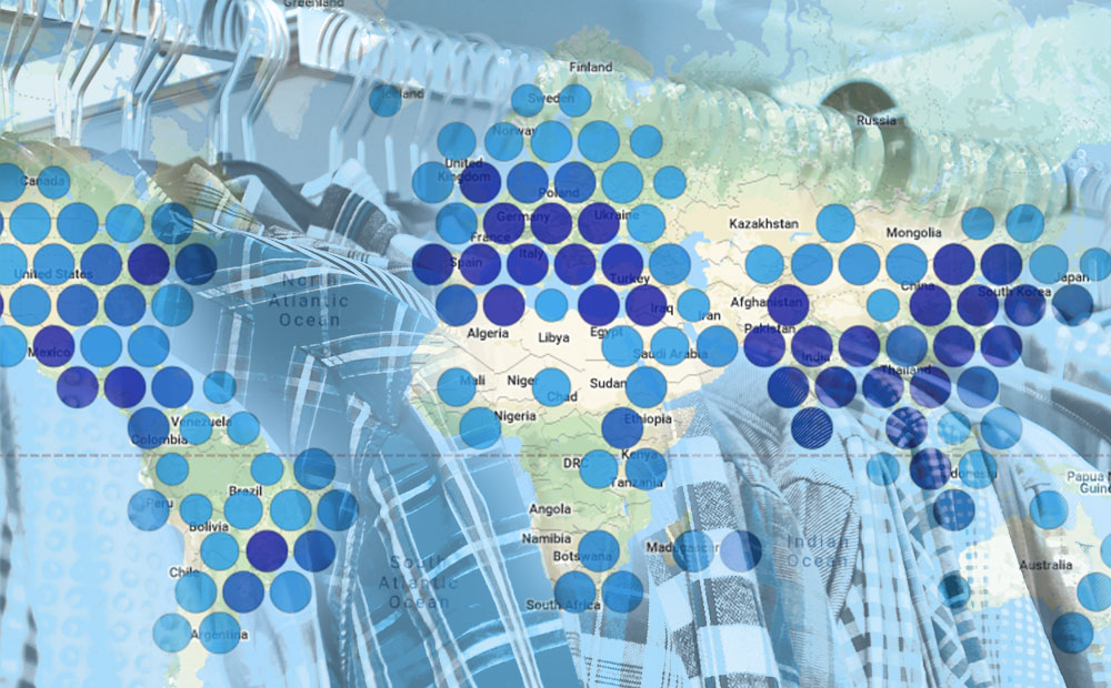
Bringing Open Data to the Apparel Industry
We chatted with the Open Apparel Registry team about how open data and open source are becoming a larger part of the apparel industry.
-
PySTAC 0.5.0 for STAC 1.0.0-beta.2
PySTAC 0.5.0 for STAC 1.0.0-beta.2 is released! We’re keeping PySTAC up with changes to the spec itself, and rounding out the library with new extensions and features. In this post, we’ll catch you up with what’s new.

-
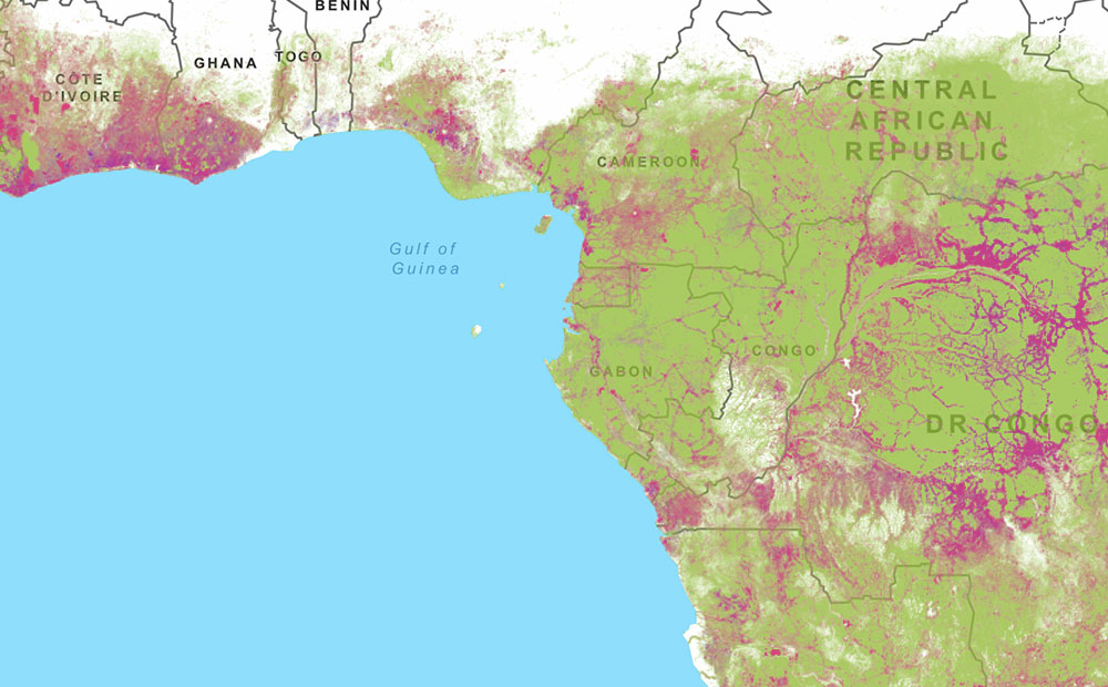
Amazon Web Services and Amazon Rain Forests: A Software Architectural Review
WRI hired Azavea to perform a software architectural review to evaluate the technical organization of Global Forest Watch.
-
The Business Case for Raster Vision
Raster Vision is the interface between the fields of earth observation and deep learning, making it easier to apply novel computer vision techniques to geospatial imagery of all types. Joe lays out how it can be implemented in your organization and give you a competitive advantage.

-
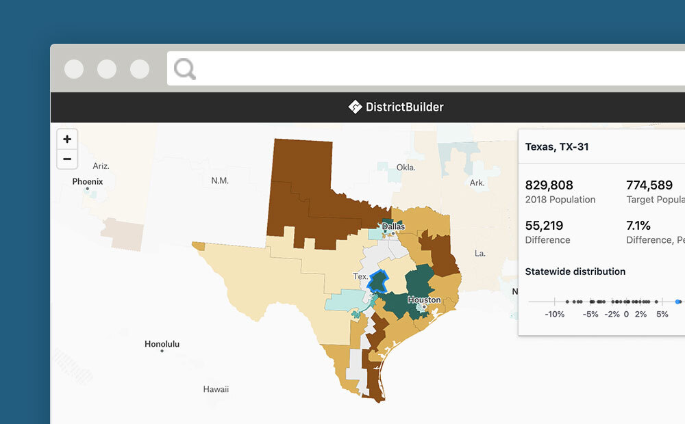
Which Congressional Districts are Over and Under Populated
We calculated which congressional districts have become over or underpopulated since they were last drawn.
-
Five Strategies for Building a Bootstrapped Product
Without taking on copious outside investment, we have to support our products with only a share of our available time and resources. Here are five strategies we use to build successful bootstrapped products.

-
3 Tips to Optimize Your Machine Learning Project for Data Labeling
Mining the knowledge and expertise of your data labeling team will improve the data quality of your machine learning project and increase your team’s productivity.

-
White Paper: Creating a GEDI Geo-Locator
Remote sensing instruments like NASA’s GEDI, which is mounted to the Japanese Experiment Module – Exposed Facility (JEM-EF) on the International Space Station (ISS), produce a massive amount of data and one of the tools scientists use when working with those data is a geo-locator–a geographic coordinates search engine. GEDI, launched in 2018, is the…
-
Summer ESIP 2020
We’re passionate about Earth Science Data and helping to solve the challenges in that field. At this year’s ESIP Summer Meeting, we have four E84 team members speaking and moderating across multiple sessions. Here’s where you can find us if you want to chat! STAC and Sentinel-2 Cloud-Optimized GeoTIFFs SpatioTemporal Asset Catalogs (STAC) is an…