Author: Ross Bernet
<- Return to all blogs
-
Amazon Web Services and Amazon Rain Forests: A Software Architectural Review
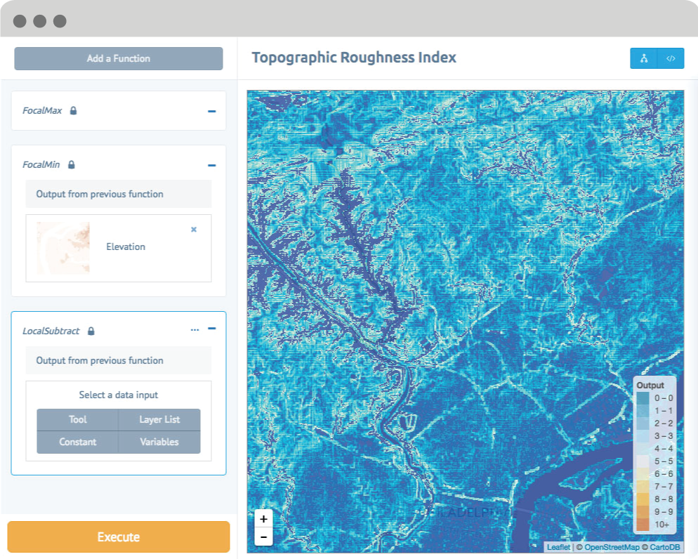
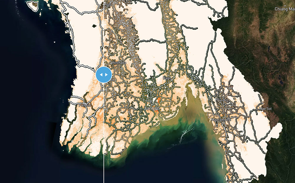
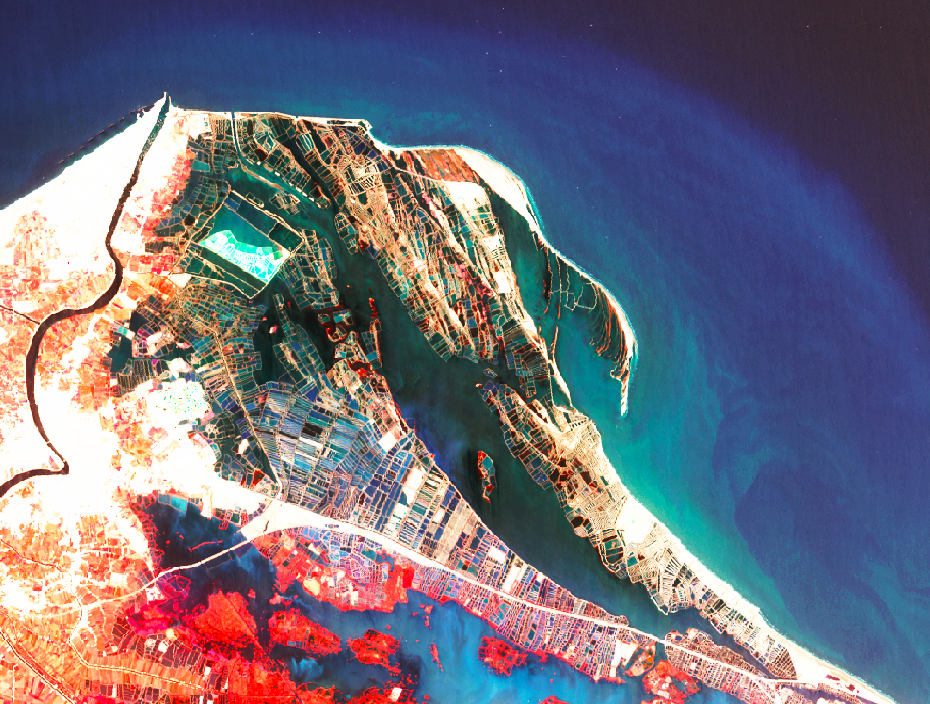
WRI hired Azavea to perform a software architectural review to evaluate the technical organization of Global Forest Watch.
-
Amazon Web Services and Amazon Rain Forests: A Software Architectural Review
WRI hired Azavea to perform a software architectural review to evaluate the technical organization of Global Forest Watch.
-
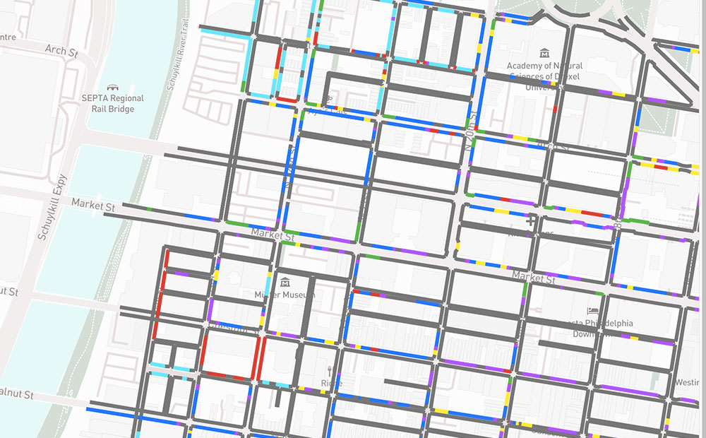
Maintaining Data on the Curb with CurbLR: A New Open Standard
CurbLR is a promising new open data specification for curb regulation. We used it to visualize and analyze Philadelphia’s curb management approaches affect on traffic.
-
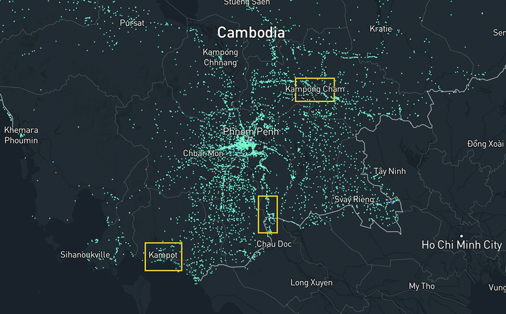
Building Footprint Comparison in Cambodia: Orbital Insight and OpenStreetMap
We created a map that shows the difference between two building footprint datasets of Cambodia: OSM and Orbital Insights’ AI generated dataset.
-
Calculating Rural Road Access Globally Using Open Datasets
We used three open datasets to calculate the number of people in the world who do not have sufficient access to a road in an effort to move forward the conversation on the Rural Access Indicator (RAI).
-
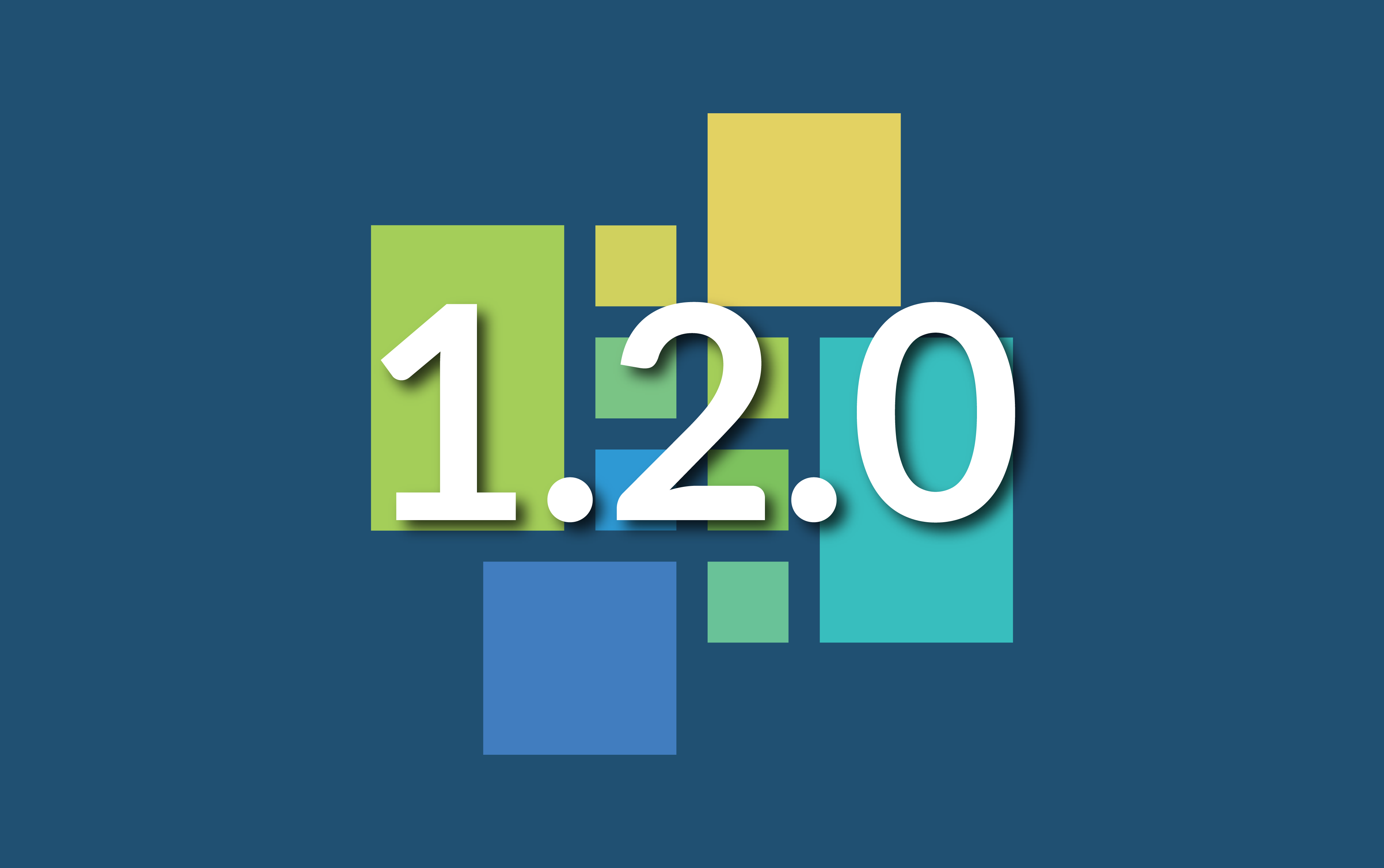
GeoTrellis 1.2 Release: New Features & Optimizations
LocationTech GeoTrellis, library that enables distributed processing of geospatial raster data, reached a new milestone in the development timeline.
-
Climate Change Projections for Excessive Heat Days at Arizona Airports
We used GeoPySpark, Python binding for GeoTrellis, to analyze climate change data and determine Arizona airports at risk for excessive heat days.
-
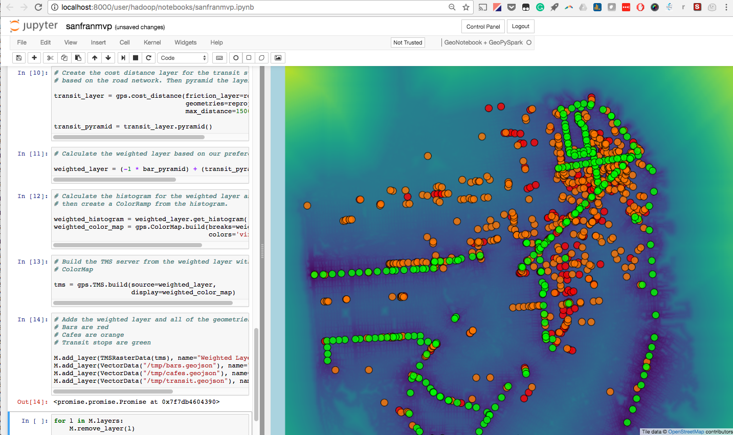
How to Run GeoPySpark in a GeoNotebook with Docker
Walk through the easiest path to enable the use of GeoPySpark, a Python library for geoprocessing big data, interactively in a GeoNotebook with Docker.
-
GeoTrellis 1.0 Release with LocationTech
This post will explain the motivation to release GeTrellis under LocationTech and what the decision means for GeoTrellis users and contributors.
-
Two Research Grants Awarded for New Imagery Processing Tools
We discuss two research grants we were awarded for our imagery processing tools: Raster Foundry and ModelLab.