Author: Joe Morrison
<- Return to all blogs
-
STAC Labeling Competition — Video Recap
Hear from labeling competition participants on why this diverse group of people came together, from across the world, to collaborate on a hallmark training dataset compliant with the STAC standard.
-
STAC Labeling Competition — Video Recap
Hear from labeling competition participants on why this diverse group of people came together, from across the world, to collaborate on a hallmark training dataset compliant with the STAC standard.
-
Three Lessons from Running an Imagery Labeling Competition
We joined with Radiant Earth at the Cloud Native Geospatial Sprint to run a labeling competition for non-technical folks. This resulted in over 2.3 million square kilometers mapped and lots of lessons learned.
-
The Business Case for Raster Vision
Raster Vision is the interface between the fields of earth observation and deep learning, making it easier to apply novel computer vision techniques to geospatial imagery of all types. Joe lays out how it can be implemented in your organization and give you a competitive advantage.
-
SpaceNet Data Now Available in GroundWork
Incorporate high-resolution satellite imagery into your labeling projects for free.

-
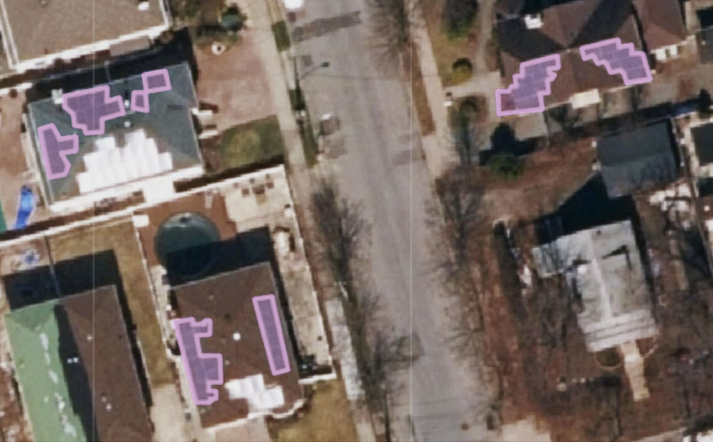
America’s Cities are Sitting on a Gold Mine of Machine Learning TrainingВ Data
Cities may not know it, but by nature of collecting and maintaining various datasets, they are sitting on a treasure trove of machine learning-ready training data.

-
How to Find the Most Recent Satellite Imagery Anywhere on Earth
Every project with satellite imagery begins with a data source. Here’s a rundown of the best options, considering cost, usability, and resolution.

-
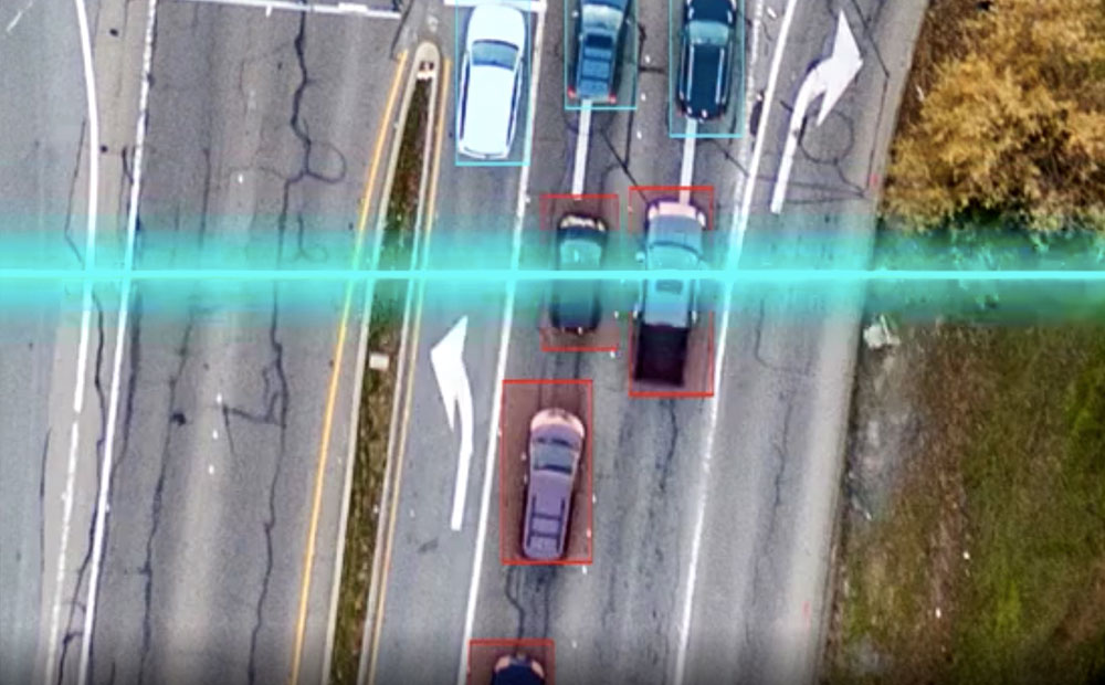
3 Ways to Analyze the Results of a Supervised Machine Learning Model
How accurate are our supervised machine learning models and what are they really doing? We offer 3 tips to help you better understand these models.
-
Betting Big on the Spatiotemporal Asset Catalog (STAC) Standard
We’re investing heavily in the STAC specification – including building a STAC-compatible Python library and server as well contributing to the Label Extension. We’re hoping this work will help accelerate adoption across the geospatial engineering community more broadly.

-
An Introduction to Satellite Imagery and Machine Learning
Today, the availability of satellite imagery still far outpaces our capacity to analyze it, but machine learning and tools like Raster Vision are helping.
-
Partnering with CloudFactory on Quality Training Data and Social Impact
Read about our journey to hiring an outsourced data labeling firm and how we’ve found a partner in CloudFactory.