PostGIS
<- Return to all blogs
-
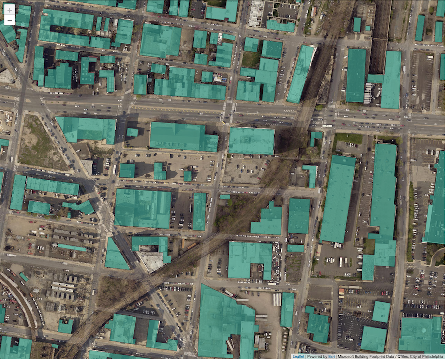
Creating Leaflet Tiles from Open Data using PostGIS and QGIS
A guide to transforming open geospatial data into slippy map tiles to display in Leaflet or OpenLayers using PostGIS, QGIS, and QTiles.
-
Creating Leaflet Tiles from Open Data using PostGIS and QGIS
A guide to transforming open geospatial data into slippy map tiles to display in Leaflet or OpenLayers using PostGIS, QGIS, and QTiles.
-
Measuring District Compactness in PostGIS
In this blog we discuss strategies for measuring district compactness in PostGIS.