All blog posts
<- View categories
-
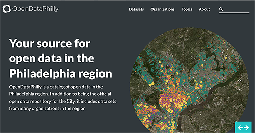
OpenDataPhilly Gets a New Look and More Datasets
Just in time for International Open Data Day, Azavea launched a re-designed and re-engineered OpenDataPhilly.org. This update sets the stage for the future of open data in Philadelphia as well, because the application will be more easily maintained and extended.
-
Open Transit Indicators Enable Cities to Design Better Transit Systems
In this blog we detail the Open Transit Indicators project developed by the World Bank.
-
More Sustainable Cities with Building Energy Benchmarking
In this blog post we detail our work to visualize building energy benchmarking data.
-
Selecting a NAT Instance Size on EC2
In this blog, we describe our experience with selecting a NAT Instance Size on EC2.
-
Five New GIS Tools in 2014
We discuss five exciting GIS tools released in 2014 that are sure to grow in 2015.
-
The Geographic Context of #MediaInContext
In this blog we discuss our involvement in a media innovation hackathon called #MediaInContext.

-
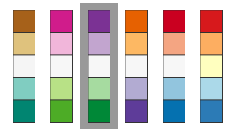
A New Vision for Accessible Maps
In this blog, we discuss how, as mapmakers, we can keep in mind individuals with visual impairment including low vision and color blindness.
-
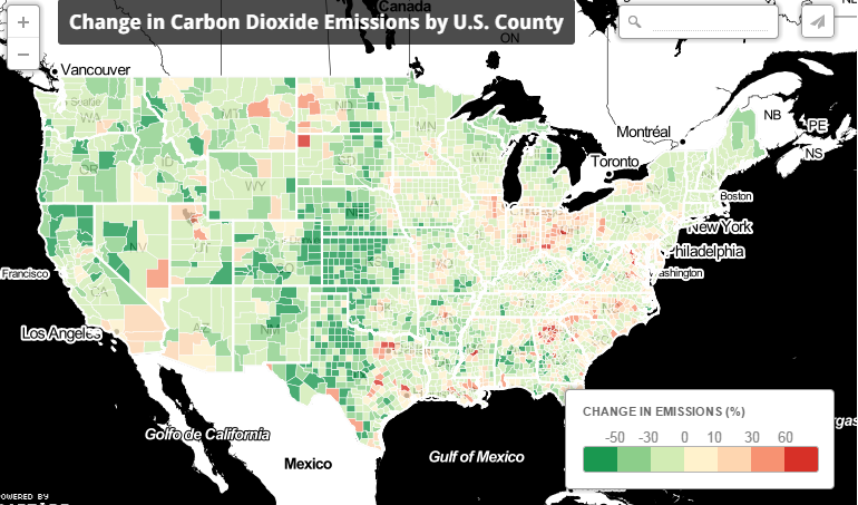
Mission Emission: Analyzing and Mapping CO2 Emissions
In this blog, we discuss our work estimating and mapping CO2 emissions between 1997 and 2010.
-
Running Vagrant with Ansible Provisioning on Windows
In this blog we outline how to run Vagrant with Ansible provisioning on Windows.
-
4 Cartography Color Tips Hue Should Know
In this blog, we compile some tips on the thoughtful use of color in cartographic design.