Author: Lewis Fishgold
<- Return to all blogs
-
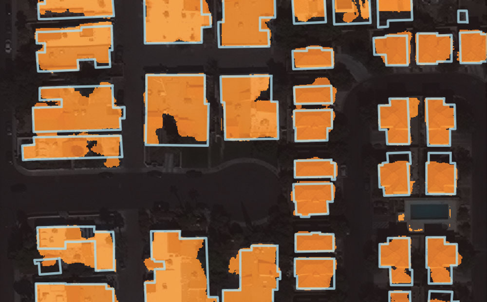
Automated Building Footprint Extraction (Part 3): Model Architectures
Reviewing model architectures for building footprint extraction including naive approaches, model improvement strategies, and recent research.
-
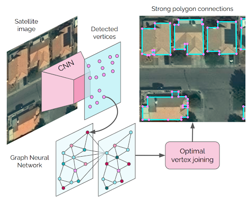
Automated Building Footprint Extraction (Part 3): Model Architectures
Reviewing model architectures for building footprint extraction including naive approaches, model improvement strategies, and recent research.
-
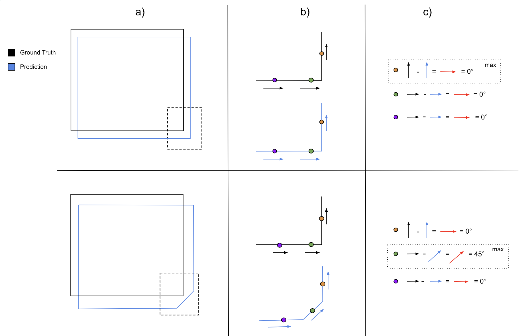
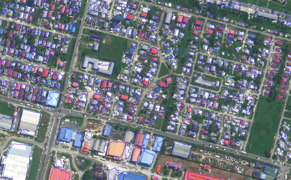
Automated Building Footprint Extraction (Part 2): Evaluation Metrics
In the second part of our Automated Building Footprint Extraction series, we review some evaluation metrics for building footprint extraction.
-
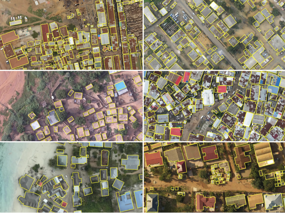
Automated Building Footprint Extraction (Part 1): Open Datasets
In the first installment of this three-part blog series, we summarize some of the latest research on automated building footprint extraction.
-
Introducing Raster Vision 0.12
We refactored the Raster Vision codebase from the ground up to make it simpler, more consistent, and more flexible. Check out Raster Vision 0.12.
-
The Future of Machine Learning AMA
3 of our machine learning engineers answer your questions about the future of machine learning.

-
Using Noisy Labels to Train Deep Learning Models on Satellite Imagery
How do noisy labels affect the accuracy of a deep learning model? We added different amounts of noise to the SpaceNet Vegas buildings dataset and trained some models to find out.
-
Raster Vision 0.9 Release Candidate
This release of Raster Vision includes bug fixes, an easier setup, improved performance, and the ability to train models off of labels in OSM.
-
Predicting Land Use in the Amazon using Deep Learning
Learn about our methods and results leveraging our RasterVision deep learning project to predict land use in satellite images of the Amazon.

-
Video: Using Convolutional Neural Networks to Automatically Analyze Aerial and Satellite Imagery
In this recording of our most recent Technical Staff Meeting, we walk through our team’s work on Raster Vision, a set of open source tools for automatically analyzing aerial and satellite imagery using convolutional neural networks. As part of Raster Vision, we have implemented approaches to tagging (predicts a set of tags for each image)…
-
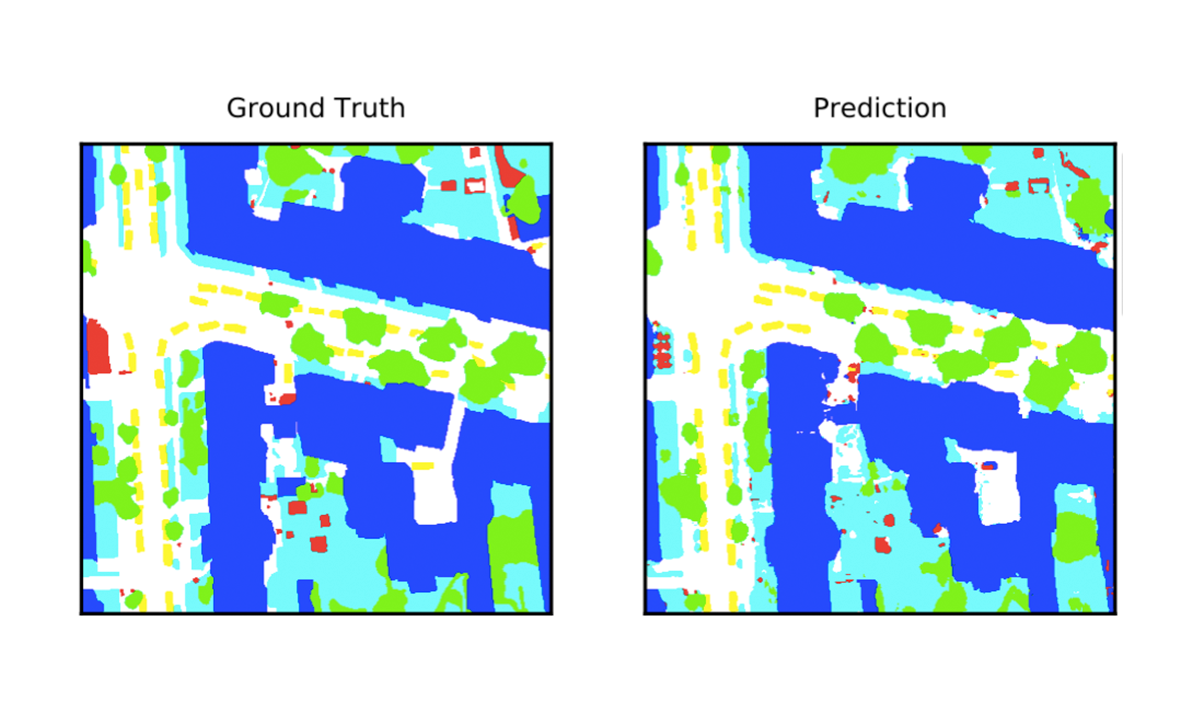
Deep Learning for Semantic Segmentation of Aerial and Satellite Imagery
This post describes how to use deep learning to do semantic segmentation on aerial and satellite imagery, experiments on the ISPRS Potsdam dataset, and how to visualize model predictions on a map.