Author: Kelly Innes
<- Return to all blogs
-
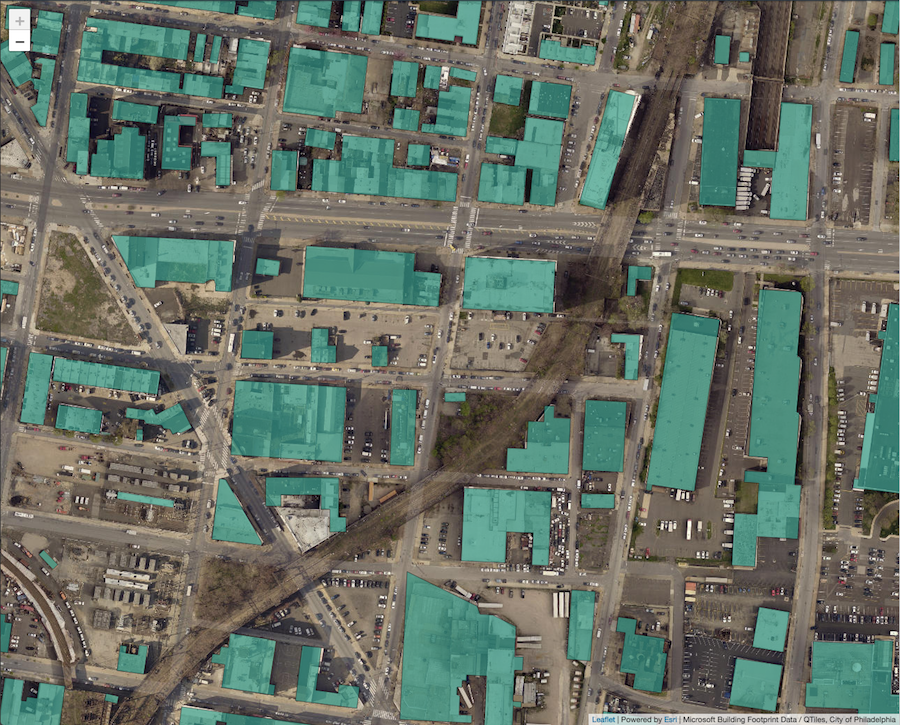
Creating Leaflet Tiles from Open Data using PostGIS and QGIS
A guide to transforming open geospatial data into slippy map tiles to display in Leaflet or OpenLayers using PostGIS, QGIS, and QTiles.
-
Creating Leaflet Tiles from Open Data using PostGIS and QGIS
A guide to transforming open geospatial data into slippy map tiles to display in Leaflet or OpenLayers using PostGIS, QGIS, and QTiles.
-
How to Build a Geoprocessing App with GeoTrellis and React
Follow this guide to set up a geoprocessing web application using GeoTrellis, Akka HTTP, and React.
-
Getting Started with React and Leaflet
This blog post offers a brief tutorial for beginningВ to use React with Leaflet.
