Author: Fernando Ramirez
<- Return to all blogs
-
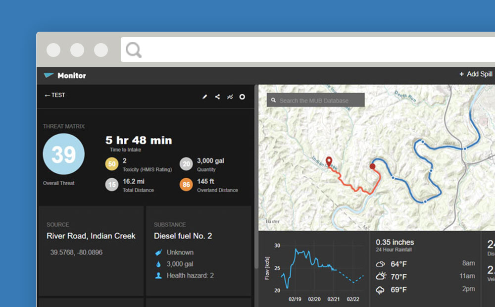
MUB Monitor: Helping Water Utilities Track and Respond to Upstream Threats
In partnership with Downstream Strategies, we created MUB Monitor – a comprehensive GIS-based tool that helps water professionals track spills, assess watershed threats, and make informed decisions.
-
MUB Monitor: Helping Water Utilities Track and Respond to Upstream Threats
In partnership with Downstream Strategies, we created MUB Monitor – a comprehensive GIS-based tool that helps water professionals track spills, assess watershed threats, and make informed decisions.
-
Developing Countries, Capacity Building, and SDGs
Utilizing earth imagery to achieve all 17 UN SDGs by 2030 will take considerate effort. In order to do this effectively, we must include training and capacity building in our solutions.